Maps of Aru Islands

P[oelau] Trangan / samengesteld door den Topografischen Dienst (Kartogr[afische] Afd[eling]) naar diverse gegevens in 1941
Topografische Dienst Batavia Batavia : Topografische Dienst
Aroe Islands / Australian Survey Corps
Australian Survey Corps [S.l.] : Australian Survey Corps
Aroe Eilanden / U.S. Army Map Service
U.S. Army Map Service Washington D.C. Washington D.C. : U.S. Army Map Service
Aroe-Eilanden / samengesteld en gedrukt bij den Topografischen Dienst
Topografische Dienst Batavia Batavia : Topografische Dienst
Geologische overzichtskaart van den Nederlandsch Oost-Indischen Archipel : Aroe-, Kei- en Tenimbereilanden / bewerkt door J. Zwierzycki
Landsdrukkerij Weltevreden (Batavia) [Weltevreden (Batavia) : Landsdrukkerij]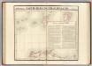
Partie, Nouvelle Hollande. Oceanique no. 29.
1 : 1641836 Vandermaelen, Philippe, 1795-1869
Kaart van een gedeelte der zuid en zuidwest kust van Nieuw-Guinea : volgens de opnemingen gedaan door Zr. Ms. schepen Dourga, Triton, Sireen en Postillon tusschen de jaren 1826 en 1835 / zamengesteld door Salomon Müller
[S.l. : s.n.]
De Molukken of Specerij-Eilanden / gelith. door E. de Geest
Seyffardts Boekhandel Amsterdam Amsterdam : Seyffardts Boekhandel
Kaart van de zuyd-ooster eylanden van Banda
1 : 2200000 [Dordrecht etc.] : J. van Braam en G. Onder de Linden exc.
Nederlands Nieuw-Guinea / [Netherlands Topographic Service]
Netherlands Topographic Service Delft [Delft : Netherlands Topographic Service]
Nederlandsch-Nieuw-Guinee
Topographische Inrichting Batavia Batavia : Top[ographische] Inr[ichting]
Kaart van Nederlandsch Nieuw-Guinea en omliggende eilanden / Topographisch Bureau
Topographisch Bureau Batavia Batavia : Topographisch Bureau
Kaart van de Molukken
D. Heyse, graveur lith. te 's Hage te 's Hage : uitgave van K. Fuhri
Západní Irian

Overzichtskaart van de Residentie Amboina en de Afdeeling Noord-Nieuw Guinea / samengesteld door het Encyclopaedisch Bureau [in] 1915
Encyclopaedisch Bureau Batavia Batavia : G. Kolff & Co.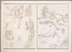
16. [Ambon, Molukken], uit: Atlas van Nederlandsch Oost-Indië / samengest. door Topographisch Bureau te Batavia van 1897-1904
Annotatie: Omgewerkte versie van: Atlas der Nederlandsche bezittingen in Oost-Indië / naar de nieuste bronnen samengest. door J.W. Stemfoort en J.J. ten Siethoff. - 's-Gravenhage : Topographische Inrichting, [ca. 1885] Topographisch Bureau, Batavia 's-Gravenhage : Topographische Inrichting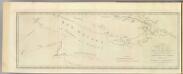
New Britain discoveries.
1 : 4500000 Hawkesworth, John, 1715?-1773
Geologische schetskaart van het oostelijke gedeelte van den Nederlandsch-Indischen Archipel / door Dr. R.D.M. Verbeek
Topographische Inrichting Batavia [Batavia : Landsdrukkerij]
Carte des iles Moluques
1 : 3425000 par P. Melvill de Carnbee gravé par D. Heyse La Haye : lith de Ch. van Lier
Kaart van het oostelijke gedeelte van den Nederlandsch-Indischen Archipel / Topographische Inrichting
Topographische Inrichting Batavia [Batavia : Landsdrukkerij]
[Schetskaart van Nieuw-Guinea] / Topografische Dienst
Topografische Dienst Batavia Batavia : Reproductiebedrijf Topografische Dienst
[Nieuw Guinea] / Topografische Dienst
Topografische Dienst Batavia Batavia : Reproductiebedrijf Topografische Dienst
Elf kaarten van Nieuw-Guinea / Directie Ned[erlands] Nieuw Guinea, Ministerie van Binnenlandse Zaken
Ministerie van Binnenlandse Zaken 's-Gravenhage . Directie Nederlands Nieuw Guinea ['s-Gravenhage : Staatsdrukkerij]
Schetskaart van Nieuw-Guinea / Topografische Dienst
Topografische Dienst Batavia Batavia : Reproductiebedrijf Topografische Dienst
Vegetatiekaart van Nieuw-Guinea
Topografische Dienst Delft Delft : Topografische Dienst
Schetskaart van Nieuw Guinea / Topografische Dienst
Topografische Dienst Batavia Batavia : Reproductiebedrijf Topografische Dienst
Nieuw Guinea / Topografische Dienst
Topografische Dienst Batavia Batavia : Reproductiebedrijf Topografische Dienst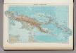
335. New Guinea, Solomon Islands. The World Atlas.
1 : 7500000 USSR (Union of Soviet Socialist Republics).
Blad VII Siding, uit: Residentie Wester-Afdeeling van Borneo / Topographisch Bureau
1 : 200000 titelvariant: Residentie Westerafdeeling van Borneo; Annotatie: Titelvariant: Residentie Westerafdeeling van Borneo; Voor aanwezige bladen zie overzichtsblad; Annotatie geografische gegevens: Opname: 1886-1895 Topographisch Bureau, Batavia Batavia : Topographisch Bureau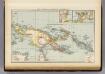
![P[oelau] Trangan / samengesteld door den Topografischen Dienst (Kartogr[afische] Afd[eling]) naar diverse gegevens in 1941](https://images-2.georeferencer.com/images/iiif/960442195927/full/,300/0/native.jpg)

