Carte cataloguée
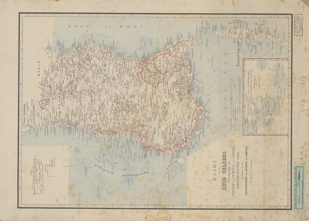
Kaart van Zuid-West-Celebes : bevattende de Gouvernements-, de leenroerige en een gedeelte der bondgenootschappelijke landen behoorende tot het Gouvernement van Celebes en Onderh[origheden]
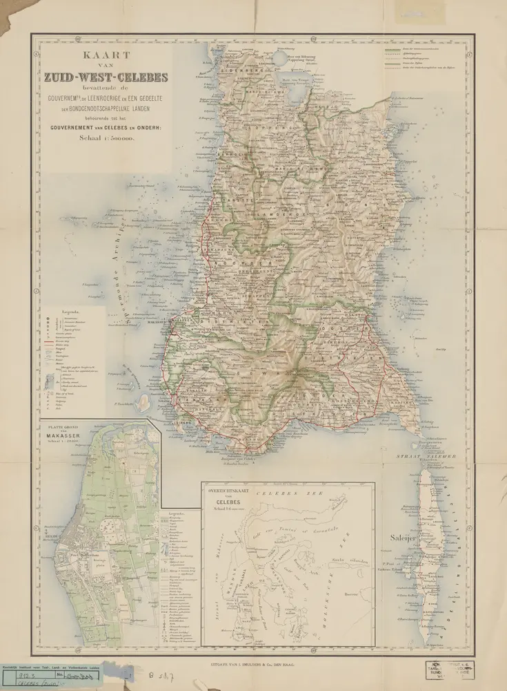

Titre complet:Kaart van Zuid-West-Celebes : bevattende de Gouvernements-, de leenroerige en een gedeelte der bondgenootschappelijke landen behoorende tot het Gouvernement van Celebes en Onderh[origheden]
Année de l'image:1890
Éditeur:Den Haag : Smulders & Co
Taille physique:20 x 30 cm
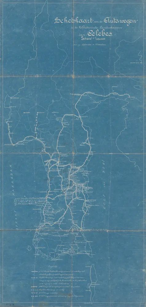
Schetskaart van de autowegen in de Zelfbesturende Landschappen van Celebes
1930
[S.l. : s.n.]
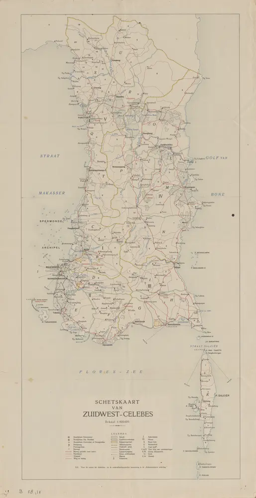
Schetskaart van Zuid-West-Celebes
1920
[S.l. : s.n.]
Gouvernement Celebes en Onderh[origheden] / Topografische Dienst, Batavia
1944
[S.l. : s.n.]
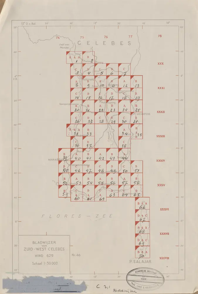
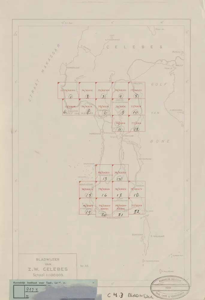
Bladwijzer van Zuid-West Celebes : 1:50.000
1945
[S.l. : s.n.]

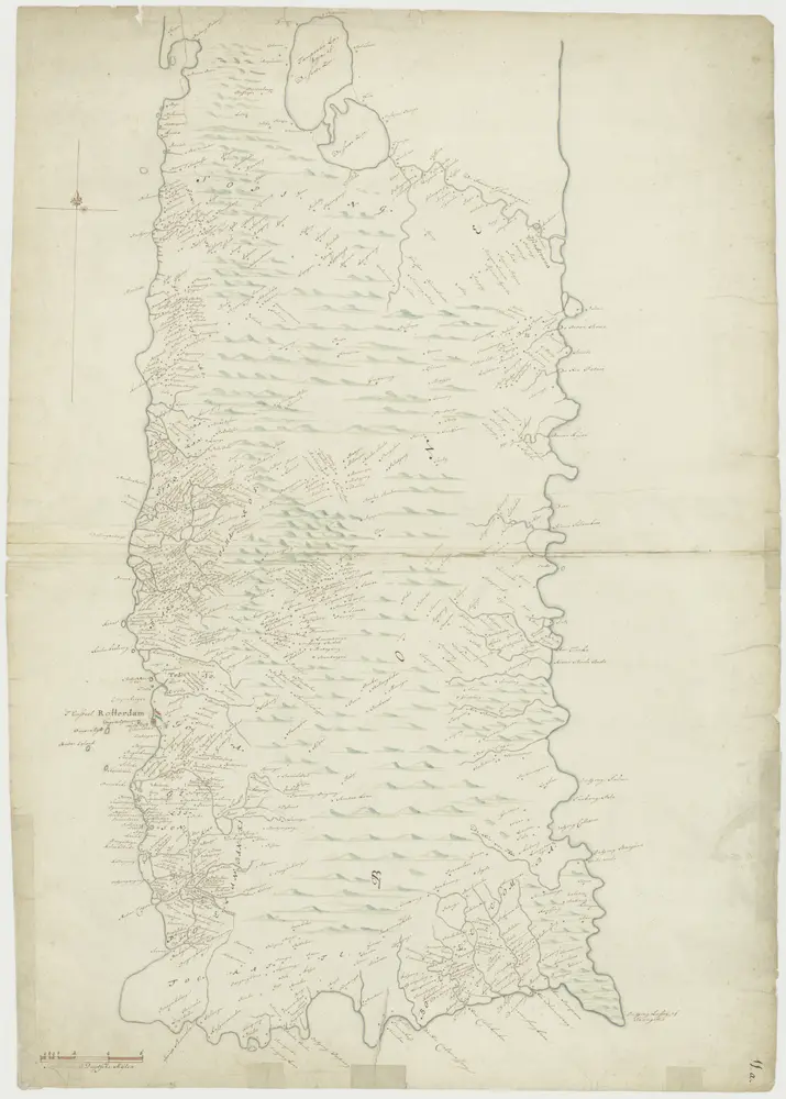
"Kaart van een gedeelte der kusten van Celebes strekkende van Mandhar tot aan het eiland Saleijer."
1822
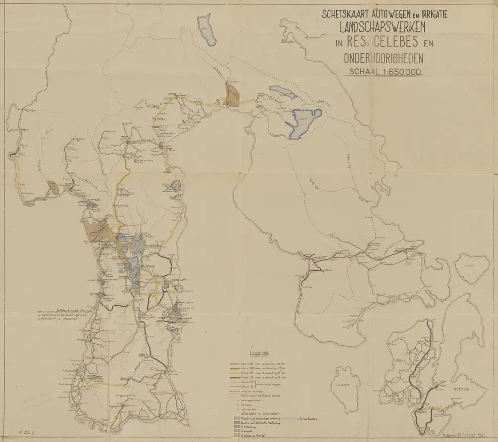
Schetskaart autowegen en irrigatie landschapswerken in Res[identie] Celebes en Onderhoorigheden
1941
[S.l. : s.n.]
Kaart van de zuidwest punt van Celebes
1700
Kaart van Zuid Celebes : bevattende de Gouvernemts- en een gedeelte der leenroerige- en bondgenootschappelijke landen behoorende tot het Gouvernement van Celebes en Onderh[origheden] / [Topographische Inrichting]
1885
Topographische Inrichting Batavia
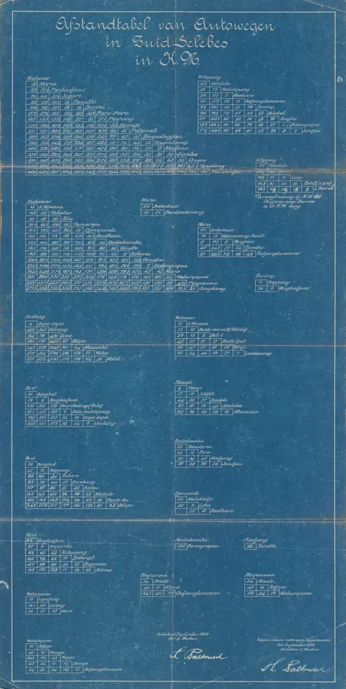
Afstandstabel van autowegen in Zuid-Selebes in km / Th. Paltrusch, directeur L. Werken
1930
L. Werken

Schetskaart van Zuid Celebes
1925