Carte cataloguée
Sangir- en Talaud

Titre complet:Sangir- en Talaud
Année de l'image:1935
Éditeur:[S.l. : s.n.]
Taille physique:20 x 30 cm
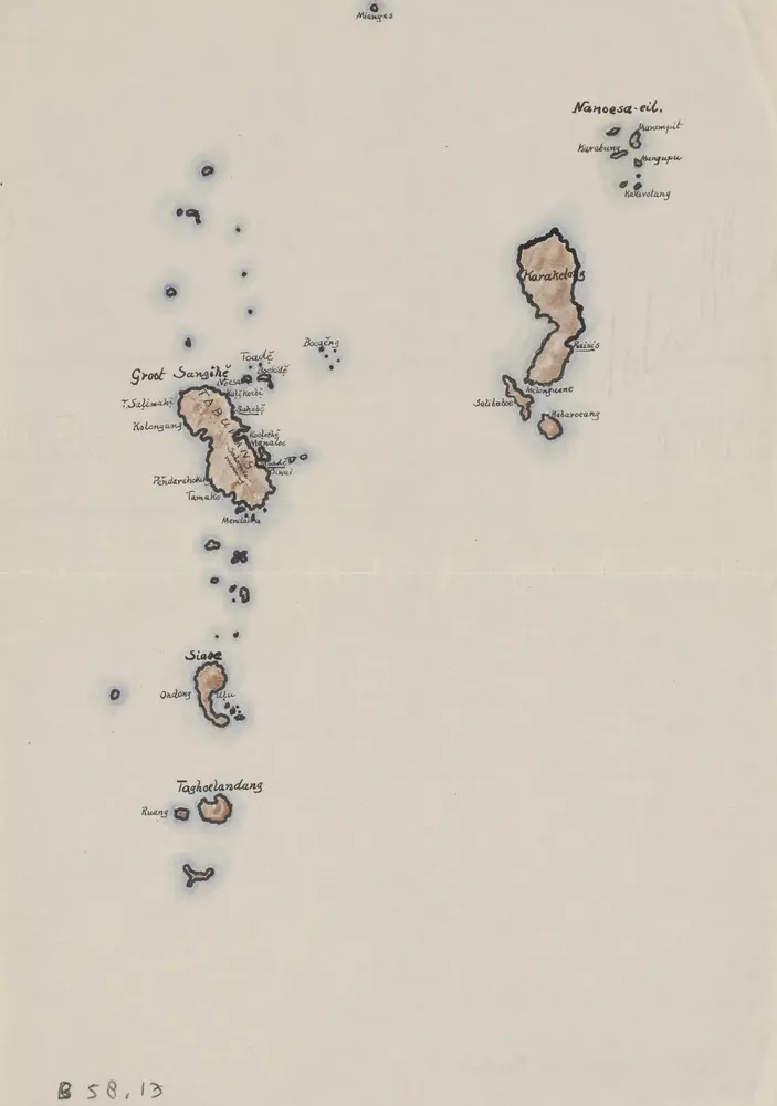
Sangir- en Talaud
1935
[S.l. : s.n.]
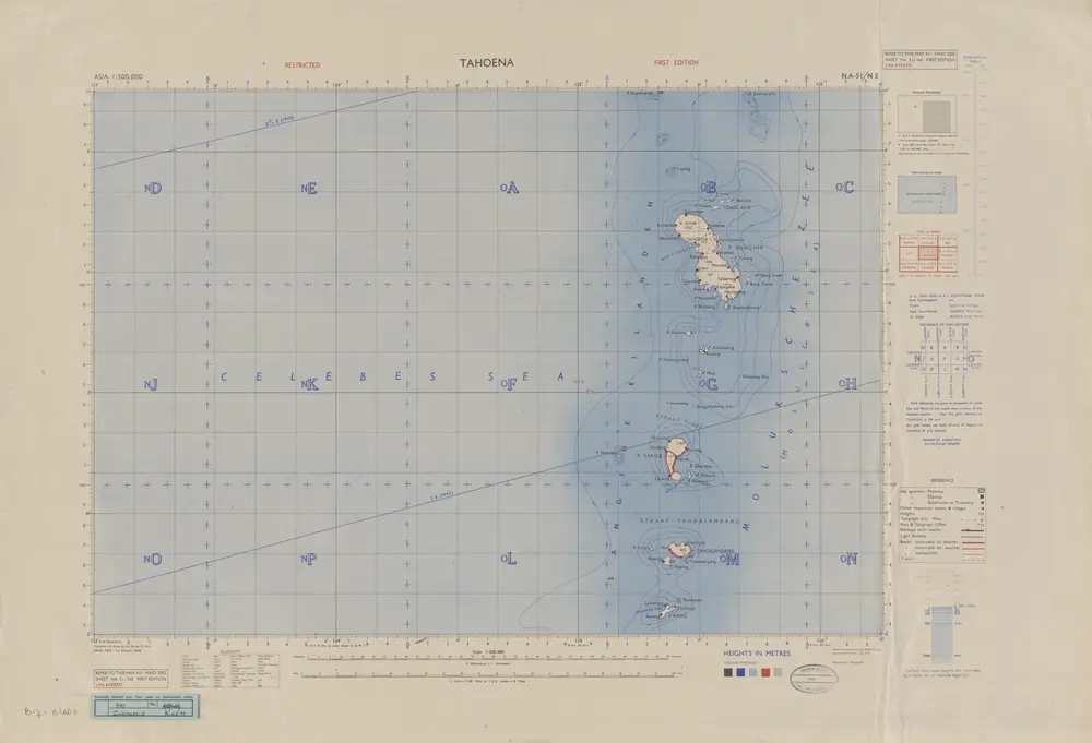
Tahoena / Survey of India
1946
Survey of India
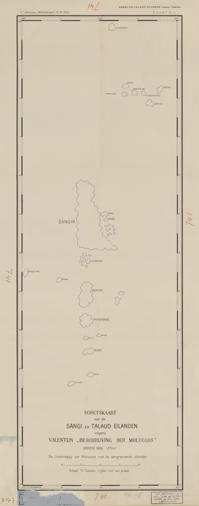
Schetskaart van de Sangi- en Talaud Eilanden / E[ncyclopaedisch] B[ureau]
1912
Encyclopaedisch Bureau Batavia
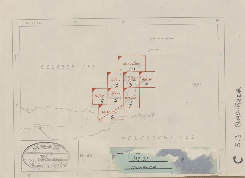
Algemeene schetskaart van Nederlandsch-Indië : Gouv[ernement] Groote Oost, Res[identie] Manado 1:100.000 / Topografische Dienst, Batavia
1944
[S.l. : s.n.]
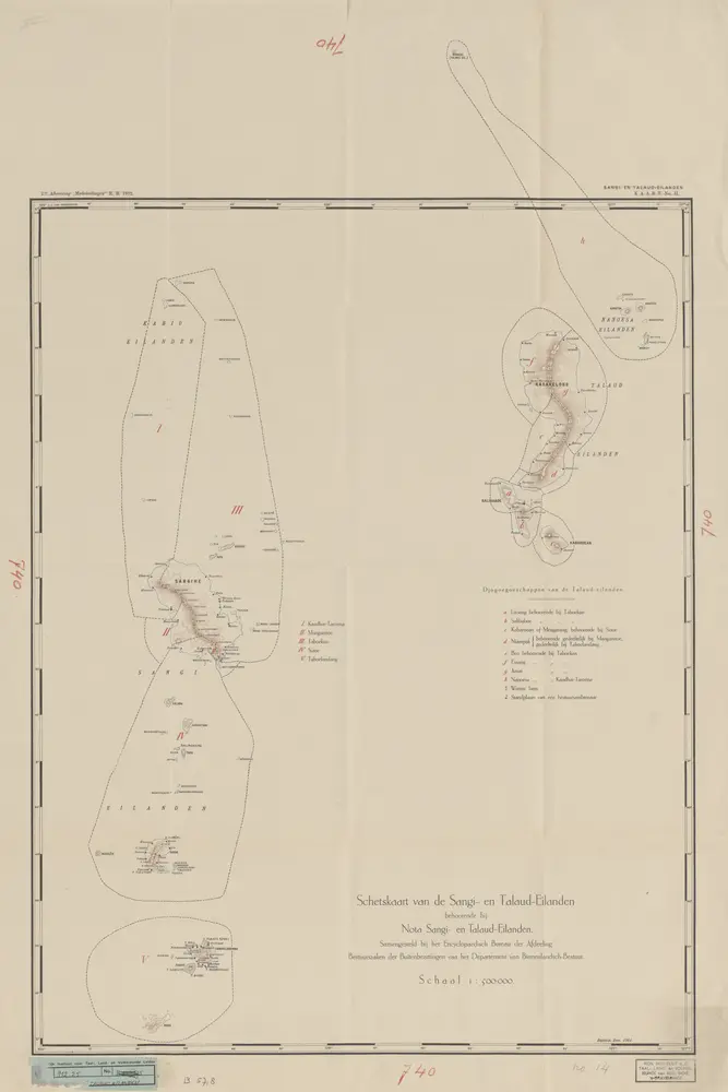
Schetskaart van de Sangi- en Talaud Eilanden / samengesteld bij het E[ncyclopaedisch] B[ureau] der Afdeeling Bestuurszaken der Buitenbezittingen van het Departement van Binnenlandsch-Bestuur
1912
Encyclopaedisch Bureau Batavia
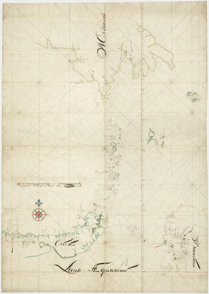
Kaart van een deel van Celebes en Ternate en Tidore
1800
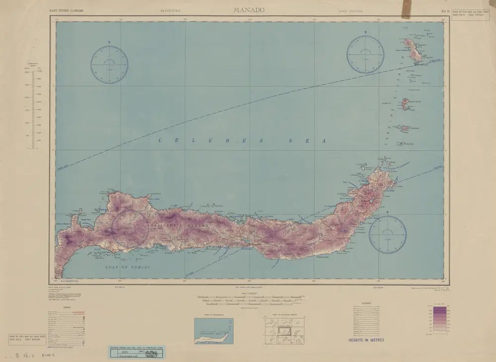
Manado / Survey of India
1946
Survey of India
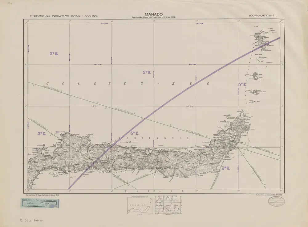
Manado / Topografische Dienst
1942
Topografische Dienst Batavia
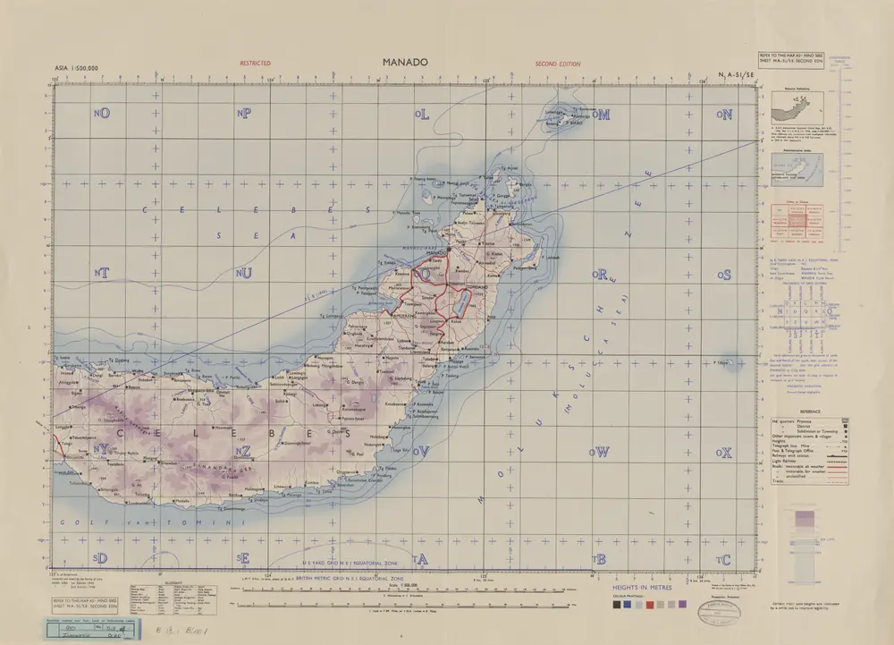
Manado / U.S. Army Map Service
1944
U.S. Army Map Service Washington D.C.
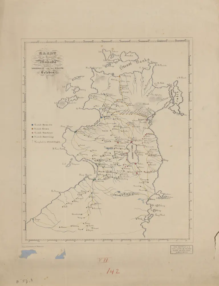
Kaart van de Residentie Manado : of van de Noordkust van het eiland Celebes
1880
[S.l. : s.n.]