Mapa catalogado
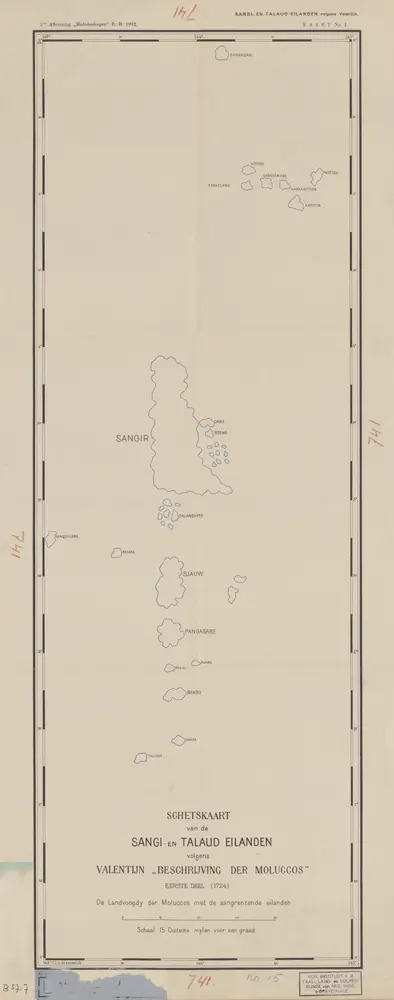
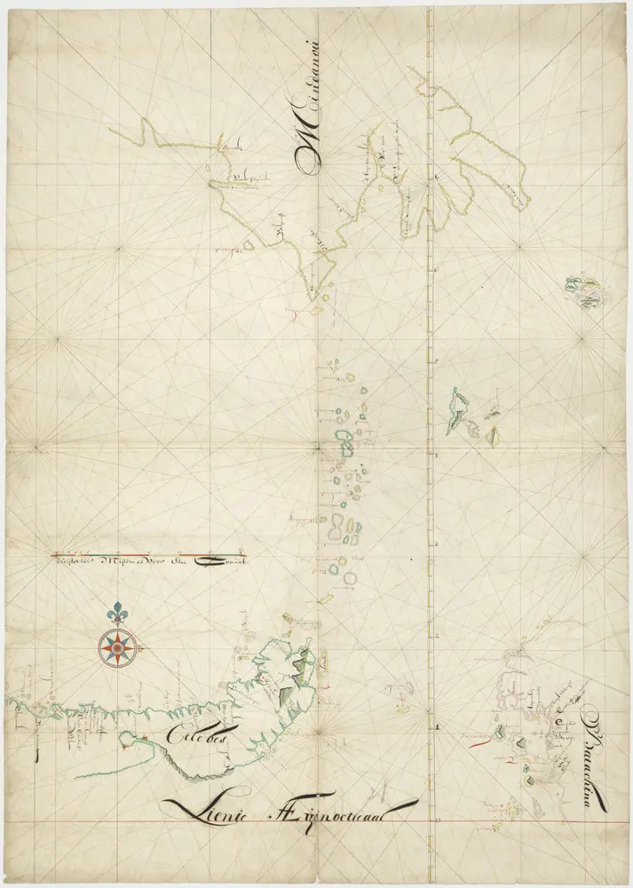
Schetskaart van de Sangi- en Talaud Eilanden / E[ncyclopaedisch] B[ureau]

Título completo:Schetskaart van de Sangi- en Talaud Eilanden / E[ncyclopaedisch] B[ureau]
Año de ilustración:1912
Editorial:['s-Gravenhage : N.V. Electrische Drukkerij 'Luctor et Emergo']
Tamaño físico:20 x 30 cm
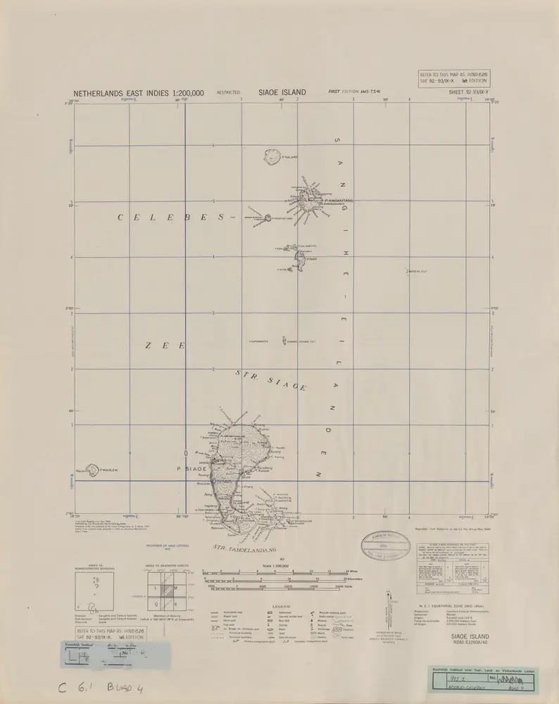
Siaoe Island / prepared under the direction of the Chief of Engineers U.S. Army
1946
Army Map Service U.S. Army Washington D.C.
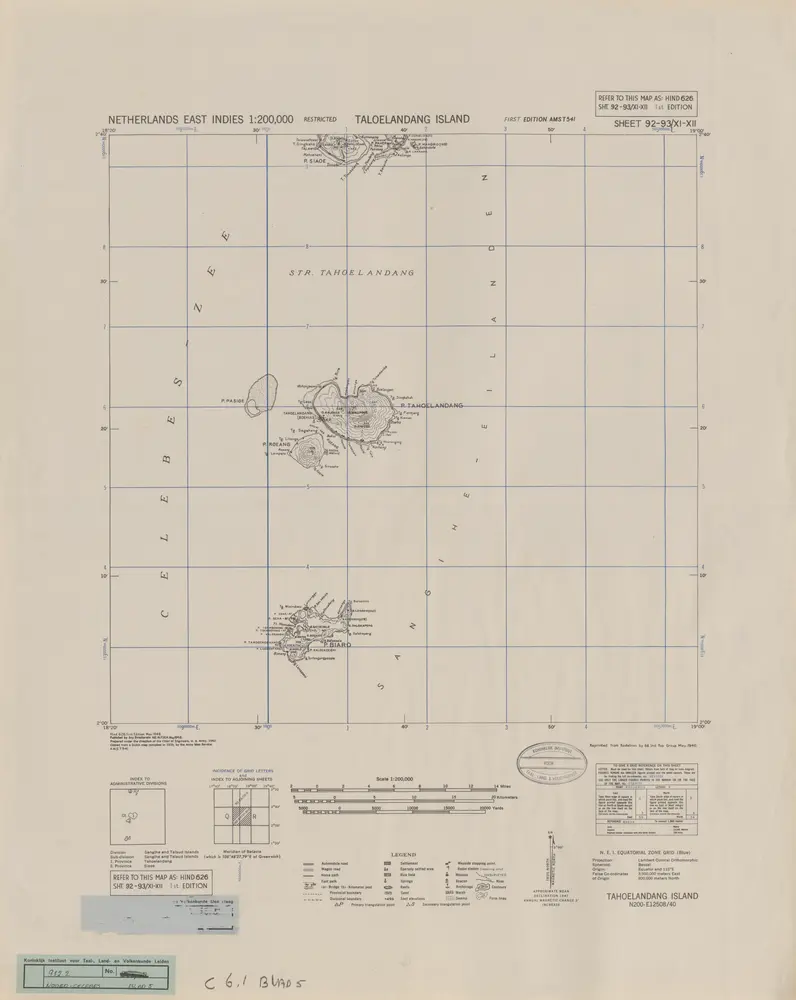
Taloelandang Island / prepared under the direction of the Chief of Engineers U.S. Army
1946
Army Map Service U.S. Army Washington D.C.
Schetskaart van de Sangi- en Talaud Eilanden / E[ncyclopaedisch] B[ureau]
1912
Encyclopaedisch Bureau Batavia
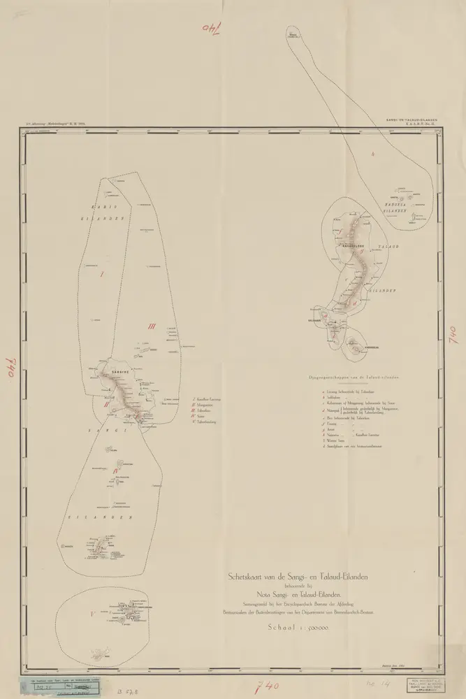
Schetskaart van de Sangi- en Talaud Eilanden / samengesteld bij het E[ncyclopaedisch] B[ureau] der Afdeeling Bestuurszaken der Buitenbezittingen van het Departement van Binnenlandsch-Bestuur
1912
Encyclopaedisch Bureau Batavia
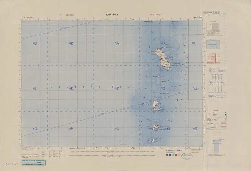
Tahoena / Survey of India
1946
Survey of India
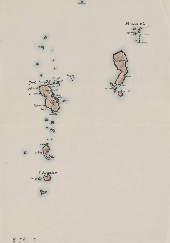
Sangir- en Talaud
1935
[S.l. : s.n.]
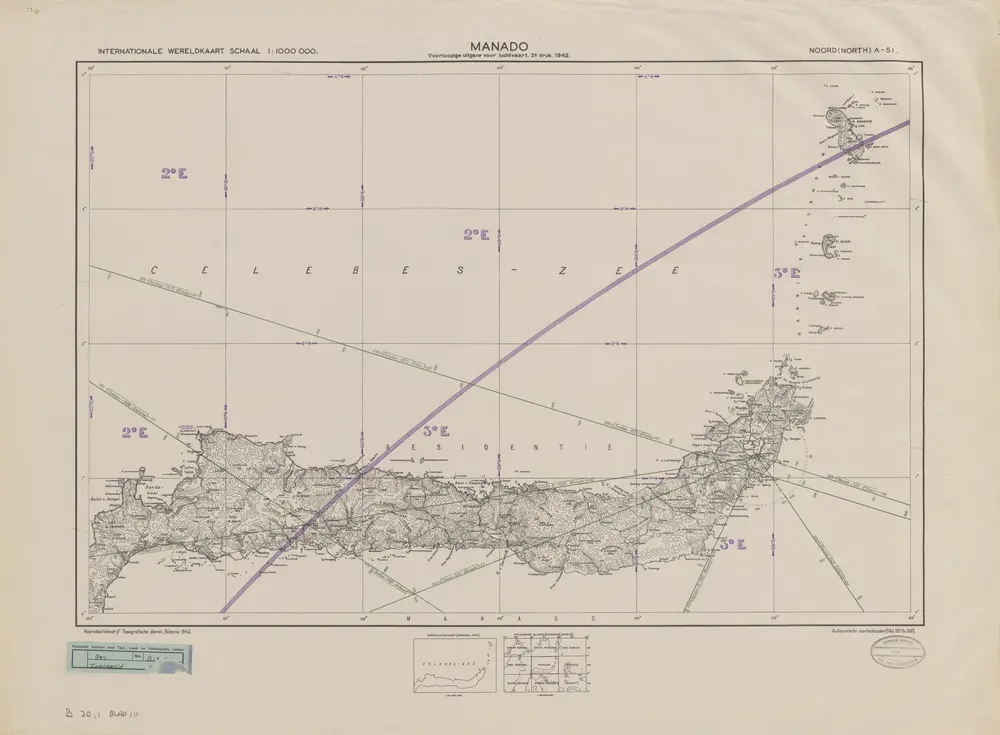
Manado / Topografische Dienst
1942
Topografische Dienst Batavia
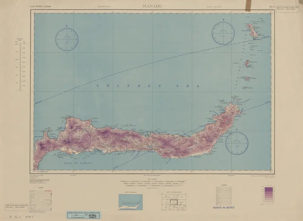
Manado / U.S. Army Map Service
1944
U.S. Army Map Service Washington D.C.
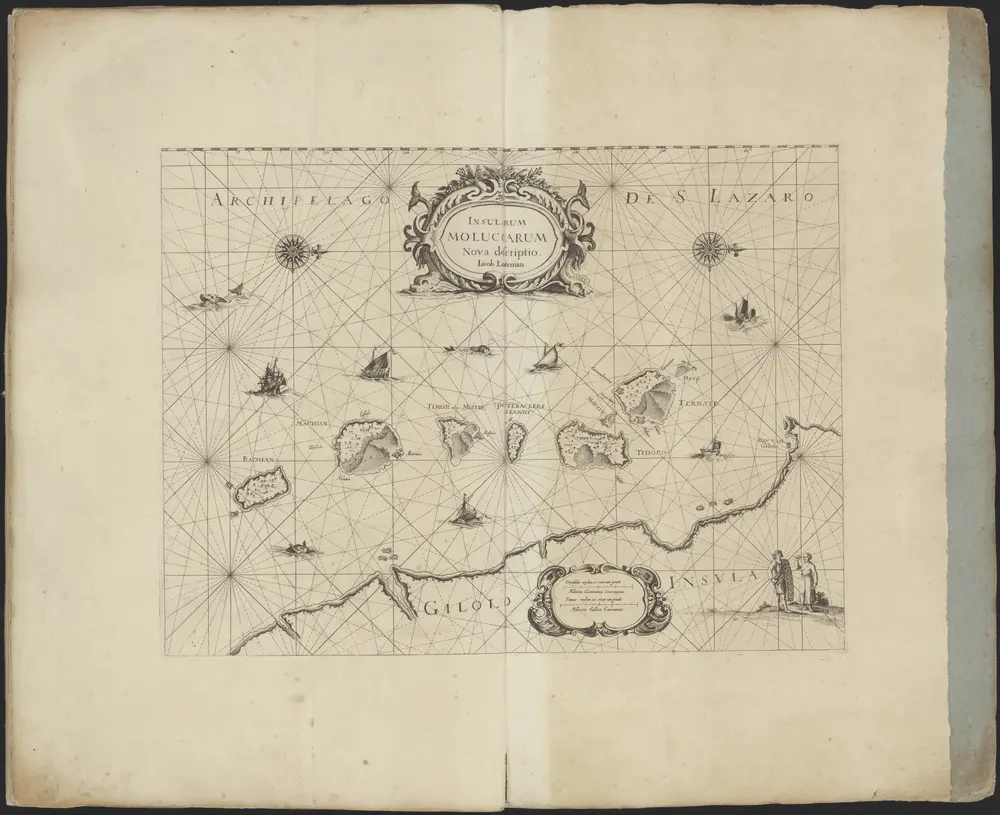
Verzameling van 20 door de firma Van Keulen uitgegeven paskaarten.
1800
Johannes en Gerard van Keulen;Ioan Heyteman;Iohn Heyteman;Joannes van Keulen;Iohn of Keulen;Iean van Keulen;Iohannis van Keulen;Ioannes van Keulen;G. v. Keulen;G: v: Keulen;Gerard van Keulen;Jean van Keulen;Pieter Goos;Iohannes van Kuelen;Pierre Mortier;Hadriano Relando;Iacob Lootsman
Kaart van een deel van Celebes en Ternate en Tidore
1800