Maps of Kalimantan Selatan

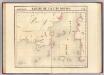
[P[oelau] Birahbirahan (Dwaalder)]
Topografische Dienst Weltevreden (Batavia) Weltevreden (Batavia) : Reproductiebedrijf Topografische Dienst
Blad XIX Sintang, blad m, uit: Residentie Wester-Afdeeling van Borneo : weg- en rivierkaart / Topographisch Bureau
1 : 50000 Annotatie: Voor aanwezige bladen zie overzichtsblad Topographisch Bureau, Batavia Batavia : Topographisch Bureau
Makassar / Topografische Inrichting
Topografische Dienst Batavia Batavia : Topografische Inrichting
Gouv[ernement] Borneo : Res[identie] Z[uider] en O[oster] Afd[eeling] van Borneo / Topografische Dienst, Batavia
[S.l. : s.n.]
Blad XXV Boengan, blad c, uit: Residentie Wester-Afdeeling van Borneo : weg- en rivierkaart / Topographisch Bureau
1 : 50000 Annotatie: Voor aanwezige bladen zie overzichtsblad Topographisch Bureau, Batavia Batavia : Topographisch Bureau
Mission map of South Borneo
Partie, Borneo. Oceanique no. 20.
1 : 1641836 Vandermaelen, Philippe, 1795-1869
Geologische kaart van zuidelijk Borneo / door H. von Gaffron
Aardrijkskundig Genootschap [Amsterdam : G.L. Brinkman]
Overzichtskaart van de administratieve indeeling der Residentie Zuider- en Oosterafdeeling van Borneo / Top[ographische] Inr[ichting]
Topographische Inrichting Batavia Batavia : Top[ographische] Inr[ichting]
Kaart van het Zuidelijk gedeelte bezuiden 1ÿê N.B. van het eiland Borneo / [J.W. Stemfoort en J.J. ten Siethoff ; gereproduceerd op last van het Departement van Koloniën, aan de Topographische Inrichting te 's-Gravenhage, onder leiding van den Directeur C.A. Eckstein]
Ministerie van Koloniën Den Haag s-Gravenhage : Departement van Koloniën
Het Eiland Borneo / gelithogr. door E. de Geest
Amsterdam : Seyffardt's Boekhandel
13. Kaart der residentie Zuider- en Ooster-Afdeeling van Borneo, uit: Atlas van Nederlandsch Oost-Indië / samengest. door Topographisch Bureau te Batavia van 1897-1904
Annotatie: Omgewerkte versie van: Atlas der Nederlandsche bezittingen in Oost-Indië / naar de nieuste bronnen samengest. door J.W. Stemfoort en J.J. ten Siethoff. - 's-Gravenhage : Topographische Inrichting, [ca. 1885] Topographisch Bureau, Batavia 's-Gravenhage : Topographische Inrichting
Bladwijzer Zuider en ooster afd. van Borneo
[S.l. : s.n.]
Kalimantan
[S.l. : s.n.]
Borneo / Top[ographische] Inr[ichting]
Topographische Inrichting Batavia Batavia : Top[ographische] Inr[ichting]
Borneo
1 : 5000000 Annotatie: Linksonder: Molengraaff, Borneo; Proefdruk, bestemd voor, maar uiteindelijk niet opgenomen in: Geologische verkenningstochten in Centraal-Borneo (1893-94) / G.A.F. Molengraaff. - Leiden : Brill ; [etc.], 1900 [S.l. : s.n.] / (Leiden : Trap)
Concept oudheidkundige kaart van Borneo

Kaart van het eiland Borneo
Grav. en druk van T. Hooiberg te Leiden te 's Hage : uitgave van K. Fuhri
Süd-Borneo

Præfectura Apostolica de Bandjarmasin : anno 1938 i.e. anno dismembrationis a Vicariatu Apostolico Bornaei Hollandici ; Præfectura Apostolica de Sintang : anno 1948 i.e. anno dismembrationis a Vicariatu Apostolico de Pontianak
1 : 7500000 titelvariant: Præfectura Apostolica de Sintang; Annotatie: Stationes primariae cum anno erectionis [S.l. : Vicario Apostolico de Pontianak]
Borneo / Army Map Service, Washington D.C.
Army Map Service Washington D.C. Washington D.C. : Army Map Service
Overzichtskaart van het eiland Borneo : met aanduiding van de politieke indeeling, de organisatie van het bestuur, de bestaande en nog aan te leggen verkeerswegen en van de groote cultuur- en industrieele centra / samengesteld op last van de N.I. regeering [door de] Topographische Inrichting, Batavia
Topografische Inrichting Batavia Batavia : Topographische Inrichting
Kaart van het eiland Borneo / Topographisch Bureau
Topographisch Bureau Batavia Batavia : Topographisch Bureau
Borneo / Geogr[aphische] lith[ographie] v[an] E. de Geest
Seyffardt's Boekhandel Amsterdam Amsterdam : Seyffardt's Boekhandel
Borneo / Topografische Dienst
Topografische Dienst Batavia Batavia : Reproductiebedrijf Topografische Dienst
Celebes, de Kleine Soenda-Eilanden / Geogr[aphische] lithogr[aphie] v[an] E. de Geest
Seyffardt's Boekhandel Amsterdam Amsterdam : Lith[ographische] Drukkerij van Seyffardt's Boekhandel te Amsterdam
Blad XXI Boven Embaloeh (2) en Blad XXII Boven Kapoewas, uit: Residentie Wester-Afdeeling van Borneo / Topographisch Bureau
1 : 200000 titelvariant: Residentie Westerafdeeling van Borneo; Annotatie: Titelvariant: Residentie Westerafdeeling van Borneo; Voor aanwezige bladen zie overzichtsblad; Annotatie geografische gegevens: Opname: 1886-1895 Topographisch Bureau, Batavia Batavia : Topographisch Bureau
Borneo.
1 : 3168000 Stanford, Edward
Borneo, Billiton en omliggende eilanden / ontworpen en geteekend door W.F. Versteeg
J.Voltelen Arnhem Arnhem : J. Voltelen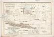
![[P[oelau] Birahbirahan (Dwaalder)]](https://images-2.georeferencer.com/images/iiif/218287055674/full/,300/0/native.jpg)

