Cataloged map
Sindumin / compilation: LHQ Carthographic Coy., Aust. Svy. Corps

Full title:Sindumin / compilation: LHQ Carthographic Coy., Aust. Svy. Corps
Depicted:1945
Publisher:[S.l.] : LHQ Carthographic Coy
Physical Size:20 x 30 cm
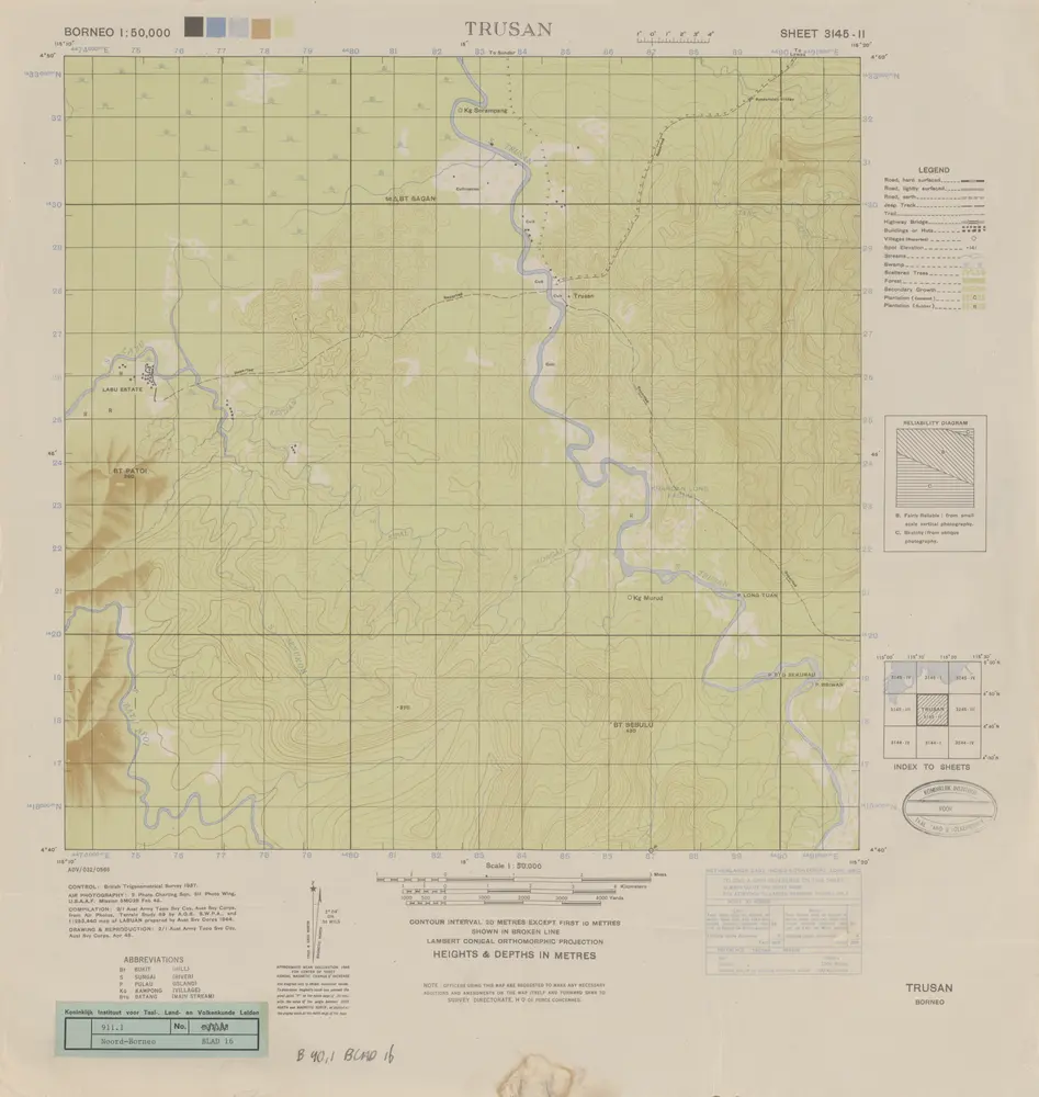
Trusan / compilation: LHQ Cartographic Coy., Aust. Svy. Corps
1945
Australian Survey Corps . LHQ Cartographic Company
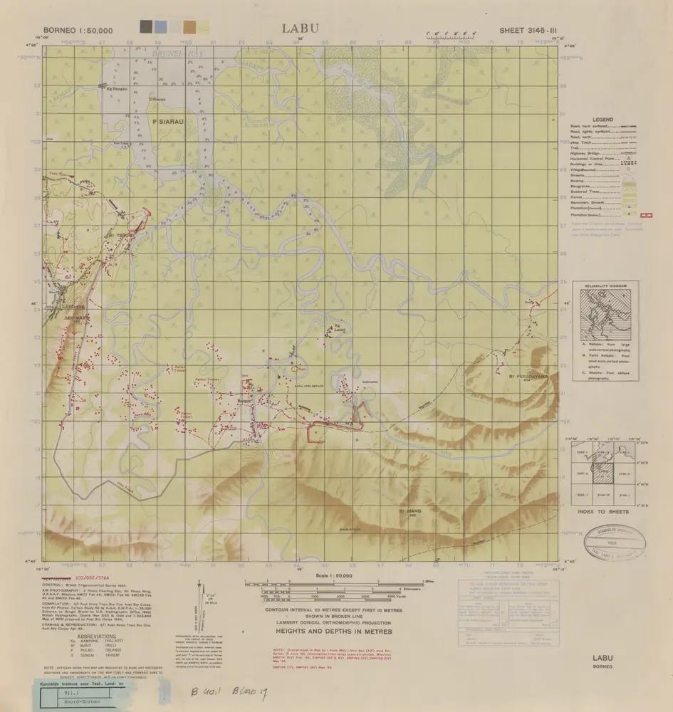
Labu / compilation: LHQ Cartographic Coy., Aust. Svy. Corps
1945
Australian Survey Corps . LHQ Cartographic Company
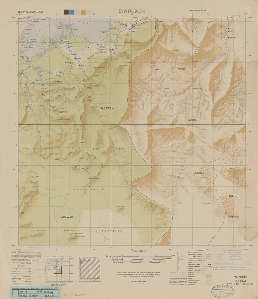
Sindumin / compilation: LHQ Carthographic Coy., Aust. Svy. Corps
1945
Australian Survey Corps . LHQ Cartographic Company
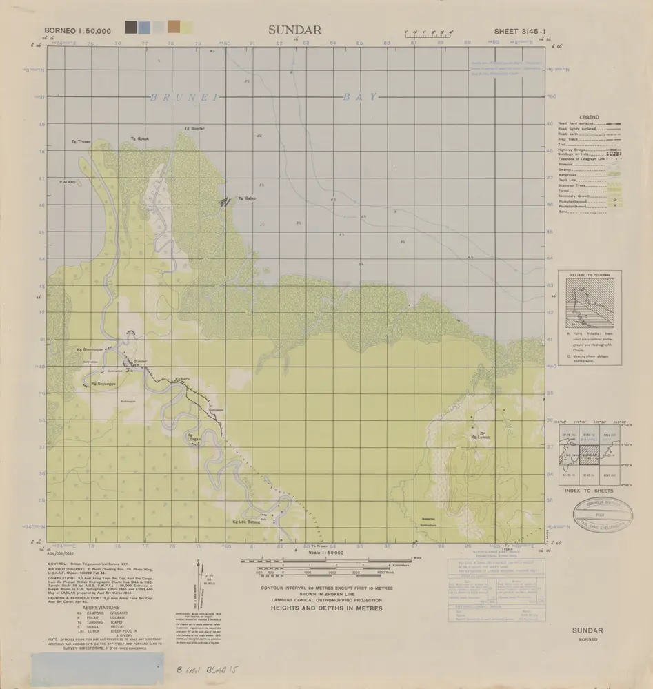
Sundar / compilation: LHQ Cartographic Coy., Aust. Svy. Corps
1945
Australian Survey Corps . LHQ Cartographic Company
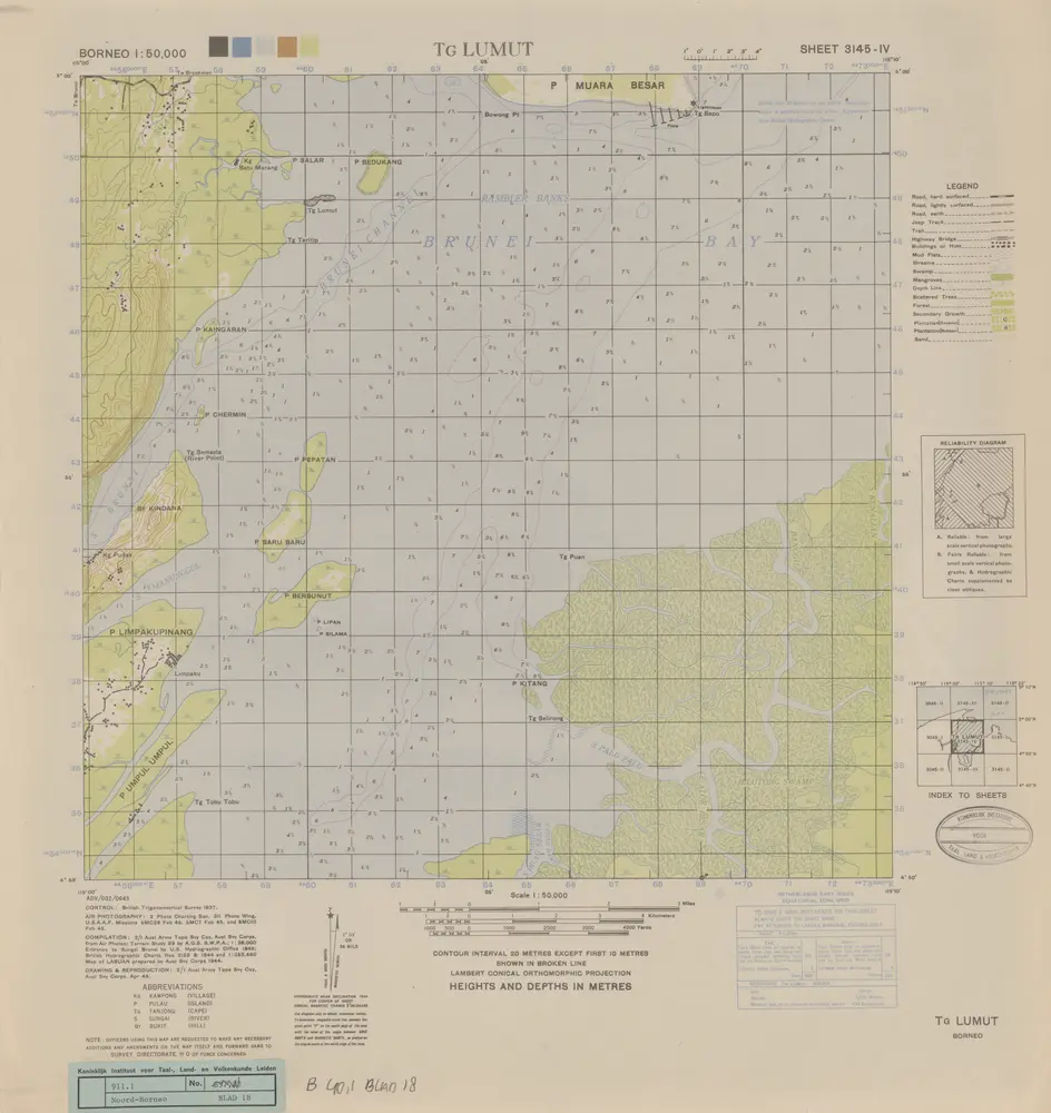
Tg. Lumut / compilation: LHQ Cartographic Coy., Aust. Svy. Corps
1945
Australian Survey Corps . LHQ Cartographic Company
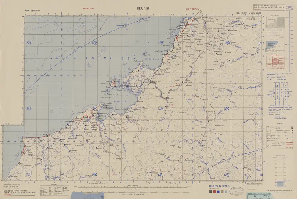
Brunei / Survey of India
1945
Survey of India
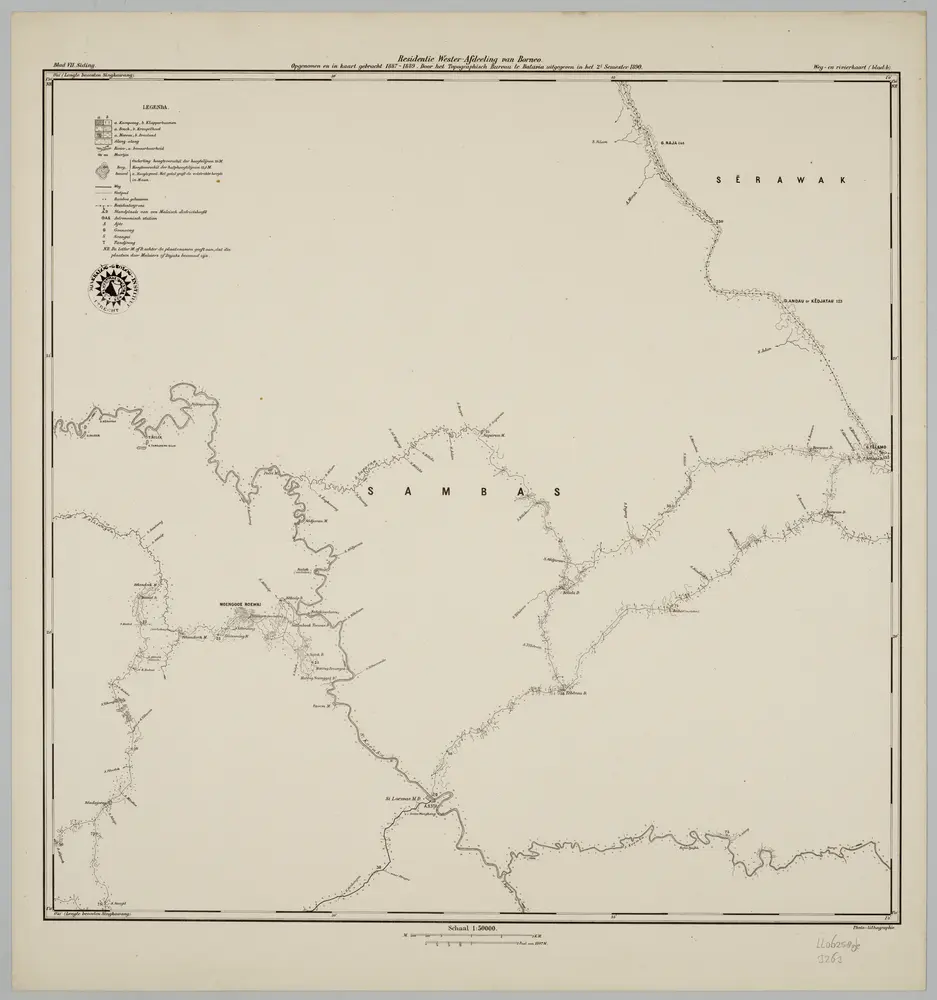
Blad VII Siding, blad b, uit: Residentie Wester-Afdeeling van Borneo : weg- en rivierkaart / Topographisch Bureau
1889
Topographisch Bureau, Batavia
1:50k
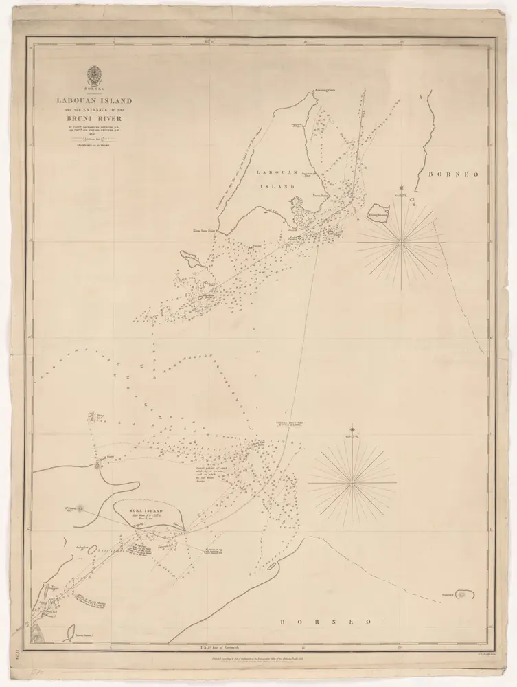
Borneo. Labouan Island and de entrance of de Bruni-river. Getekend door kapiteins Drinkwater Bethune en E. Belcher in 1845. Uitgave van het Hydrographic Office of Admirality.
1846
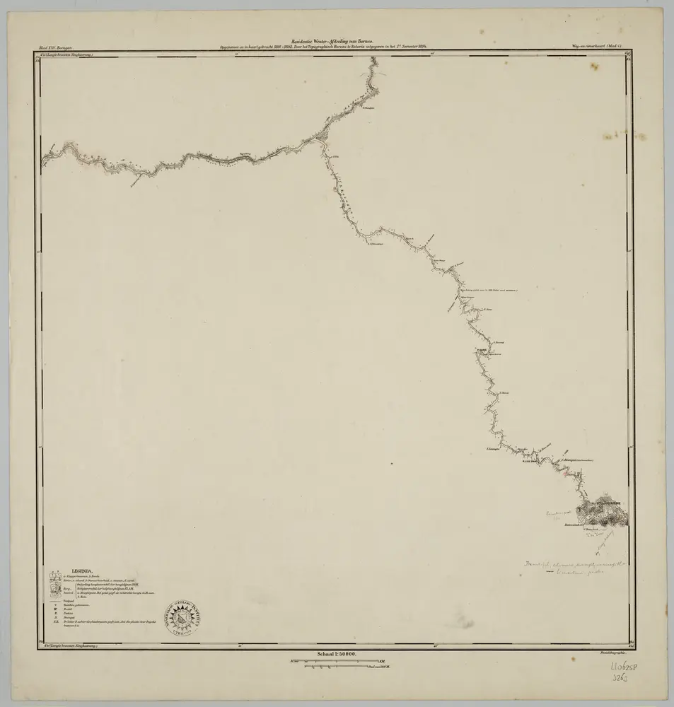
Blad XXV Boengan, blad i, uit: Residentie Wester-Afdeeling van Borneo : weg- en rivierkaart / Topographisch Bureau
1889
Topographisch Bureau, Batavia
1:50k
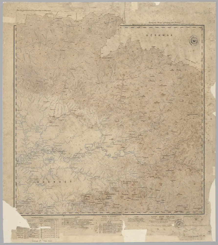
Blad XXI Boven Embaloeh (2) en Blad XXII Boven Kapoewas, uit: Residentie Wester-Afdeeling van Borneo / Topographisch Bureau
1889
Topographisch Bureau, Batavia
1:200k