Maps of Malang

Djember / Survey of India
Survey of India [S.l.] : Survey of India
[Ambulu]
1 : 200000 Joh. C. Stemler Cz.
Kaart der landbouw-ondernemingen in Oost-Java : (Soerabaja, Kediri, Pasoeroean, Probolinggo en Besoeki) / bewerkt naar de oorspronkelijke teekeningen van den heer H.Ph.Th. Witkamp ; uitgave van J.H. de Bussy Amsterdam, 1892
Amsterdam : J.H. de Bussy
[Tambakrejo]
1 : 200000 Joh. C. Stemler Cz.
Bondowoso / prepared under the direction of the Chief of Engineers, U.S. Army by the Army Map Service
Army Map Service Washington D.C. Washington D.C. : Army Map Service
Overzichtskaart van de Residentie Pasoeroean / Topographische Inrichting
Topographische Inrichting Batavia Batavia : Topographische Inrichting
Kaart van de Residentie Probolingo op de schaal van 1:20.000 : opgenomen ingevolge Gouv[ernements] Besluit dd. 6 juli 1866 nr. 8 in de jaren 1875 t/m 1880 / Topographisch Bureau van den Generalen Staf, Batavia
Topographisch Bureau van den Generalen Staf Batavia [Batavia : Topographisch Bureau van den Generalen Staf]
Kaart der Residentiën Pasoeroean en Probolinggo / Topographisch Bureau te Batavia, November 1885
Topographisch Bureau Batavia Batavia : Topographisch Bureau
Overzichtskaart van de Residentie Besoeki / Topographisch Bureau
Topographisch Bureau Batavia Batavia : Topographisch Bureau
Madioen / prepared under the direction of the Chief of Engineers, U.S. Army by the Army Map Service
Army Map Service Washington D.C. Washington D.C. : Army Map Service
Pasoeroean / prepared under the direction of the Chief of Engineers, U.S. Army by the Army Map Service
Army Map Service Washington D.C. Washington D.C. : Army Map Service
Oost Java = East Java / Reproductiebedrijf Top[ografische] Dienst, Batavia
Topografische Dienst Batavia Batavia : Officieële Vereeniging voor Toeristenverkeer in Nederlandsch Indië
Kaart van de Residentie Pasoeroean : opgenomen ingevolge Gouvernements Besluit d.d. 6 juli 1866 nr. 8 in de jaren 1874 t/m 1879 / Topographisch Bureau van de Generale Staf, Batavia
Topographisch Bureau van de Generale Staf Batavia [Batavia : Topographisch Bureau van de Generale Staf]
Tengger-Semeroe-Kawi-Ardjoena / Topographical Service
Topographical Service Batavia Batavia : Topographical Service
Kaart der Residentie Besoeki / Topographisch Bureau te Batavia, april 1887
Topographisch Bureau Batavia Batavia : Topographisch Bureau
Kaart van de Residentie Kediri : opgenomen ingevolge Gouvernements besluit d.d. 6 juli nr.8 in de jaren 1869 t/m 1875 / Topographisch Bureau, Batavia
Topographisch Bureau Batavia Batavia : Topogr[aphisch] Bureau
Kaart van de Residentie Kediri / Topographisch Bureau te Batavia, 1891
Topographisch Bureau Batavia Batavia : Topographisch Bureau
[Pacitan]
1 : 200000 Joh. C. Stemler Cz.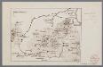
[Oudheden op Oost Java]
1 : 500000 Annotatie: Concept voor atlas van C. Lekkerkerker? [S.l. : s.n.]
[Probolinggo]
1 : 200000 Joh. C. Stemler Cz.
[Pasuruan]
1 : 200000 Joh. C. Stemler Cz.
Wandelkaart Malang en Omstreken / Vereeniging Malang en Omstreken Vooruit
Vereeniging Malang en Omstreken Vooruit [Malang] : Vereeniging Malang en Omstreken Vooruit
Garnizoenskaart Malang en Omstreken / herzien door den Topografischen Dienst in 1929-1931
Topografische Dienst Batavia Batavia : Reproductiebedrijf Topografische Dienst
[Ider-Ider] / [Topographisch Bureau van den Generalen Staf]
Topographisch Bureau van den Generalen Staf Batavia [Batavia : Topographisch Bureau van den Generalen Staf]
Idjen Hoogland / Top[ografische] Inr[ichting]
Topografische Inrichting Batavia Bat[avia] : Top[ographische] Inr[ichting]
[Goenoeng Brama] / [Topographisch Bureau van de Generale Staf]
Topographisch Bureau van de Generale Staf Batavia [Batavia : Topographisch Bureau van de Generale Staf]
[Kepoendan] / [Topographisch Bureau van den Generalen Staf]
Topographisch Bureau van den Generalen Staf Batavia [Batavia : Topographisch Bureau van den Generalen Staf]
[Kust ten zuiden van Woengkal] / [Topographisch Bureau van den Generalen Staf]
Topographisch Bureau van den Generalen Staf Batavia [Batavia : Topographisch Bureau van den Generalen Staf]
[Krai] / [Topographisch Bureau van den Generalen Staf]
Topographisch Bureau van den Generalen Staf Batavia [Batavia : Topographisch Bureau van den Generalen Staf]


