Maps of Siberut

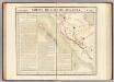
Poelautelo / Survey of India
Survey of India [S.l.] : Survey of India
[P[oelau] Siburut]
Topografische Dienst Batavia Batavia : Reproductiebedrijf Topografische Dienst
[Batoe-Eilanden]

Siberoet = Groot-Fortuin / Topographische Inrichting
Topographische Inrichting Batavia Batavia : Topographische Inrichting
[T[andjoen]g Oewai] / vluchtig opgenomen door den Topografische Dienst in 1933-1934
Topografische Dienst Batavia Batavia : Reproductiebedrijf Topografische Dienst
[T[andjoen]g Sakaladat] / vluchtig opgenomen door den Topografische Dienst in 1933-1934
Topografische Dienst Batavia Batavia : Reproductiebedrijf Topografische Dienst
[G[oenoeng] Katatet] / vluchtig opgenomen door den Topografische Dienst in 1932-1933
Topografische Dienst Batavia Batavia : Reproductiebedrijf Topografische Dienst
[Moearasimataloe] / vluchtig opgenomen door den Topografische Dienst in 1933
Topografische Dienst Batavia Batavia : Reproductiebedrijf Topografische Dienst
[P[oelau] Ngiau] / schetskaart samengesteld door den Topografischen Dienst in 1932
Topografische Dienst Batavia Batavia : Reproductiebedrijf Topografische Dienst
[P[oelau] Nias]
Topografische Dienst Batavia Batavia : Reproductiebedrijf Topografische Dienst
Padang / Survey of India
Survey of India [S.l.] : Survey of India
Padang / samengesteld en gedrukt bij den Topografischen Dienst
Topografische Dienst Batavia Batavia : Topografische Dienst
Siberoet = Groot-Fortuin / Topographische Inrichting
Topographische Inrichting Batavia Batavia : Topographische Inrichting
[P[oelau] Pandjang] : opgenomen in 1897-1900 / door het Topographisch Bureau te Batavia uitgegeven in het 1e semester 1903
Topographisch Bureau Batavia Batavia : Topographisch Bureau
Sirombu / dicetak oleh Reptak Jantop T.N.I. A.D.
Reptak Ja[wata]n Top[ografi] T.N.I. Angkatan Darat Jakarta [Jakarta] : Reptak Ja[wata]n Top[ografi] T.N.I. Angkatan Darat
[Moearasiberoet] / schetskaart samengesteld door den Topografischen Dienst in 1932
Topografische Dienst Batavia Batavia : Reproductiebedrijf Topografische Dienst
[P[oelau] Karangmadjat] / schetskaart samengesteld door den Topografischen Dienst in 1932
Topografische Dienst Batavia Batavia : Reproductiebedrijf Topografische Dienst
Geologische overzichtskaart van den Nederlandsch Oost-Indischen Archipel : Tapanoeli, Sumatra's Oostkust, Sumatra's Westkust / bewerkt door J. Zwierzycki
Batavia : Landsdrukkerij
Automobielkaart van Noord-Sumatra / samengesteld en uitgegeven door de Koninklijke Vereeniging Java Motor Club
Koninklijke Vereeniging Java Motor Club Semarang Semarang : Koninklijke Vereeniging Java Motorclub
Figuratieve schets van het Gouvernement Sumatra's Westkust tot 1830 / door H. de S.
Partie, Sumatra. Oceanique no. 18.
1 : 1641836 Vandermaelen, Philippe, 1795-1869
Overzichtskaart van den weg Medan-Padang / samengest. door de Deli Automobiel Club
Deli Automobiel Club Medan [Medan] : Deli Automobiel Club
Overzichtskaart van den weg Medan-Padang / samengesteld door den Deli Automobiel Club
Deli Automobiel Club Medan [Medan] : Deli Automobiel Club
Residentie Sumatra's Westkust / bewerkt door het Encyclopaedisch Bureau
Encyclopaedisch Bureau Batavia [Batavia] : Encyclopaedisch Bureau
Bladwijzer van West Sumatra
[S.l. : s.n.]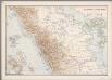
7. Midden-Sumatra, uit: Atlas van Nederlandsch Oost-Indië / samengest. door Topographisch Bureau te Batavia van 1897-1904
Annotatie: Omgewerkte versie van: Atlas der Nederlandsche bezittingen in Oost-Indië / naar de nieuste bronnen samengest. door J.W. Stemfoort en J.J. ten Siethoff. - 's-Gravenhage : Topographische Inrichting, [ca. 1885] Topographisch Bureau, Batavia 's-Gravenhage : Topographische Inrichting
Kaart van Midden-Sumatra : Gouver.nt v. Sumatra's Westkust, Zuid ged. d. R. Sumatra's-Oostkust, Afd. Lingga v.d. Res. Riouw en Onderh. en het Rijk Djambi/ [J.W. Stemfoort en J.J. ten Siethoff ; gereproduceerd op last van het Departement van Koloniën, aan de Topographische Inrichting te 's-Gravenhage, onder leiding van den Directeur C.A. Eckstein]
Ministerie van Koloniën Den Haag s-Gravenhage : Departement van Koloniën
Overzichtskaart bij het reisverslag van Medan naar Padang en terug

De autoweg Medan-Padang / bewerkt door het Encyclopaedisch Bureau
Encyclopaedisch Bureau Batavia [Batavia] : Encyclopaedisch Bureau


