Maps of Natuna Basar

Anambas Eilanden / Survey of India
Survey of India [S.l.] : Survey of India
Gouv[ernemen]t Sumatra : Res[identie] Riouw / Topografische Dienst, Batavia
[S.l. : s.n.]
Terempah / samengesteld door den Topografischen Dienst (Kartogr[afische] Afd[eeling]) naar diverse gegevens in 1941
Topografische Dienst Batavia Batavia : Reproductiebedrijf Topografische Dienst
P[oelau] Djemadja / samengesteld door den Topografischen Dienst (Kartogr[afische] Afd[eeling]) naar diverse gegevens in 1941
Topografische Dienst Batavia Batavia : Reproductiebedrijf Topografische Dienst
Schetskaart eiland Boengoeran (Groot Natoena) / opgenomen door den Dienst van het Boschwezen voor de Buitengewesten
Dienst van het Boschwezen voor de Buitengewesten Batavia : Top[ografische] Inr[ichting]
Singapore / Survey of India
Survey of India [S.l.] : Survey of India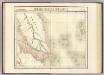
Presqu'ile de Malacca. Oceanique no. 12.
1 : 1641836 Vandermaelen, Philippe, 1795-1869
Geologische overzichtskaart van het schiereiland Malakka en omgeving = Geological map of British Malaya / J.B. Scrivenor
Landsdrukkerij Batavia [Weltevreden (Batavia) : Landsdrukkerij]
Tambelan Eilanden / Survey of India
Survey of India [S.l.] : Survey of India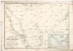
Reduzirte Karte vom Chinesischen Meere.
Jihočínské moře Berghaus, Heinrich Karl Wilhelm Horsburgh, James J. Perthes
Sumatra : aangevende het aantal inrichtingen voor Inlandsch onderwijs op 31 december 1914
Topographische Inrichting, Batavia Batavia : Top[ographische] Inr[ichting]
Sumatra : aangevende het aantal inrichtingen voor Inlandsch onderwijs op 31 december 1913 / [Encyclopaedisch Bureau]
Encyclopaedisch Bureau Batavia [Batavia : encyclopaedisch Bureau]
Sumatra / [W.A.] Withington
[Lexington (Kentucky)] : [s.n.]
Sumatra : aangevende de bestuursindeeling, de standplaatsen der ambtenaren, de dichtheid der bevolking per vierkante KM en de verspreiding der inheemsche bevokingsgroepen / [bewerkt door het Encyclopaedisch Bureau, 1916]
Encyclopaedisch Bureau Batavia [Semarang ; Soerabaja ; 's-Gravenhage : N.V. Boekhandel en Drukkerij v/h G.C.T. van Dorp & Co.]
Het Eiland Sumatra : benevens Bangka, Billiton en Riouw / gelithogr. door E. de Geest
Seyffardt's Boekhandel Amsterdam Amsterdam : Seyffardt's Boekhandel
Sumatra : bevolkingsdichtheid per onderafdeeling volgens uitkomsten der volkstelling in 1930 = density of population per subdivision in 1930
[S.l. : s.n.]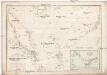
REDUZIRTE KARTE vom CHINESISCHEN MEERE
1 : 2350000 Asie jihovýchodní Berghaus, Heinrich Karl Wilhelm Brose, Wilhelm J. Perthes
Overzichtskaart Algemeen Wegenplan Sumatra
[S.l. : s.n.]
[Overzichtskaart van den Oost-Indischen Archipel]. Bl. I
1 : 2500000 Annotatie: Overige bladen (II-VI) ontbreken [Batavia : Topographische Inrichting]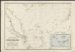
Reduzirte Karte vom Chinesischen Meere, 1.stes oder Südliches Blatt
1 : 2300000 H. Berghaus gestochen von W. Jaeck u. W. Brose Gotha : Perthes
Nieuwe kaart van het eyland Sumatra
1 : 3000000 verb. door François Valentijn [S.l.] : J. van Braam et G. Onder de Linden exc.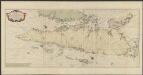
Zee-caart van het eyland Sumatra : met de straaten Malacca, Sincapoera, Banca en Sunda, en alle de daar onderhoorende eylanden, met derzelver bekende dieptens droogtens en ankergronden
1 : 1800000 Te Amsterdam : by Joannes van Keulen [...]
Farther India.
1 : 4000000 John Bartholomew & Co.
Karte von der Insel Sumatra
[H. Berghaus] Gotha : Perthes
Borneo

Indonesia, Thailand and Malaya. Pergamon World Atlas.
1 : 5000000 Polish Army Topography Service
Insula Borneo in Indonesia : Præfectura Apostolica Bornæi Hollandici : anno 1905 erecta eiusque regiones vicinæ et dismembrationes ecclesiasticæ
1 : 16500000 titelvariant: Præfectura Apostolica Bornæi Hollandici [S.l. : Vicario Apostolico de Pontianak]
Overzichtskaart van het Eiland Sumatra / Topographische Inrichting
Topographische Inrichting, Batavia Batavia : Topographische Inrichting
[Sumatra] / Top[ographisch] Bureau v/d Gen[erale] Staf
Topographisch Bureau van de Generale Staf Batavia Batavia : Top[ographisch] Bureau v/d Gen[erale] Staf


