Mappa catalogata
Aitape / U.S. Army Map Service

Titolo completo:Aitape / U.S. Army Map Service
Anno di illustrazione:1944
Editore:Washington D.C. : U.S. Army Map Service
Dimensione fisica:20 x 30 cm
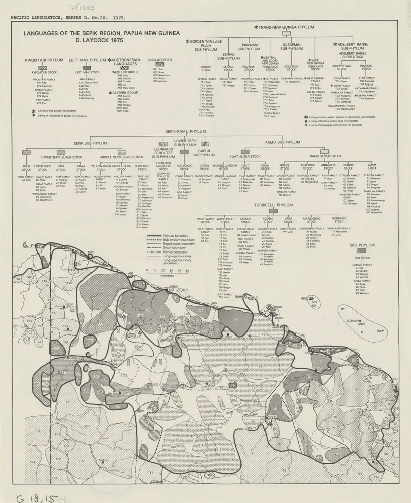
Languages of the Sepic Region, Papua New Guinea / D. Laycock
1975
Australian National University Canberra
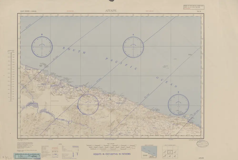
Aitape / U.S. Army Map Service
1944
U.S. Army Map Service Washington D.C.
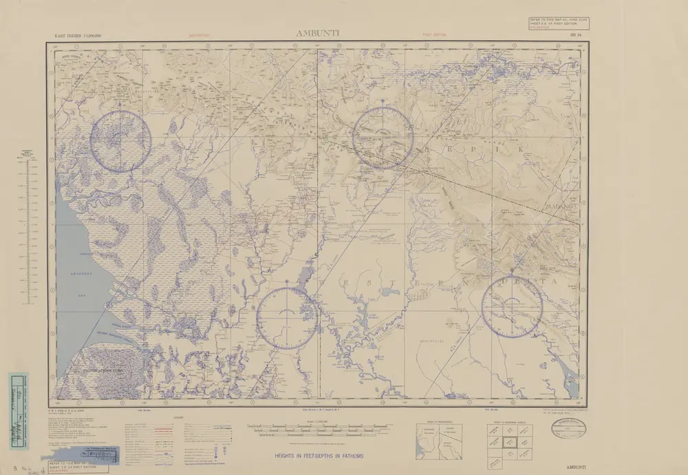
Ambunti / U.S. Army Map Service
1944
U.S. Army Map Service Washington D.C.
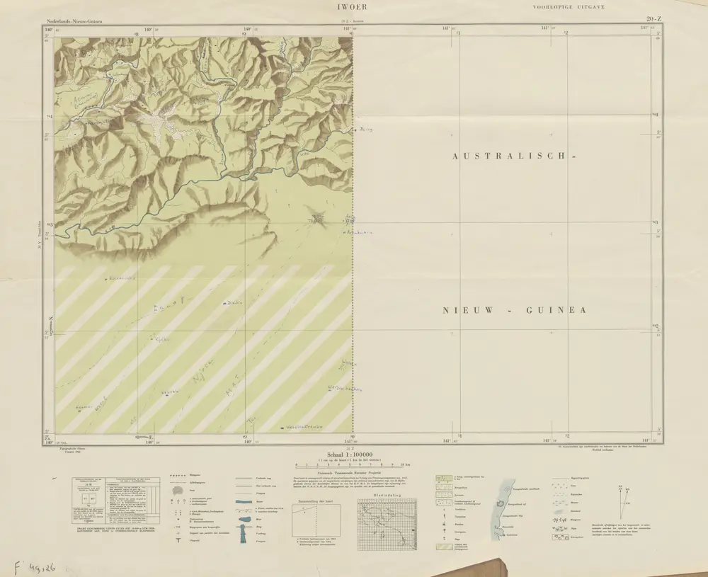
Iwoer / Topografische Dienst
1956
Topografische Dienst Delft
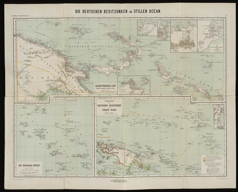
Die deutschen Besitzungen im Stillen Ozean
1893
Kiepert, Richard
1:3m
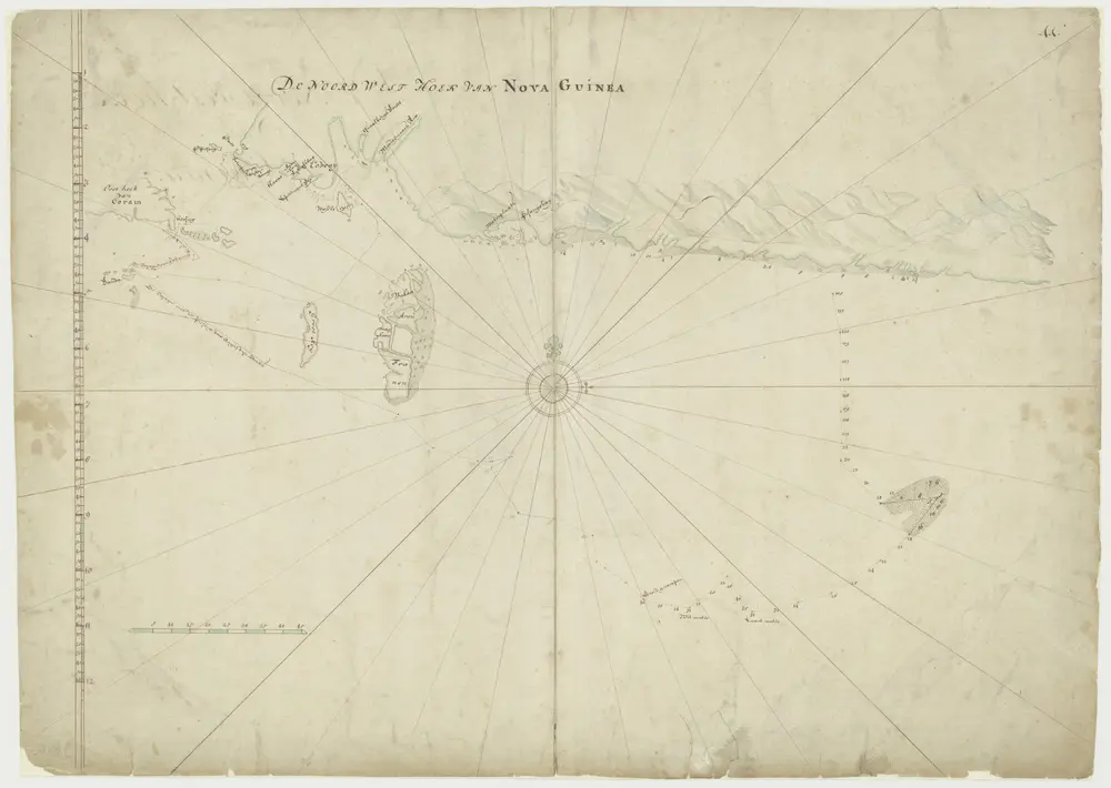
Kaart van de noordwesthoek van Nova Guinea
1700
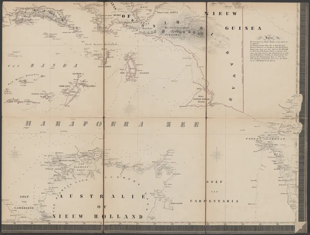
Algemeene land- en zee-kaart van de Nederlandsche overzeesche bezittingen met het Koningrijk der Nederlanden in Europa op de schaal van 1:3.000.000 [Blad 2]
1857
Adriaen Jan Bogaerts (1813-1891)
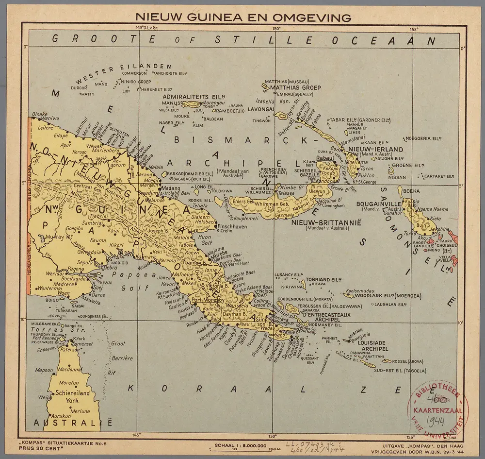
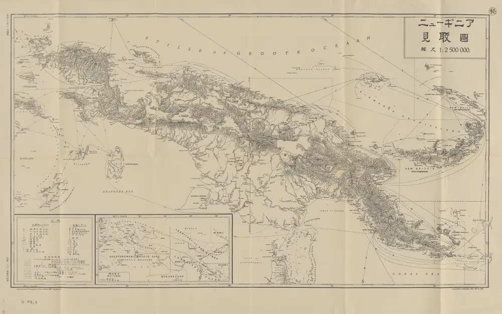
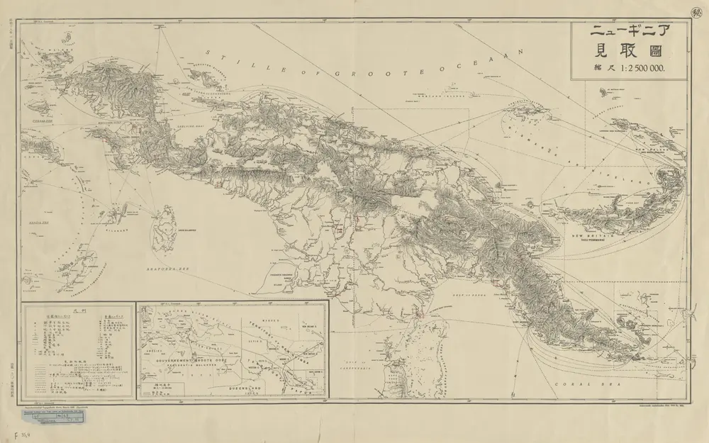
Nieuw Guinea en omgeving
1944
Den Haag : Kompas
1:8m
[Schetskaart van Nieuw-Guinea] / Topografische Dienst
1942
Topografische Dienst Batavia
[Nieuw Guinea] / Topografische Dienst
1942
Topografische Dienst Batavia