Mappa catalogata
Geologische overzichtskaart van den Nederlandsch Oost-Indischen Archipel : Tapanoeli, Sumatra's Oostkust, Sumatra's Westkust / bewerkt door J. Zwierzycki


Titolo completo:Geologische overzichtskaart van den Nederlandsch Oost-Indischen Archipel : Tapanoeli, Sumatra's Oostkust, Sumatra's Westkust / bewerkt door J. Zwierzycki
Anno di illustrazione:1919
Editore:Batavia : Landsdrukkerij
Dimensione fisica:20 x 30 cm
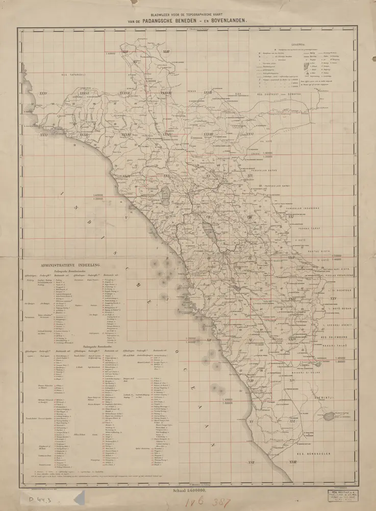
Bladwijzer der Topographische Kaart van de Padangsche Beneden- en Bovenlanden
1905
Topographisch Bureau Batavia
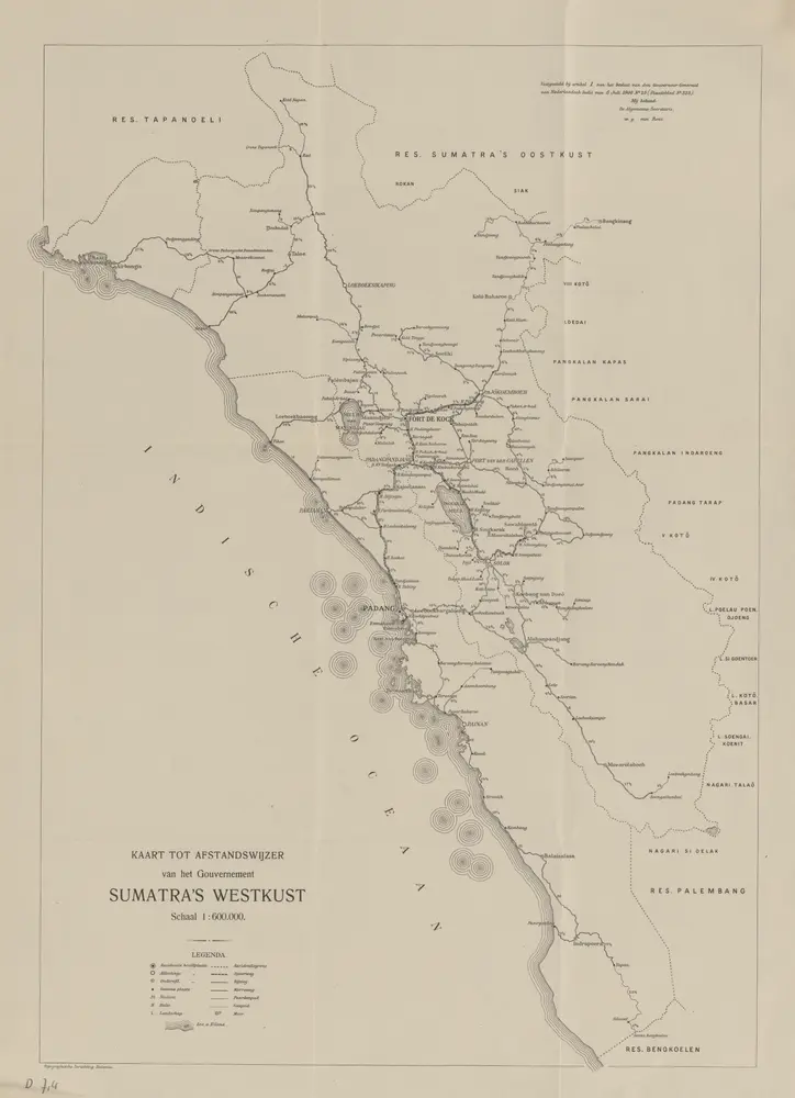
Kaart tot afstandswijzer van het Gouvernement Sumatra's Westkust / Topographische Inrichting
1906
Topographische Inrichting Batavia

Residentie Sumatra's Westkust / bewerkt door het Encyclopaedisch Bureau
1919
Encyclopaedisch Bureau Batavia
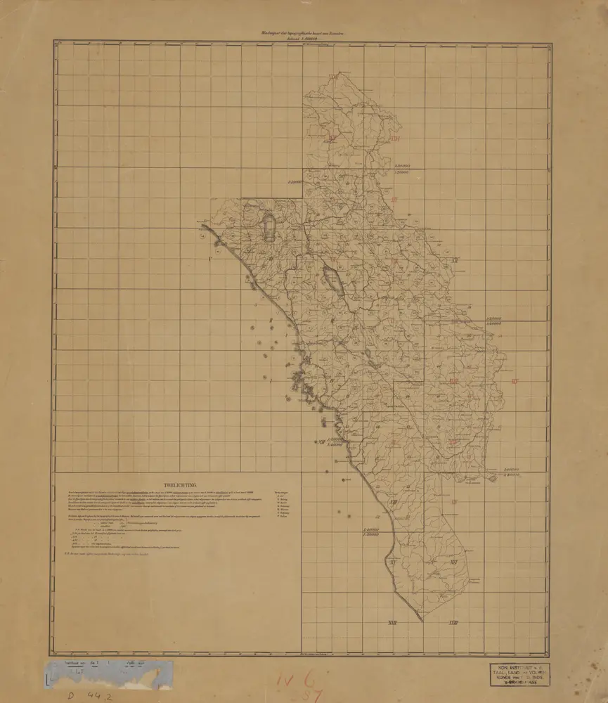
Bladwijzer der Topographische Kaart van Sumatra
1890
[Batavia : Topographisch Bureau]
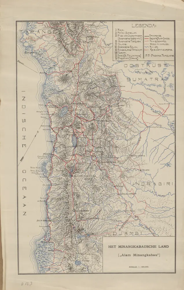
Het Minangkabausche land (Alam Minangkabau)
1925
[S.l. : s.n.]
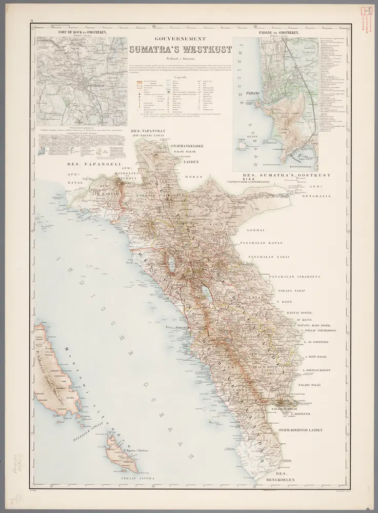
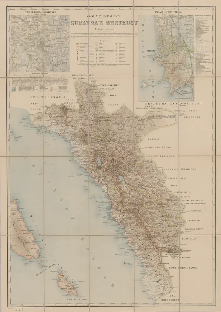
9. Gouvernement Sumatra's Westkust, uit: Atlas van Nederlandsch Oost-Indië / samengest. door Topographisch Bureau te Batavia van 1897-1904
1898
Topographisch Bureau, Batavia
Gouvernement Sumatra's Westkust / Topographische Inrichting
1903
Topographische Inrichting
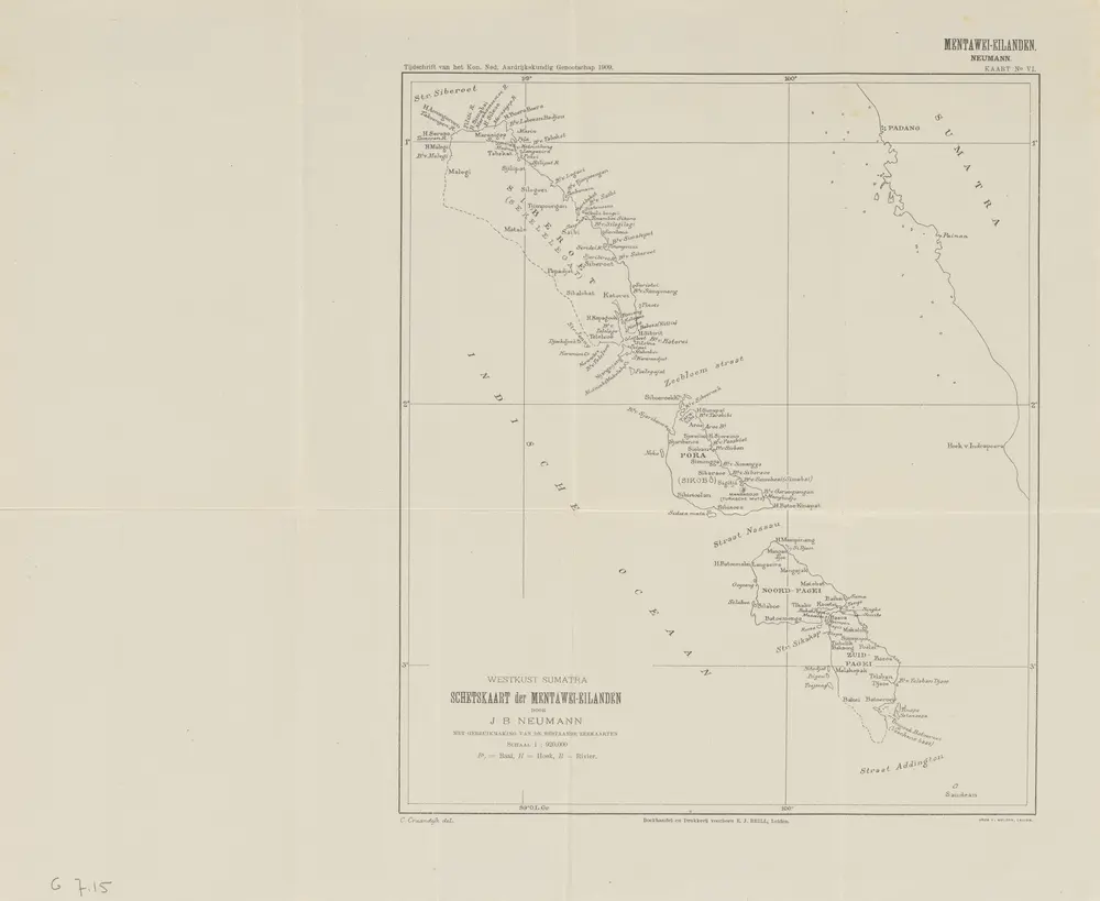
Schetskaart der Mentawei-Eilanden : West Sumatra / door J.B. Neumann ; C. Craandijk del
1909
Koninklijk Nederlandsch Aardrijkskundig Genootschap Amsterdam
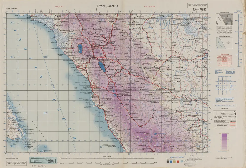
Sawahloento / Survey of India
1944
Survey of India
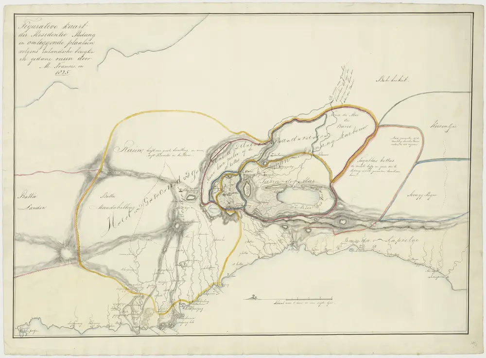
"Figurative kaart der residentie Padang en omliggende plaatsen, volgens inlandsche berigten en gedane reisen."
1825