Maps of Delta Amacuro
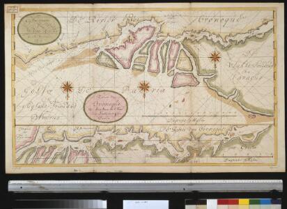
De rivier van Oronoque van Moco Moco tot St. Thome en een gedeelte van de Golf van Paria
Venezuela Gerard van Keulen
Facsimile: Part of Northern Coast of South America by Jefferys.
1 : 1540000 Jefferys, Thomas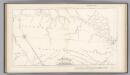
Boundary-line of Spanish and Dutch Guinana by Heneman.
1 : 1940000 Heneman, J.C. v.
Facsimile: Part of Chart of the Guiana Coast by Jefferys.
1 : 560000 Jefferys, Thomas
Boundaries Claimed or Proposed.
1 : 2027520 Venezuela-British Guiana Boundary Commission
Facsimile: Guiana by Blaeuw.
1 : 7100000 Blaeuw, William
Partie, Colombie. Amer. Merid. 3.
1 : 1641836 Vandermaelen, Philippe, 1795-1869
European Occupation in 1803 (1814).
1 : 2027520 Venezuela-British Guiana Boundary Commission
European Occupation in 1796.
1 : 2027520 Venezuela-British Guiana Boundary Commission
European Occupation in 1724.
1 : 2027520 Venezuela-British Guiana Boundary Commission
European Occupation in 1626.
1 : 2027520 Venezuela-British Guiana Boundary Commission
European Occupation in 1674.
1 : 2027520 Venezuela-British Guiana Boundary Commission
Grand View of European Occupation, 1597-1803 (1814).
1 : 2027520 Venezuela-British Guiana Boundary Commission
European Occupation in 1756.
1 : 2027520 Venezuela-British Guiana Boundary Commission
Forests and Savannas.
1 : 2027520 Venezuela-British Guiana Boundary Commission
Drainage Basins.
1 : 2027520 Venezuela-British Guiana Boundary Commission
European Occupation in 1597.
1 : 2027520 Venezuela-British Guiana Boundary Commission
European Occupation in 1773.
1 : 2027520 Venezuela-British Guiana Boundary Commission
European Occupation in 1648.
1 : 2027520 Venezuela-British Guiana Boundary Commission
European Occupation in 1703.
1 : 2027520 Venezuela-British Guiana Boundary Commission
Facsimile: Part of Chart of the Guiana Coast by Jefferys.
1 : 1510000 Jefferys, Thomas
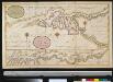
Facsimile: Part of South America by Arrowsmith.
1 : 2800000 Arrowsmith, John
Facsimile: Surinam by Popple.
1 : 3787000 Popple, Henry
Orinoco.
1 : 2650000 Restrepo, Jose Manuel, 1781-1863

Insula S. Iuan De Puerto Rico Caribes; Vel Canibalum Insulae. [Karte], in: Het vijfde Deel Des Grooten Atlas : Vervatende De Water-Weereld, S. 66.
1 Karte aus Atlas Jansson, Jan Jansson, Jan
Insula S.Iuan de Puerto Rico Caribes; Vel Canibalum Insulae. [Karte], in: Novus atlas absolutissimus, Bd. 9, S. 76.
1 Karte aus Atlas Janssonius Offizin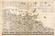
A Map of the British Empire in America. (Sheet 19).
1 : 2000000 Popple, Henry
Facsimile: Part of Venezuela, Guiana by Arrowsmith.
1 : 4850000 Arrowsmith, John