Maps of Desierto De Atacama

Maps of Desierto De Atacama

$title$

Een gedeelte van de Zuijdt-Zee van Quilca tot Po. El Guasco geleegen aen de kust van Peru
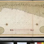
Chile Gerard van Keulen
$title$

South America 3.

1 : 2800000 Arrowsmith, Aaron
$title$

Partie du Chili. Amer. Merid. 29.

1 : 1641836 Vandermaelen, Philippe, 1795-1869
$title$

West Coast of South America. Peru and Bolivia (mostly Chile) ... Quilca to Cobija.

1 : 1230000 Berghaus, Henry
$title$

Carta de la rejion salitrera comprendida entre los paralelos 19° y 27°30' lat. sur

1 : 500000 (Chili) Delegacion fiscal de salitreras Antofagasta : Delegacion fiscal de salitreras
$title$

Departamento de Moquegua.

1 : 1080000 Paz Soldan, Mariano Felipe, 1821-1886
$title$

(Mapa de la Republica de Chile 2)

1 : 11000000 Pissis, Aime, 1812-1889
$title$

(Mapa de la Republica de Chile 3)

1 : 11000000 Pissis, Aime, 1812-1889
$title$

Mapa de la Republica de Chile (1)

1 : 11000000 Pissis, Aime, 1812-1889
$title$

Cote, Perou.

1 : 830000 Lartigue, Joseph, 1791-1876
$title$

Republica de Chile [27°-29° S]

1 : 500000 (Chili) Oficina de Mensura de Tierras Santiago du Chili : Oficina de Mensura de Tierras
$title$

La Paz : South America, 1:1,000,000

1 : 1000000
$title$

Republica de Chile [17°-19° S]

1 : 500000 (Chili) Oficina de Mensura de Tierras Santiago du Chili : Oficina de Mensura de Tierras
$title$

Port de Hillaij, reede van Hierbabouenna en Dierbaboine, de Hoek of Pointe Tambot en Rade deHillot aen de kust van Perou in de Zuijd Zee

Peru Grout Gerard van Keulen
$title$

Demarcacion de limites con Chile. Plano general de la sub-comision n°1. Hoja n°I

1 : 500000 Argentine. Oficina de Límites Internacionales [Buenos Aires ?] :
$title$

Croquis, ferro-carril entre Arequipa y la costa.

1 : 317500 Paz Soldan, Mariano Felipe, 1821-1886
$title$

Plano de la ciudad de la Paz

1 : 5000 1 Mapa. Abans 31-5-4 José Rodríguez M. Oficina Cartografica Bemporat
$title$

Demarcacion de limites con Chile. Puna de Atacama.

1 : 500000 Argentine. Oficina de Límites Internacionales [Buenos Aires ?] :
$title$

Coupe de la route de Buenos-Ayres a Lima.

1 : 1949000 Martin de Moussy, V. (Victor), 1810-1869
$title$

Richard Mayer's commercial map of Northern Chili, Bolivia, & southern Peru

1 : 1000000
$title$

West Coast of South America.

Fullarton, A. & Co.
$title$

Composite: Mapa de la Republica de Chile (1-8)

1 : 11000000 Pissis, Aime, 1812-1889
$title$

Chili, cote.

1 : 2500000 Spain. Marina
$title$

Cote, Perou.

1 : 2200000 Spain. Marina
$title$

Partie du Perou. Amer. Merid. 25.

1 : 1641836 Vandermaelen, Philippe, 1795-1869
$title$

Catamarca et Tucuman.

1 : 1850000 Martin de Moussy, V. (Victor), 1810-1869
$title$

Carte, provinces de Salta et Jujuy, partie de la Bolivie.

1 : 1850000 Martin de Moussy, V. (Victor), 1810-1869
$title$

Mapa del sur del Peru y parte de Bolivia

1 : 1000000 Arequipa : J.L. Villanueva
$title$

Carte, provinces de La Rioja et San Juan.

1 : 1850000 Martin de Moussy, V. (Victor), 1810-1869
$title$

Provincia de Catamarca.

1 : 1800000 Paz Soldan, Mariano Felipe, 1821-1886
© MapTiler © OpenStreetMap contributors
How does it work?
These instructions will show you how to find historical maps online.
Getting started
Type the place name in the search box to find the exact location. You can further adjust the search by zooming in and out.
Zoom
Zoom in and out with the buttons or use your mouse or touchpad natively.
Exact Area tool
Click here and draw a rectangle over the map to precisely define the search area.
Set filters
Narrow your search with advanced settings, such as Years (from/to), Fulltext, Publisher, etc.
Results
See the results of your search on the right side. You can scroll down to find more maps of this location.
?

Download OldMapsOnline Mobile