Maps of Ecuador
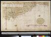
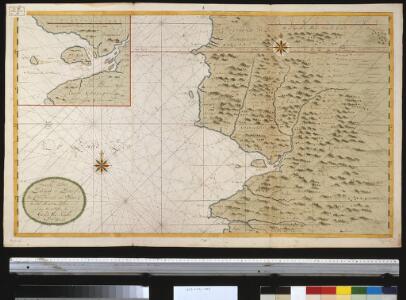
Een gedeelte van de Zuijd-Zee van C. de S. Francisco tot Paijta aen de kust van Peru
Ecuador Gerard van Keulen
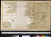
Carte de la province de Quito au Perou / dressée sur les observations astronomiques, journaux de route et mémoires de Mr. de la Condamine et sur ceux de Don Pedro Maldonado par Mr. D'Anville
1 Mapa, b/n. Tom. XIII, no 10. - Les triangles tracés dans cette carte sont ceux qui ont servi a la mesure de la Meridienne Anville, Jean Baptiste Bourguignon d'
Carta Geografica del Ecuador.
1 : 445000 Wolf, Teodoro
Carta geográfica del Ecuador
1 : 445000 Wolf, Teodoro Instituto geográfica de H. Wagner & E. Debes
Guayaquil.
1 : 2700000 Restrepo, Jose Manuel, 1781-1863
Mapa del Peru
1 : 500000 Raimondi, Antonio 1826-1890 Paris : Erhard Frères
Departamento litoral de Piura.
1 : 1070000 Paz Soldan, Mariano Felipe, 1821-1886
Mapa del Peru
1 : 500000 Raimondi, Antonio 1826-1890 Paris : Erhard Frères
Plateau von Quito
1 : 200000 Berghaus, Heinrich Karl Wilhelm, 1797-1884 J. Perthes
Vermischtes zur Geologie
Erster Band, enthaltend in vier Abtheilungen die Erscheinungen der anorganischen Natur: 1. Meteorologie und Klimatographie. 2. Hydrologie und Hydrographie. 3. Geologie. 4. Tellurischer Magnetismus Humboldt, Alexander von Verlag von Justus Perthes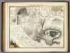
Vermischtes zur Geologie.
Berghaus, Heinrich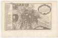
Plan de la ville et cite de St. Franciscois de Quito
1 mapa. A la part inferior: Tom. XIII, Num. 11.
HMS Swiftsure, Panama to Payta, Jan 1885.
Henderson, C.F.
Cote occid., l'Amerique.
1 : 2150000 Spain. Marina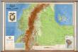
Ecuador -- Physical
1 : 500000 Instituto Geografico Militar
Partie, Colombie. Amer. Merid. 8.
1 : 1641836 Vandermaelen, Philippe, 1795-1869
Carta dei Paesi sopra il Mare Meridionale de Panama a Guayaquil
La Historia de América del reverendo William Robertson (1721-1793), originalmente publicada en Londres en 1777, fue todo un éxito editorial en Europa. La obra, dividida en diez libros, aborda diferentes aspectos y episodios del descubrimiento y conquista del continente, particularmente la conquista de México y del Perú, siendo el istmo de Panamá y la región de Darién un paso estratégico en la historia colonial del Perú. En Italia hubo múltiples ediciones de la traducción de Antonio Pillori, la mayoría de las cuales incluyeron mapas. Esta versión se caracteriza por la inscripción “Aloja Inc”, en la parte inferior derecha del mapa Kitchin, Thomas (1719–1784). Aloja
Asuay.
1 : 2700000 Restrepo, Jose Manuel, 1781-1863
Ecuador.
1 : 2700000 Restrepo, Jose Manuel, 1781-1863
Mapa del Peru
1 : 500000 Raimondi, Antonio 1826-1890 Paris : Erhard Frères
Mapa del Peru
1 : 500000 Raimondi, Antonio 1826-1890 Paris : Erhard Frères
Departamento de Amazonas.
1 : 1070000 Paz Soldan, Mariano Felipe, 1821-1886
Terra Firma et Novum Regnum Granatense et Popayan
from America: being the latest, and most accurate description of the Nevv vvorld; containing the original of the inhabitants, and the remarkable voyages thither. The conquest of the vast empires of Mexico and Peru, and other large provinces and territories, with the several European plantations in those parts. Also their cities, fortresses, towns, temples, mountains, and rivers. Their habits, customs, manners, and religions. Their plants, beasts, birds, and serpents. With an appendix, containing, besides several other considerable additions, a brief survey of what hath been discover'd of the vnknown south-land and the Arctick region. Collected from most authentick authors, augmented with later observations, and adorn'd with maps and sculptures, by John Ogilby ...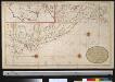
Nieuwe afteekening van Peru met alle desselfs gelegentheden zijnde geleegen in de Groote Zuijt Zee
Peru Gerard van Keulen
Venezuela, Colombia, Ecuador.
1 : 7500000 Colton, G.W.
PERV
[Amsterdam : Joan Blaeu]
Republique de Colombie.
1 : 8700000 Vivien de St Martin, L.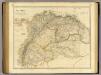
Colombia
1 : 4900000 Arrowsmith, John