Maps of Turks and Caicos Islands

Maps of Turks and Caicos Islands

$title$

De Noordkust van Espaniola van Cabo Francesos tot I. Tortuga vertonende de Machenille int groodt alles geleght na de nieuste afteekeninge
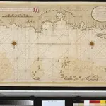
Haiti Gerard van Keulen
$title$

Turks Islands.

1 : 85000 Jefferys, Thomas
$title$

Bahía y ciudad de Bayaha, ó Puerto del Delfin, en la Isla de Santo Domingo

1 : 1
$title$

Plan du port du Cap

1 : 20900 Cap-Haitien (Haiti)
$title$

Cap Francois.

1 : 14000 Jefferys, Thomas
$title$

Carte de L'Isle de St. Domingue une des Grandes Antilles, Colonies Francoise et Espagnole

1 : 2400000
$title$

Carte de l'isle de Saint Domingue : dressée en 1722 pour l'usage du Roy sur les mémoires de Mr. Frezier, Ingenieur de S.M. et autres

1 : 1280000 L'Isle, Guillaume de, 1675-1726 Chez l'Auteur sur le Quay de l'Horloge
$title$

Carte de l'Isle de Saint Domingue : dressée en 1722 pour l'usage du Roy sur les memoires de Mr. Frezier, ingenieur de S.M. et autres

1 : 310000 L'Isle, Guillaume de, 1675-1726 Chez Jean Cóvens et Corneille Mortier, geographes
$title$

Saint Domingue.

1 : 1300000 L'Isle, Guillaume de, 1675-1726
$title$

Saint Domingue.

1 : 1300000 L'Isle, Guillaume de, 1675-1726
$title$

Hispaniola, St. Domingo.

1 : 1750000 Jefferys, Thomas
$title$

Carte de St. Domingue

1 : 1800000 Herbin de Halle, Etienne de.
$title$

Hayti or Saint Domingo.

1 : 1520640 Lucas, Fielding Jr.
$title$

Map Of Hispaniola, Or St Domingo.

1 : 1500000 Lea, I.
$title$

A map of the island of St. Domingo

1 : 950000
$title$

Hayti

Haiti im Verlage des Geographischen Instituts
$title$

Hayti ou Ile St. Domingue.

1 : 1500000 Pierron, Jean Antoine
$title$

Carte de la partie Françoise de St. Domingue, faite par Bellin, ing-r de la marine et depuis augmentée par P. C. Varlé et autres ing-rs.

from Carey's general atlas, improved and enlarged : being a collection of maps of the world and quarters, their principal empires, kingdoms, &c.
$title$

Carte politique de St. Domingue / par Leyritz, Levassor et Bourjolly

1 : 650000 Annotatie: Afdruk van de originele koperplaat; Oorspr. uitg.: 1803 Leyritz, ...; Levassor, ...; Bourjolly, ... [Paris : IGN]
$title$

[Posesiones de America, Isla de Cuba]

1 : 1000000 Coello, Francisco [Verlag nicht ermittelbar]
$title$

Carte De La Partie Francoise De St. Domingue.

1 : 870000 Carey, Mathew
$title$

Carte De La Partie Francoise De St. Domingue.

1 : 880000 Carey, Mathew
$title$

Map Of the French Part Of St. Domingo.

1 : 348480 Carey, Mathew
$title$

Carte des isles situées au nord de St. Domingue

1 : 1
$title$

Karte von der durch den Frieden zu Basel den 22 July 1795 von Spanien und Frankreich abgetrettenen Insel St. Domingo oder Hispaniola

1 : 1900000 Francie Reilly, Franz Johann Josef von F.I.I. von Reilly
$title$

Haiti ou St. Domingue. Amer. Sep. 68.

1 : 1641836 Vandermaelen, Philippe, 1795-1869
$title$

Saint Domingue ou Hispaniola, Martinique.

1 : 1700000 Robert de Vaugondy, Gilles, 1688-1766
$title$

L'isle de St. Domingue, et celle de Porto-Rico

1 : 2930000 Hispaniola (ostrov) Bonne, Rigobert André
$title$

Cuba Insula ; Hispaniola Insula

1 : 1
$title$

Zeilan Insula

1 : 1
© MapTiler © OpenStreetMap contributors
How does it work?
These instructions will show you how to find historical maps online.
Getting started
Type the place name in the search box to find the exact location. You can further adjust the search by zooming in and out.
Zoom
Zoom in and out with the buttons or use your mouse or touchpad natively.
Exact Area tool
Click here and draw a rectangle over the map to precisely define the search area.
Set filters
Narrow your search with advanced settings, such as Years (from/to), Fulltext, Publisher, etc.
Results
See the results of your search on the right side. You can scroll down to find more maps of this location.
?

Download OldMapsOnline Mobile