Maps of Provincia de Chiloé

Maps of Provincia de Chiloé

$title$

Het Vervolg van de Kust van Chili van de Straat van Magalanus tot 't Eyland La Mocha
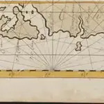
Chile Gerard van Keulen
$title$

Een gedeelte van de kust van Chili in de Zuijd Zee van Po. IJtata tot El Laguia of van 36 tot 41 graden Breete

Chile Gerard van Keulen
$title$

Een haven aen de kust van Chili

Chile Gerard van Keulen
$title$

Nieuwe afteekening van de rivier van Baldivia is geleegen in de Zuijt Zee aen de kust van Chili

Chile Gerard van Keulen
$title$

Afteekeningh en de opdoeninge van de rivier van Baldivia

Chile Gerard van Keulen
$title$

The channels between Port de Ancud and Port Montt by the Officers of H.M.S. Beagle, 1835

[The channels between Port de Ancud and Port Montt ... by the Officers of H.M.S. Beagle, 1835, etc. (Port Abtao. Port Montt. Entrance of the River Maulin)]
$title$

Plan of the Bay of Conception in Chili.

La Perouse, Jean-Francois de Galaup, comte de, 1741-1788
$title$

Afteekening van een gedeelte van de kust van Chili in de Zuijd Zee van El Laguia tot C. de la Victoria

Chile Gerard van Keulen
$title$

(Mapa de la Republica de Chile 11)

1 : 11000000 Pissis, Aime, 1812-1889
$title$

(Mapa de la Republica de Chile 9)

1 : 11000000 Pissis, Aime, 1812-1889
$title$

(Mapa de la Republica de Chile 10)

1 : 11000000 Pissis, Aime, 1812-1889
$title$

(Mapa de la Republica de Chile 8)

1 : 11000000 Pissis, Aime, 1812-1889
$title$

Mapa de la region patagonica entre los grados 47 y 52 sur

1 : 500000 Argentine. Oficina de Límites Internacionales [Buenos Aires ?] :
$title$

Plano del Puerto de la Concepcion de Chile, citu[a]da la Poblacion de Talcaguano en la latitud S. de 36o,42',28" y en longitud al O' de cadiz de 67o,2',53"

1 : 48000
$title$

Departamento de tierras y colonizacion

1 : 1000000 (Chili) Servicio de Mensura y Clasificacion de Tierras Santiago du Chili : Taller del Servicio de Mensura y Clasificacion de Tierras
$title$

Republica de Chile [39°-41° S]

1 : 500000 (Chili) Oficina de Mensura de Tierras Santiago du Chili : Oficina de Mensura de Tierras
$title$

Republica de Chile [37°-39° S]

1 : 500000 (Chili) Oficina de Mensura de Tierras Santiago du Chili : Oficina de Mensura de Tierras
$title$

Le Chili

1 : 6400000
$title$

A new map of the southern parts of America taken from manuscript maps made in the country and a survey of the eastern coast maode by the order of the King of Spain

1 : 3168000
$title$

[147][150] Tractus Australior Americae Meridionalis ..., uit: Atlas sive Descriptio terrarum orbis

Annotatie: Gedigitaliseerde versie. Amsterdam. Heiloo : Picturae (vervaardiger), 2015. tiff-bestand. Gedigitaliseerd: 07-01-2015; Origineel: Universiteitsbibliotheek Vrije Universiteit (XL.05127.-) ; Netherlands; Titelpagina ontbreekt Wit, Frederik de Amsterdam : Frederick de Wit
$title$

Karte der zwischen Argentinien und Chile streitigen Grenzgebiete

1 : 4000000 Alemann, T. Litog. Rüegg & Mülli
$title$

Paskaarte van't zuÿdelÿckste deel van America

1 Karte : Kupferdruck ; 43 x 53 cm Doncker bÿ Hendrick Doncker boeckverkoper en graad-boog-maker inde Nieuwe-brug-steeg
$title$

Le Chili, avec les contrées voisines et le pays des Patagons

1 : 10700000 Chile Bonne, Rigobert André
$title$

Patagonia. South Orkney or Powell's Group. Falkland Islands. South Georgia Island.

Colton, G.W.
$title$

Amerique Meridionale. (Southern section)

1 : 6300000 Anville, Jean Baptiste Bourguignon d, 1697-1782
$title$

Karte von Süd-America

Jižní Amerika Anville, Jean-Baptiste Bourguinon d' Alberti, Ignaz F.A. Schraembl
$title$

Chili [Karte], in: Le théâtre du monde, ou, Nouvel atlas contenant les chartes et descriptions de tous les païs de la terre, Bd. 2, S. 347.

1 Karte aus Atlas Blaeu, Willem Janszoon und Blaeu, Joan Blaeu, Willem Janszoon
$title$

Amerique Merid., cotes.

1 : 5500000 Spain. Marina
$title$

Carte de la Patagonie et des Archipels de la Terre de Feu des Malounies et des Còtes Occidentales

1 : 2000000 Description géographique et statistique de la Confédération Argentine Martin de Moussy, Victor Librairie de Firmin Didot frères, fils et Cie
$title$

Patagonia ... South Orkney ... Falkland Islands ... South Georgia Island.

1 : 8236800 Colton, G.W.
© MapTiler © OpenStreetMap contributors
How does it work?
These instructions will show you how to find historical maps online.
Getting started
Type the place name in the search box to find the exact location. You can further adjust the search by zooming in and out.
Zoom
Zoom in and out with the buttons or use your mouse or touchpad natively.
Exact Area tool
Click here and draw a rectangle over the map to precisely define the search area.
Set filters
Narrow your search with advanced settings, such as Years (from/to), Fulltext, Publisher, etc.
Results
See the results of your search on the right side. You can scroll down to find more maps of this location.
?

Download OldMapsOnline Mobile