Maps of Almeria

Maps of Almeria

$title$

Carte particuliere des côstes d'Espagne et Barbarie depuis Gibralter jusqu'à C. de Palle et depuis Ceuta jusqu'au C. Ferat
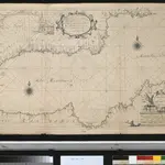
Spain Henri Michelot Gerard van Keulen
$title$

Granata, Et Murcia Regna. [Karte], in: Theatrum orbis terrarum, sive, Atlas novus, Bd. 2, S. 234.

1 Karte aus Atlas Blaeu, Joan Blaeu, Willem Janszoon
$title$

Granata, Et Murcia Regna. [Karte], in: Gerardi Mercatoris et I. Hondii Newer Atlas, oder, Grosses Weltbuch, Bd. 2, S. 198.

1 Karte aus Atlas Mercator, Gerhard und Hondius, Jodocus Jansson, Jan
$title$

Granata, Et Murcia Regna. [Karte], in: Le théâtre du monde, ou, Nouvel atlas contenant les chartes et descriptions de tous les païs de la terre, Bd. 2, S. 227.

1 Karte aus Atlas Blaeu, Willem Janszoon und Blaeu, Joan Blaeu, Willem Janszoon
$title$

43. Spagna, Portogallo sud.

1 : 1500000 Touring club italiano
$title$

GRANATA, | ET | MVRCIA | REGNA.

[Amsterdam : Joan Blaeu]
$title$

Granata, et Mvrcia regna

1 Karte : Kupferdruck ; 36 x 48 cm Janssonius Joannes Janssonius
$title$

Granata, et Mvrcia regna

1 Karte : Kupferdruck ; 36 x 48 cm Blaeu Joan Blaeu
$title$

$title$

Granata, Et Murcia Regna. [Karte], in: Novus Atlas, das ist, Weltbeschreibung, Bd. 2, S. 234.

1 Karte aus Atlas Blaeu, Joan Blaeu, Willem Janszoon
$title$

Granatae regnv[m]

1 Karte : Kupferdruck ; 15 x 23 cm Lambert Andreae
$title$

[Carte d'Espagne et de Portugal en neuf feuilles, 8]

1 Blatt : 31 x 41 cm P.G. Chanlaire
$title$

Espagne et Portugal, 8

1 Blatt : 31 x 42 cm Mentelle
$title$

Maroc (500 000 e). Oudjda

1 : 500000 France. Service géographique de l'armée Service géographique de l'Armée
$title$

Mapa del reyno de Granada

1 Karte auf 2 Blatt : Kupferdruck ; 38 x 79 cm López s.n.
$title$

$title$

Granadæ, Cordovæ et Gienensis regna

1 Karte : Kupferdruck ; 43 x 56 cm López; Güssefeld apud Homannianos Heredes
$title$

Li regni di Granata è d'Andalvcia / G. Cantelli da Vignola, 2

1 Blatt : Domenico de Rossi
$title$

Mapa del Reyno de Granada construido sobre las mejores y mas modernas memorias

1 : 570000 por Thomàs Lopez, pensionista de S. M. Madrid : [Thomas Lopez]
$title$

$title$

Carte de la partie de l'Andalousie éprouvée par le tremblement de terre du 25 décembre 1884

1 : 600000 Wuhrer, L.
$title$

Oran, Constantine.

1 : 800000 Theinert, A.
$title$

$title$

Karte der Sierra Nevada / construiert [von] Otto Neussel, 1893 ; gezeichnet 1899

1 : 200000 Annotatie: Met korte lijst van geografische begrippen in het Spaans en het Duits Otto Neussel Wien : K. und K. Militär-Geographische Institut
$title$

$title$

Accurata designatio celebris freti prope Andalusiæ castellum Gibraltar. inter in Europam et Africam

1 Karte : Kupferdruck ; 36 x 56 cm, Bildgrösse 48 x 56 cm Seutter Matthäus Seutter
$title$

Carte générale du Maroc à l'échelle de 1 : 500 000 e. Oudjda

1 : 500000 Maroc. Service géographique Rabat : Service géographique du Maroc
$title$

Almería

1 : 200000 Coello, Francisco [Verlag nicht ermittelbar]
$title$

$title$

Karte der Sierra Nevada

1 : 200000 Geographischen Gesellschaft. Balaton-Ausschusse der Ung. Wien : KK geographischen gesellschaft
© MapTiler © OpenStreetMap contributors
How does it work?
These instructions will show you how to find historical maps online.
Getting started
Type the place name in the search box to find the exact location. You can further adjust the search by zooming in and out.
Zoom
Zoom in and out with the buttons or use your mouse or touchpad natively.
Exact Area tool
Click here and draw a rectangle over the map to precisely define the search area.
Set filters
Narrow your search with advanced settings, such as Years (from/to), Fulltext, Publisher, etc.
Results
See the results of your search on the right side. You can scroll down to find more maps of this location.
?

Download OldMapsOnline Mobile