Maps of Rotterdam
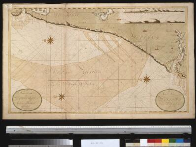
De kust van Holland van Texel tot de Maas
Netherlands Gerard van Keulen
Nieuwe Pascaert
1 : 60000 Mollova mapová sbírka Keulen, Johannes van Keulen, Johannes van II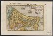
Hollandia
1 : 1100000 [Pieter van den Keere] [Middelburg etc.] : [Barent Langenes etc.]
No. II, uit: [Generale kaart van het Koningrijk Holland] / [onder leiding van C.R.T. Krayenhoff]
1 : 115200 Annotatie: Beschreven in: Topographische en militaire kaart van het Koningrijke der Nederlanden / J.A. van der Linden. - Bussum : Fibula-van Dishoeck, cop. 1973 (p. 12-13), en: Choro-topographische kaart der Noordelijke provinciën van het Koningrijk der Nederlanden / P.W. Geudeke. - Haarlem : Fibula-Van Dishoeck, [1979]; Voor aanwezige bladen zie overzichtsblad Krayenhoff, C. R. T. [Amsterdam : Dépôt Generaal van Oorlog]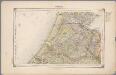
14. Rijnland, uit: Geologische kaart van Nederland / door W.C.H. Staring ; bew. aan de Topographische Inrichting
1 : 200000 Winand Carel Hugo Staring 1808-1877; Topographische Inrichting, 's-Gravenhage 's-Gravenhage : Belinfante
No. II, uit: Choro-topographische kaart der Noordelijke Provincien van het Koningrijk der Nederlanden / uitgevoerd aan het Topographisch Bureau van dezen staat ; volgens het ontwerp, de geodetische en astronomische waarnemingen van den Luitenant Generaal Baron Krayenhoff
1 : 115200 titelvariant: Generale kaart van het Koningrijk Holland; Chorographische kaart van Holland vereenigd met het Fransche Rijk; Carte chorographique des Departemens de la Hollande; Annotatie: Voor aanwezige bladen zie overzichtsblad; Blad Noord-Brabant ontbreekt Krayenhoff, C. R. T.; Ministerie van Oorlog. Topographisch Bureau ['s-Gravenhage : Archief van Oorlog]
Partie du Comté de Hollande, où sont les environs de Haarlem, Leyden, la Haye, Delft, Gonda [!] &c.
1 : 300000 gravé par Guill. Delahaye. [Paris] : par le sr. Robert géographe ord. du roi
No. II, uit: Choro-topographische kaart der Noordelijke Provinciën van het Koningrijk der Nederlanden / uitgevoerd aan het Topographisch Bureau van dezen Staat, volgens het ontwerp, de geodesische en astronomische waarnemingen van Baron Kraijenhoff
1 : 115200 Annotatie: Gestempeld r.o. in rood: AVO (=Archief van Oorlog); Lit.: J.A. van der Linden, Topographische en militaire kaart van het Koningrijk der Nederlanden. Bussum 1973. p. 9-16 & E. ten Brink, De grote kaart van Krayenhoff, speciaal p. 38-39; Op de bladwijzer staat de Hoofddriehoeksmeting aangegeven met de Alphabetische tafel der breedte en lengte van de standplaatsen; Annotatie geografische gegevens: Schaalstok van 27,77 Mylen (Kilomètres) of 7380 Rh. Roeden of 5 Uren (=23,7 cm), op schaal: 800 Rl. Roeden op den Rh. Duim of van 1,152 Myl (Kilomètre) op den Duim (Centimètre); Legenda r.o. op blad VII Topographisch Bureau, Den Haag; Archief van Oorlog, Den Haag ['s-Gravenhage : Topographisch Bureau, Archief van Oorlog]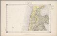
10. Kennemerland, uit: Geologische kaart van Nederland / door W.C.H. Staring ; bew. aan de Topographische Inrichting
1 : 200000 Winand Carel Hugo Staring 1808-1877; Topographische Inrichting, 's-Gravenhage 's-Gravenhage : Belinfante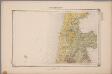
10. Kennemerland, uit: Geologische kaart van Nederland : schaal van 1:200.000 / door W.C.H. Staring ; uitgevoerd door het Topographisch Bureau van Oorlog ; uitgegeven op last van Zijne Majesteit Den Koning
Annotatie: Impressum ontleend aan omslag; Kaart "Nederland de dijken weggedacht" [kaart 25] en kaart 13 (bladwijzer) vermelden het jaar 1869; Kaart 'Limburg en de Hesbaije' (bladnr. 26) vermeldt het jaar 1868; Blad 5/9 ontbreekt Topographische Inrichting, 's-Gravenhage; Topographisch Bureau Haarlem : A.C. Kruseman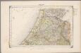
14. Rijnland, uit: Geologische kaart van Nederland / door W.C.H. Staring ; bew. aan de Topographische Inrichting
1 : 200000 Winand Carel Hugo Staring 1808-1877; Topographische Inrichting, 's-Gravenhage 's-Gravenhage : Belinfante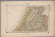
14. Rijnland, uit: Geologische kaart van Nederland : schaal van 1:200.000 / door W.C.H. Staring ; uitgevoerd door het Topographisch Bureau van Oorlog ; uitgegeven op last van Zijne Majesteit Den Koning
Annotatie: Impressum ontleend aan omslag; Kaart "Nederland de dijken weggedacht" [kaart 25] en kaart 13 (bladwijzer) vermelden het jaar 1869; Kaart 'Limburg en de Hesbaije' (bladnr. 26) vermeldt het jaar 1868; Blad 5/9 ontbreekt Topographische Inrichting, 's-Gravenhage; Topographisch Bureau Haarlem : A.C. Kruseman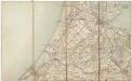
Rijnland
1 : 200000 ['s-Gravenhage : Topographische Inrichting]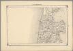
6, uit: Topografische atlas van het Koninkrijk der Nederlanden
Annotatie: Map met 19 losse krt. schaal 1:200.000 en 1 bladwijzer schaal 1:1.000.000 ['s-Gravenhage : Ministerie van Oorlog, Topografisch Bureau]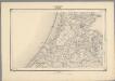
9, uit: Topografische atlas van het Koninkrijk der Nederlanden
Annotatie: Map met 19 losse krt. schaal 1:200.000 en 1 bladwijzer schaal 1:1.000.000 ['s-Gravenhage : Ministerie van Oorlog, Topografisch Bureau]
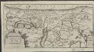
La Rhinlande Amstellande et terres circõvosines
1 : 300000 auctore Balt[hasar] Flo: a Berkêrode. [Amsterdam] : [Jacob Aertsz. Colom]
Rhenolandia, Amstelandia Et Circumiacentia aliquot Territoria, cum Aggeribus omnibus, Terminisque suis. [Karte], in: Novus atlas absolutissimus, Bd. 3, S. 179.
1 Karte aus Atlas Janssonius Offizin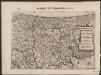
Rhinolandiæ Amstelandiæ et circumjacent. aliquot territoriû accurata descriptio
1 : 360000 Auctore Balth. Florentio a Berckenrode. Amstelodami : sumptibus Henrici Hondii.

Rhenolandia, Amstelandia et circumjacentia aliquot territoria, cum aggeribus omnibus terminisque suis
1 : 180000 accurate et distincte edita per Nicolaum Visscher. [Amsterdam] : [N. Visscher]
Rhenolandia, Amstelandia et circumjacentia aliquot territoria, cum aggeribus omnibus, terminisq[ue] suis / accurate et distincte edita per Nicolaum Visscher
1 : 180000 Annotatie: Cum privilegio Ordinum Hollandiae et West-Frisiae; Met opdracht van Nicolaus Visscher aan Johannes Hudde; Annotatie geografische gegevens: West boven; Met 2 schaalstokken Nicolaes Jansz Visscher sr 1618-1679 [Amsterdam : Nicolaus Visscher]
Novissima Delflandiae, Schielandiae et circumiacentium insularum ut Voornae, Overflackeae, Goereae, Iselmondae, aliarumque tabula [Karte], in: Novus atlas absolutissimus, Bd. 3, S. 168.
1 Karte aus Atlas Janssonius Offizin
Rhenolandia, Amstelandia et circumjacentia aliquot territoria, cum aggeribus omnibus, terminisq. suis
1 : 180000 accurate et distincte edita per Nicolaum Visscher. [Amsterdam] : nunc apud Petrum Schenk Junior
Rhenolandiae et Amstellandiae exactißima Tabula. [Karte], in: Le théâtre du monde, ou, Nouvel atlas contenant les chartes et descriptions de tous les païs de la terre, Bd. 1, S. 425.
1 Karte aus Atlas Blaeu, Willem Janszoon und Blaeu, Joan Blaeu, Willem Janszoon
Rhenolandiae et Amstellandiae exactiβima Tabula. [Karte], in: Novus Atlas, das ist, Weltbeschreibung, Bd. 1, S. 394.
1 Karte aus Atlas Blaeu, Joan Blaeu, Willem Janszoon
RHENOLANDIÆ | et | AMSTELLANDIÆ | exactißima Tabula
Exc. Guilj. Blaeuw
[Recto], uit: Delflandia, Schielandia, et insulae trans Mosam illis objacentes ut sunt Voorna, Overflackea, Goerea, Yselmonda, etc. / [Willem Jansz. Blaeu]
1 : 130000 Annotatie: Oorspr. verschenen in: Appendix Theatri A. Ortelii et Atlantis G. Mercatoris ... - Amsterdami : apud Guiljelmum Blaeu, 1631; Bestaat uit twee aan elkaar gemonteerde kaartdelen, afkomstig van twee afzonderlijke afdrukken van de kaart. Bij de rechterhelft ontbreekt op de achterzijde de tekst; Annotatie geografische gegevens: Noordwest boven Blaeu, Willem Jansz. [Amsterdam : exc. Guilj. Blaeuw]
Delflandia, Schielandia, et Insulae trans Mosam illis obiacentes ut sunt Voorna, Overflackea, Goerea, Yselmonda, etc. [Karte], in: Theatrum orbis terrarum, sive, Atlas novus, Bd. 1, S. 434.
1 Karte aus Atlas Blaeu, Joan Blaeu, Willem Janszoon
Delflandia, Schielandia, et Insulae trans Mosam illis obiacentes ut sunt Voorna, Overflackea, Goerea, Yselmonda, etc. [Karte], in: Le théâtre du monde, ou, Nouvel atlas contenant les chartes et descriptions de tous les païs de la terre, Bd. 1, S. 430.
1 Karte aus Atlas Blaeu, Willem Janszoon und Blaeu, Joan Blaeu, Willem Janszoon