Maps of Watou

Plan parcellaire de la commune de Watou : avec les mutations
1 : 5000 Royal Library of Belgium Map Room Popp, Philippe Christian (1805-1879) Popp, Philippe Christian (1805-1879)
Plan parcellaire de la commune de Proven : avec les mutations
1 : 5000 Royal Library of Belgium Map Room Popp, Philippe Christian (1805-1879) Popp, Philippe Christian (1805-1879)
[Plan of Steenvoorde]
[Amsterdam : Joan Blaeu]
Plan parcellaire de la commune de Poperinghe : avec les mutations
1 : 5000 Royal Library of Belgium Map Room Popp, Philippe Christian (1805-1879) Popp, Philippe Christian (1805-1879)
Plan parcellaire de la commune de Poperinghe : avec les mutations
1 : 5000 Royal Library of Belgium Map Room Popp, Philippe Christian (1805-1879) Popp, Philippe Christian (1805-1879)
Plan parcellaire de la commune de Haringhe : avec les mutations
1 : 5000 Royal Library of Belgium Map Room Popp, Philippe Christian (1805-1879) Popp, Philippe Christian (1805-1879)
Plan parcellaire de la commune de Crombeke : avec les mutations
1 : 5000 Royal Library of Belgium Map Room Popp, Philippe Christian (1805-1879) Popp, Philippe Christian (1805-1879)
Plan parcellaire de la commune de Westvleteren : avec les mutations
1 : 5000 Royal Library of Belgium Map Room Popp, Philippe Christian (1805-1879) Popp, Philippe Christian (1805-1879)
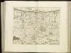
CASTELLANIA | FURNENSIS
[Amsterdam : Joan Blaeu]
Map of water supply: Ostend
1 : 100000 Series of maps on water supplies. Ostend. War Office
Carte particuliere des environs de Dunkerque, Bergues, Furnes, Gravelines, Calais, et autres
1 Karte : Kupferdruck ; 40 x 55 cm Fricx; Harrewijn chez Eugene Henry Fricx ruë de la Madelen
VI, uit: Carte chorographique des Pays-Bas Autrichiens / ... par le Comte de Ferraris ; gravée par L.A. Dupuis
1 : 86400 Annotatie: Lit.: Les militaires et la cartographie des Pays-Bas méridionaux et de la Principauté de Liège à la fin du XVIIe et au XVIII siècle / Claire Lemoine-Isabeau. - Bruxelles, 1984, p. 206-212; La cartographie au XVIIIe siècle et l'oeuvre du Comte de Ferraris (1726-1814) : colloque international, Spa, 8-11 sept. 1976. - Bruxelles, 1978; Met opdracht aan keizer Joseph II (bl.XVI); Met plattegrond van Brussel (bl. XXI), overzichtskaart (bl. XXII) en bladwijzer (bl. XXIII); Ontbreekt: bl. I-III en XXI; Voor aanwezige bladen zie overzichtsblad Ferraris, Johann Joseph; Dupuis, L. A. [S.l. : s.n.]
Carte particuliere des environs de Dunkerque, Bergues, Furnes, Gravelines, Calais, et autres
1 : 110000 Belgie Fricx, Eugene Henry Harrewyn, Jacques chez Eugene Henry Fricx
DITIO CASLETANA IN COMITATU FLANDRIÆ Vulgó Cassel Ambacht
Vedastus du Plouich invenit et fecit Amstelodami | Sumtibus Henrici Hondy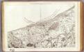
6 Dunkerque.
1 : 86400 Cassini family; Cassini, Cesar-Francois, 1714-1784
Flandriae Comitatus pars occidentalis
1 : 133000 Mollova mapová sbírka Visscher, Nicolaes Schenk, Peter II
Map of water supply: Hazebrouck
1 : 100000 Series of maps on water supplies. 2nd Army area water supply. Secret. Hazebrouck War Office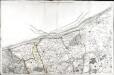
[Dunkerque]
1 Blatt : 60 x 91 cm s.n.
Flandriae pars occidentalis
1 : 185000 Belgie Hondius, Henricus sumptibus Henrici Hondii
IPRENSIS | Episcopatus
Ioh. Blaeu excud.
Artesia vulgo Artois, et Sedes Belli in Picardia &c Stoel des OOrlogs in Artois en Picardy, enz
1 : 250000 Mollova mapová sbírka Allard, Abraham Allart, Abraham
Carte du département du Nord ou les provinces de Flandre du Hainaut et du Cambresis, 1
1 Blatt : 47 x 58 cm s.n.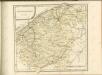
[108][111] Pars Flandriae occiden[talis] ..., uit: Atlas sive Descriptio terrarum orbis
Annotatie: Gedigitaliseerde versie. Amsterdam. Heiloo : Picturae (vervaardiger), 2015. tiff-bestand. Gedigitaliseerd: 07-01-2015; Origineel: Universiteitsbibliotheek Vrije Universiteit (XL.05127.-) ; Netherlands; Titelpagina ontbreekt Wit, Frederik de Amsterdam : Frederick de Wit
Kriegsgeologische Uebersichtskarte für den Stellungsbau : Zusammendruck für die 4. Armee
1 : 20000 Relief shown by spot heights and hachures. War Geological overview map of the fortifications. "Stand der Erkundung: 1. September 1918." " ... am 12.9.18." "Lfd. Nr. 3297." Germany. Heer. Stoverm IV. Geologengruppe.; Germany. Heer. Vermessungs-Abteilung 24. Germany : Gruppen-Kartenstelle II, Verm. Abtlg. 24
Flandriae Pars Occidentalis [...] [Karte], in: Novus atlas absolutissimus, Bd. 3, S. 115.
1 Karte aus Atlas Janssonius Offizin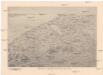
Reliefkarte von Flandern
Flandry Franckh'sche Verlagshandlung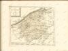

Tabula Comitatvs Artesiae
1 : 200000 Mollova mapová sbírka Wit, Frederik de Wit, Frederick


