Maps of Herve

Plan parcellaire de la commune de Battice : avec les mutations
1 : 5000 Royal Library of Belgium Map Room Popp, Philippe Christian (1805-1879) Popp, Philippe Christian (1805-1879)
Plan parcellaire de la commune de Thimister : avec les mutations
1 : 5000 Royal Library of Belgium Map Room Popp, Philippe Christian (1805-1879) Popp, Philippe Christian (1805-1879)
Plan parcellaire de la commune de Chaineux : avec les mutations
1 : 5000 Royal Library of Belgium Map Room Popp, Philippe Christian (1805-1879) Popp, Philippe Christian (1805-1879)
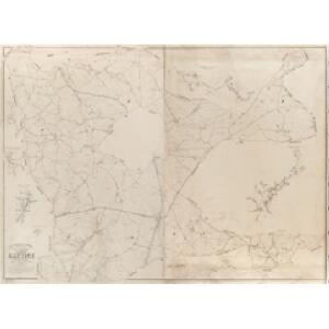
Plan parcellaire de la commune de Herve : avec les mutations
1 : 2500 Royal Library of Belgium Map Room Popp, Philippe Christian (1805-1879) Popp, Philippe Christian (1805-1879)
Plan parcellaire de la commune de Xhendelesse : avec les mutations
1 : 5000 Royal Library of Belgium Map Room Popp, Philippe Christian (1805-1879) Popp, Philippe Christian (1805-1879)
Plan parcellaire de la commune de Bolland : avec les mutations
1 : 5000 Royal Library of Belgium Map Room Popp, Philippe Christian (1805-1879) Popp, Philippe Christian (1805-1879)
Plan parcellaire de la commune de Petit-Rechain : avec les mutations
1 : 5000 Royal Library of Belgium Map Room Popp, Philippe Christian (1805-1879) Popp, Philippe Christian (1805-1879)
Développement du village de Dison et du hameau aux Aurys à l'échelle d'un à 1250
1 : 1250 Royal Library of Belgium Map Room Popp, Philippe Christian (1805-1879) Popp, Philippe Christian (1805-1879)
Plan parcellaire de la commune de Dison : avec les mutations
1 : 2500 Royal Library of Belgium Map Room Popp, Philippe Christian (1805-1879) Popp, Philippe Christian (1805-1879)
Plan parcellaire de la commune de Grand-Rechain : avec les mutations
1 : 5000 Royal Library of Belgium Map Room Popp, Philippe Christian (1805-1879) Popp, Philippe Christian (1805-1879)
Plan parcellaire de la commune de Clermont lez-Aubel : avec les mutations
1 : 5000 Royal Library of Belgium Map Room Popp, Philippe Christian (1805-1879) Popp, Philippe Christian (1805-1879)
Plan parcellaire de la commune de Melen : avec les mutations
1 : 5000 Royal Library of Belgium Map Room Popp, Philippe Christian (1805-1879) Popp, Philippe Christian (1805-1879)
Plan parcellaire de la commune de Soumagne : avec les mutations
1 : 5000 Royal Library of Belgium Map Room Popp, Philippe Christian (1805-1879) Popp, Philippe Christian (1805-1879)
Meßtischblatt 3090 : Herbesthal, 1894
1 : 250000 Herbesthal. - Aufn. 1893. - 1:25000. - [Berlin]: Kgl. Preuss. Landesaufnahme, 1894. - 1 Kt.
Plan parcellaire de la commune de Saint-André (lez-Dalhem) : avec les mutations
1 : 5000 Royal Library of Belgium Map Room Popp, Philippe Christian (1805-1879) Popp, Philippe Christian (1805-1879)
Plan parcellaire de la commune de Andrimont : avec les mutations
1 : 5000 Royal Library of Belgium Map Room Popp, Philippe Christian (1805-1879) Popp, Philippe Christian (1805-1879)
Plan parcellaire de la commune de Mortier : avec les mutations
1 : 5000 Royal Library of Belgium Map Room Popp, Philippe Christian (1805-1879) Popp, Philippe Christian (1805-1879)
Plan parcellaire de la commune de Julémont : avec les mutations
1 : 5000 Royal Library of Belgium Map Room Popp, Philippe Christian (1805-1879) Popp, Philippe Christian (1805-1879)
Plan parcellaire de la commune de Lambermont : avec les mutations
1 : 5000 Royal Library of Belgium Map Room Popp, Philippe Christian (1805-1879) Popp, Philippe Christian (1805-1879)
Tabula ducatus Limburch et comitatus Valckenburch
1 : 115000 Limbursko Wit, Frederick de by Frederick de Wit
Nieuwe en naauwkeurige kaart van de drie landen van Overmaaze, Valkenburg, Daalhem en 's Hertogenrade
1 : 200000 J. Keyser schulp. 1739. te Amsterdam : by Isaak Tirion
Carte du Marquisat de Franchimont
1 : 140000 H. Godin sculp. [S.l.] : [s.n.]
Limburgi Ducatus et Comitatus Valckenburgi Nova Descriptio
1 : 110000 Mollova mapová sbírka Visscher, Nicolaes Schenk, Peter II
Tabula Ducatus Limburch et Comitatus Valckenburch in Lucem edita
1 : 120000 Mollova mapová sbírka Wit, Frederik de Wit, Frederick
Plan du chemin de fer compris entre Liège et Aix-la-Chapelle
1 : 100000 Etablissement géographique
De klassis van Maastricht en landen van Overmaas
1 : 180000 door W.A. Bachiene ... J. van Jagen sculp. 1768. te Amsterdam : by D. onder de Linden
LIMBURGI Ducatus et Comitatus Nova Descriptio
1 : 110000 Limburg (Belgie : provincie) Visscher, Nicolaus per N. Visscher
Carte particuliere des environs de Liege, Limbourg, et partie de Luxembourg
1 : 110000 Belgie Fricx, Eugene Henry Harrewyn, Jacques chez Eugene Henry Friex
Dvcatvs Limbvrgvm
1 : 180000 Mollova mapová sbírka Martini, Aegidius Schenk, Peter I
Dvcatvs Limbvrgvm
1 : 266000 Mollova mapová sbírka Merian, Matthaeus Merian, Matthäus
Dvcatvs Limbvrgvm
1 : 180000 Mollova mapová sbírka Martini, Aegidius Blaeu, Joan I.