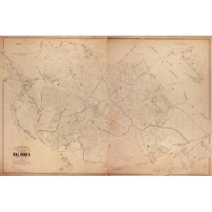
Maps of Namur

Plan parcellaire de la commune de Nalinnes : avec les mutations
1 : 5000 Royal Library of Belgium Map Room Popp, Philippe Christian (1805-1879) Popp, Philippe Christian (1805-1879)
Plan parcellaire de la commune de Jamioulx : avec les mutations
1 : 5000 Royal Library of Belgium Map Room Popp, Philippe Christian (1805-1879) Popp, Philippe Christian (1805-1879)
Plan parcellaire de la commune de Ham-sur-Heure : avec les mutations
1 : 5000 Royal Library of Belgium Map Room Popp, Philippe Christian (1805-1879) Popp, Philippe Christian (1805-1879)
Plan parcellaire de la commune de Gerpinnes : avec les mutations
1 : 5000 Royal Library of Belgium Map Room Popp, Philippe Christian (1805-1879) Popp, Philippe Christian (1805-1879)
Plan parcellaire de la commune de Marcinelle : avec les mutations
1 : 5000 Royal Library of Belgium Map Room Popp, Philippe Christian (1805-1879) Popp, Philippe Christian (1805-1879)
Plan parcellaire de Marbais lez-Thuin : avec les mutations
1 : 5000 Royal Library of Belgium Map Room Popp, Philippe Christian (1805-1879) Popp, Philippe Christian (1805-1879)
Plan parcellaire de la commune de Mont-sur-Marchienne : avec les mutations
1 : 5000 Royal Library of Belgium Map Room Popp, Philippe Christian (1805-1879) Popp, Philippe Christian (1805-1879)
Plan parcellaire de la commune de Loverval : avec les mutations
1 : 5000 Royal Library of Belgium Map Room Popp, Philippe Christian (1805-1879) Popp, Philippe Christian (1805-1879)
Plan parcellaire de la commune de Cour-sur-Heure : avec les mutations
1 : 5000 Royal Library of Belgium Map Room Popp, Philippe Christian (1805-1879) Popp, Philippe Christian (1805-1879)
Comitatus Namurci Tabula
Mollova mapová sbírka Wit, Frederik de Covens, Johannes I
Comitatvs Namvr
1 : 100000 Fricx, Eugene Henry par Homaniannos Heredes
The Battle of Waterloo
Tyler Ackermann
Die Grafschafft Namur Nach dero Eigendlichen Lager
1 : 567000 Mollova mapová sbírka Bodenehr, Gabriel Bodenehr, Gabriel
COMITATUS NAMURCI Emendata Delineatio
1 : 120000 Belgie Visscher, Nicolaus per Nicolaum Visscher
Carte du Comté de Namvr
1 : 130000 Mollova mapová sbírka Fricx, Eugène Henry Homann, Johann Baptista - dědici
Map of water supply: Namur
1 : 100000 Series of maps on water supplies. Namur. War Office
[Rocroy]
1 Blatt : 59 x 91 cm Brunet; Le Roy s.n.
NAMVRCVM | COMITATVS
Auctore Iohann. Surhonio. [Amsterdam : Joan Blaeu]
Namurcum Comitatus. [Karte], in: Theatrum orbis terrarum, S. 111.
1 Karte aus Atlas Ortelius, Abraham
Namurcum Comitatus 1632 [Karte], in: Gerardi Mercatoris et I. Hondii Newer Atlas, oder, Grosses Weltbuch, Bd. 1, S. 434.
1 Karte aus Atlas Mercator, Gerhard und Hondius, Jodocus Jansson, Jan
NAMVRCVM | COMITATVS
Auctore Iohann. Surhonio. [Amsterdam : Joan Blaeu]
Namurcum Comitatus. [Karte], in: Theatrum orbis terrarum, S. 177.
1 Karte aus Atlas Ortelius, Abraham Vrients, Jan Baptista
XVIII, uit: Carte chorographique des Pays-Bas Autrichiens / ... par le Comte de Ferraris ; gravée par L.A. Dupuis
1 : 86400 Annotatie: Lit.: Les militaires et la cartographie des Pays-Bas méridionaux et de la Principauté de Liège à la fin du XVIIe et au XVIII siècle / Claire Lemoine-Isabeau. - Bruxelles, 1984, p. 206-212; La cartographie au XVIIIe siècle et l'oeuvre du Comte de Ferraris (1726-1814) : colloque international, Spa, 8-11 sept. 1976. - Bruxelles, 1978; Met opdracht aan keizer Joseph II (bl.XVI); Met plattegrond van Brussel (bl. XXI), overzichtskaart (bl. XXII) en bladwijzer (bl. XXIII); Ontbreekt: bl. I-III en XXI; Voor aanwezige bladen zie overzichtsblad Ferraris, Johann Joseph; Dupuis, L. A. [S.l. : s.n.]
Namvrcvm Comitatvs
1 : 140000 Mollova mapová sbírka Surhon, Jean de Schenk, Peter I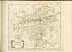


Carte particulière des mouvements faits, et des postes occupez par les armées des aliez commandées par le Roy de la Grande Bretagne et celles de France commandées par le Marechal de Villeroy pendant le siège de namur, 1695
1 : 160000 A Amsteldam : chez N. Visscher
Tractatus inter Sabim et Mosam
1 : 130000 Mollova mapová sbírka Visscher, Nicolaes Visscher, Nicolaus