Gecatalogiseerde kaart
Plan parcellaire de la commune de Adeghem : avec les mutations


Volledige titel:Plan parcellaire de la commune de Adeghem : avec les mutations
Jaar illustratie:1840 - 1880
Uitgever:Popp, Philippe Christian (1805-1879)
Fysieke grootte:20 x 30 cm
Schaal kaart:1:5 000
Plan parcellaire de la commune de Maldegem : avec les mutations
1880
Popp, Philippe Christian (1805-1879)
1:5k
Plan parcellaire de la commune de Adeghem : avec les mutations
1880
Popp, Philippe Christian (1805-1879)
1:5k
Plan parcellaire de la commune de Middelburg : avec les mutations
1880
Popp, Philippe Christian (1805-1879)
1:5k
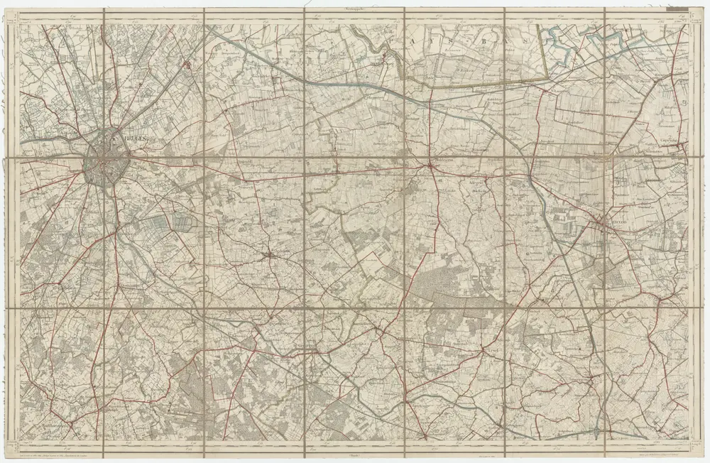
13 Bruges, uit: [Belgique 1:40.000]
1873
Bruxelles : Dépot de la Guerre
1:40k
Plan parcellaire de la commune de St. Laurent : avec les mutations
1880
Popp, Philippe Christian (1805-1879)
1:5k
Plan parcellaire de la commune de Moerkerke : avec les mutations
1880
Popp, Philippe Christian (1805-1879)
1:5k
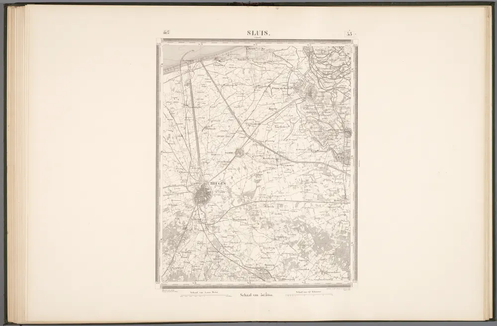
53 Sluis, uit: Topographische en militaire kaart van het Koningrijk der Nederlanden / vervaardigd door de officieren van den Generale Staf ; en gegraveerd op het Topographisch Bureau, van het Ministerie van Oorlog
1888
Generale Staf, Nederland; Ministerie van Oorlog. Topographisch Bureau
1:50k
Plan parcellaire de la commune de Oedelem : avec les mutations
1880
Popp, Philippe Christian (1805-1879)
1:8k
Plan parcellaire de la commune de Eecloo : avec les mutations
1880
Popp, Philippe Christian (1805-1879)
1:5k
Développement du village de Maldegem
1880
Popp, Philippe Christian (1805-1879)
1:1k