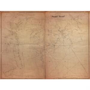
Maps of Watermael-Boitsfort - Watermaal-Bosvoorde

Plan parcellaire de la commune de Watermael-Boitsfort : avec les mutations
1 : 5000 Royal Library of Belgium Map Room Popp, Philippe Christian (1805-1879) Popp, Philippe Christian (1805-1879)
Plan parcellaire de la commune de Woluwe St Pierre : avec les mutations
1 : 5000 Royal Library of Belgium Map Room Popp, Philippe Christian (1805-1879) Popp, Philippe Christian (1805-1879)
Plan parcellaire de la commune de Etterbeek : avec les mutations
1 : 2500 Royal Library of Belgium Map Room Popp, Philippe Christian (1805-1879) Popp, Philippe Christian (1805-1879)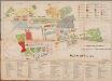
Plan officiel, uit: Exposition universelle et internationale de Bruxelles 1910 : plan officiel
1 : 2500 Annotatie: Met register Bruxelles : Bertels
Carte de Belgique au 20.000e / Institut Cartographique Militaire = Kaart van België op een 20.000e
1 : 20000 titelvariant: Kaart van België op een 20.000e; Annotatie: Titel afkomstig van legenda; Gedeeltelijk in zwart-wit of bruindrukuitvoering; Incompleet; Voor aanwezige bladen zie overzichtsblad Institut Cartographique Militaire, Brussel Bruxelles : Institut Cartographique Militaire
Plan parcellaire de la commune de Uccle : avec les mutations
1 : 5000 Royal Library of Belgium Map Room Popp, Philippe Christian (1805-1879) Popp, Philippe Christian (1805-1879)
Plan parcellaire de la commune de Ixelles : avec les mutations
1 : 5000 Royal Library of Belgium Map Room Popp, Philippe Christian (1805-1879) Popp, Philippe Christian (1805-1879)
Plan parcellaire de la commune de Crainhem : avec les mutations
1 : 5000 Royal Library of Belgium Map Room Popp, Philippe Christian (1805-1879) Popp, Philippe Christian (1805-1879)
Commune de Ixelles : développement de l'aggloméré
1 : 1250 Royal Library of Belgium Map Room Popp, Philippe Christian (1805-1879) Popp, Philippe Christian (1805-1879)
Plan parcellaire de la commune de Tervueren : avec les mutations
1 : 5000 Royal Library of Belgium Map Room Popp, Philippe Christian (1805-1879) Popp, Philippe Christian (1805-1879)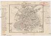
Bruxelles
Brusel (Belgie) Kruse, Friedrich Brügner, C.
Plan parcellaire de la commune de Over-Yssche : avec les mutations
1 : 5000 Royal Library of Belgium Map Room Popp, Philippe Christian (1805-1879) Popp, Philippe Christian (1805-1879)
Plan parcellaire de la commune de Hoeylaert : avec les mutations
1 : 5000 Royal Library of Belgium Map Room Popp, Philippe Christian (1805-1879) Popp, Philippe Christian (1805-1879)
[Kaart], uit: Plan de Bruxelles et faubourgs
1 : 12500 titelvariant: Bruxelles et ses faubourgs; Annotatie: Omslagtitel: Bruxelles et ses faubourgs Bruxelles : A. de Boeck
Plan parcellaire de la ville de Bruxelles : avec les mutations
1 : 1250 Royal Library of Belgium Map Room Popp, Philippe Christian (1805-1879) Popp, Philippe Christian (1805-1879)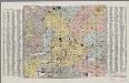
[Bruxelles]
1 : 12000 Annotatie: Met straatnamenregister; Annotatie geografische gegevens: Zuidoost boven Bruxelles : Castaigne
Plan parcellaire de la commune de Rhode-St-Genèse : avec les mutations
1 : 5000 Royal Library of Belgium Map Room Popp, Philippe Christian (1805-1879) Popp, Philippe Christian (1805-1879)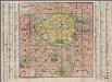
Plan de la ville de Bruxelles & des faubourgs
1 : 12000 Annotatie: Met straatnamenregister Brux[elles] : Van Cortenbergh
Plan parcellaire de la commune de Wesembeek : avec les mutations
1 : 5000 Royal Library of Belgium Map Room Popp, Philippe Christian (1805-1879) Popp, Philippe Christian (1805-1879)
Brüssel
1 : 7600 Brusel (Belgie)
Plan Guide de Bruxelles et de ses Faubourgs

Plan parcellaire de la commune de Woluwe St Lambert : avec les mutations
1 : 5000 Royal Library of Belgium Map Room Popp, Philippe Christian (1805-1879) Popp, Philippe Christian (1805-1879)
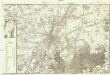
Plan de Bruxelles et des communes limitrophes
Imbreghts, P Kiessling & cie, P. Imbreghts, successeur
Bruxeliæ Belgii Cathol. ornamentum et ducatus Brabantiæ metropolis
Seutter, Matthaeus, 1678-1756 Matthæo Seuttero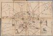
Nouveau plan-bijou & monumental de la ville de Bruxelles, uit: Exposition universelle et internationale de Bruxelles 1910 : plan officiel
1 : 2500 Annotatie: Met register Bruxelles : Bertels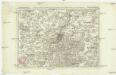
Carte particuliere des environs de Bruxelles et Vilvorden
1 : 163000 Brusel (Belgie) Covens & Mortier
Carte routiere des environs de Bruxelles
Carte topographique de Bruxelles et de ses environs
1 : 30000 Brusel-oblast (Belgie) DeWautier, G. Jouvenel, J. B.
Carte particuliere des environs de Bruxelles avec le Bois de Soigne et d'une partie de la Flandre jusques a Gand
1 : 110000 Belgie Fricx, Eugene Henry chez Eugene Henry Friex