Maps of Bornem

Plan parcellaire de la commune de Bornhem : avec les mutations
1 : 5000 Royal Library of Belgium Map Room Popp, Philippe Christian (1805-1879) Popp, Philippe Christian (1805-1879)
Plan parcellaire de la commune de Weert lez-Puers : avec les mutations
1 : 5000 Royal Library of Belgium Map Room Popp, Philippe Christian (1805-1879) Popp, Philippe Christian (1805-1879)
Plan parcellaire de la commune de Op-Puers : avec les mutations
1 : 5000 Royal Library of Belgium Map Room Popp, Philippe Christian (1805-1879) Popp, Philippe Christian (1805-1879)
Plan parcellaire de la commune de Mariekerke : avec les mutations
1 : 2500 Royal Library of Belgium Map Room Popp, Philippe Christian (1805-1879) Popp, Philippe Christian (1805-1879)
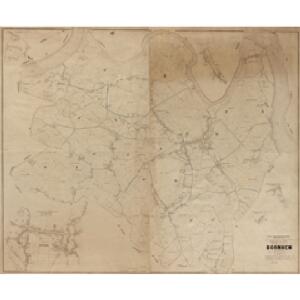
Castellaniæ | Siue | Baronat. Bornhemii | Accurata delineatio
[Amsterdam : Joan Blaeu]
Plan parcellaire de la commune de Hingene : avec les mutations
1 : 5000 Royal Library of Belgium Map Room Popp, Philippe Christian (1805-1879) Popp, Philippe Christian (1805-1879)
Plan parcellaire de la commune de Puers : avec les mutations
1 : 5000 Royal Library of Belgium Map Room Popp, Philippe Christian (1805-1879) Popp, Philippe Christian (1805-1879)
Plan parcellaire de la commune de Saint-Amand lez-Puers : avec les mutations
1 : 5000 Royal Library of Belgium Map Room Popp, Philippe Christian (1805-1879) Popp, Philippe Christian (1805-1879)
Plan parcellaire de la commune de Liezele : avec les mutations
1 : 5000 Royal Library of Belgium Map Room Popp, Philippe Christian (1805-1879) Popp, Philippe Christian (1805-1879)
Plan parcellaire de la commune de Thielrode : avec les mutations
1 : 5000 Royal Library of Belgium Map Room Popp, Philippe Christian (1805-1879) Popp, Philippe Christian (1805-1879)
Plan parcellaire de la commune de Lippeloo : avec les mutations
1 : 5000 Royal Library of Belgium Map Room Popp, Philippe Christian (1805-1879) Popp, Philippe Christian (1805-1879)
Carte particuliere des environs de Lier et de Malines
1 : 163000 Lier (Belgie) Covens & Mortier
[Carte de la Belgique au 1:60 000]. 23, Malines
1 : 60000 [Lieu de publication inconnu] : [éditeur inconnu]
Delflants Zesde Stuk; van de Maes tot de Nieuwe Maesdyk: En van de Huyzinge op Staelduynen, tot over de Korte Kruyswegh in de Oranje Polder begrypende Staelduynen het Zuyder Gors de Korte en Lange Bonnen. Een deel van d'Oranje en Nieulantse Polder &c. Zynde het Derde blat van Zand Ambacht En het Eerste blat van d'Oranje Polder
Mollova mapová sbírka Cruquius, Nicolaas Samuelszoon Deur, Jacob
Plan parcellaire de la commune de Tamise : avec les mutations
1 : 5000 Royal Library of Belgium Map Room Popp, Philippe Christian (1805-1879) Popp, Philippe Christian (1805-1879)
Plan parcellaire de la commune de Moerzeke : avec les mutations
1 : 5000 Royal Library of Belgium Map Room Popp, Philippe Christian (1805-1879) Popp, Philippe Christian (1805-1879)
Plan parcellaire de la commune de Basel : avec les mutations
1 : 5000 Royal Library of Belgium Map Room Popp, Philippe Christian (1805-1879) Popp, Philippe Christian (1805-1879)
Plan parcellaire de la commune de Hamme Lez Termonde : avec les mutations
1 : 5000 Royal Library of Belgium Map Room Popp, Philippe Christian (1805-1879) Popp, Philippe Christian (1805-1879)
Plan parcellaire de la commune de Rupelmonde : avec les mutations
1 : 2500 Royal Library of Belgium Map Room Popp, Philippe Christian (1805-1879) Popp, Philippe Christian (1805-1879)
Plan parcellaire de la commune de Baesrode : avec les mutations
1 : 2500 Royal Library of Belgium Map Room Popp, Philippe Christian (1805-1879) Popp, Philippe Christian (1805-1879)
Antwerpen u. Umgegend
1 : 100000 L. Friederichsen & Co.
Carte tres-particuliere du Pays de Waes, ou sont marqués les Lignes depuis Anvers jusques a Gand
1 : 116600 Mollova mapová sbírka Fricx, Eugène Henry Harrewyn, Jacques Fricx, Eugené Henry
Carte Particuliere des Environs d'Anvers, Gand, Hulst, et de tout le Pays de Waes, et le Marquisat du St. Empire
1 : 116600 Mollova mapová sbírka Fricx, Eugène Henry Covens, Johannes I
Carte tres-particuliere du Pays de Waes
1 : 120000 Antverpy (Belgie) Fricx, Eugene Henry chez Eugene Henry Fricx
Carte Particul. des Environs d'Anvers, Gand, Hulst, et de tout le Pays de Waes. et la Marquisat du St. Empire
1 : 250000 Mollova mapová sbírka Seutter, Matthäus Lotter, Tobias Conrad Seutter, Matthäus
Carte particuliere des environs d'Anvers, Gand, Hulst, et de tout le Pays de Waes
1 : 106000 Antverpy (Belgie) Fricx, Eugene Henry Harrewyn, Jacques chez Eugene Henry Friex
S.R.I. sive Antverpiae Marchionatus, et Dominium Mechliniae
1 : 100000 Mollova mapová sbírka Allard, Carel Covens, Johannes I
KAERTE | VAN | DE VIER AMBACHTEN
Gerard Coeck sculp. [Amsterdam : Joan Blaeu]
Carte particuliere des Environs d'Anvers. Gand Hulst. et de tout le Pays de Waes
1 : 116600 Mollova mapová sbírka Fricx, Eugène Henry Harrewyn, Jacques Fricx, Eugené Henry