Maps of Storfjord
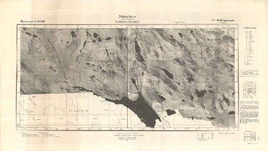
Tysk kart over Hellingskogen (Bildplankarte)
1 : 50000
R7-3; R7-4
1 : 50000 Andreas Theodor Walle | Houge
1633-2 Helligskogen
1 : 50000 Norges Geografiske Oppmåling
1633-2 Helligskogen
1 : 50000 Statens kartverk
Spesielle kart 171-kart1: Riksgrensekart fra grenseoppgangen Norge_Finland fra Treriksrà ̧ysa til Krokfjellet
1 : 50000 Th. Sà ̧mod | Erik O. Dahle | Yrjö Kärkkäinen | Seppo Härmälä
Spesielle kart 172-1: Kart over riksgrensen mellom Norge og Finland
1 : 40000 K. Vaala | Gleditsch | Arvo Manner | Kristian Nissen
R7-3; R7-4
1 : 50000 Andreas Theodor Walle | Torgeir Gundersen
R7-1; R7-2
1 : 50000 M. Gulbrandsen | Lyder Selvik | Bay Berntsen
R7-5; R7-6
1 : 50000 Andreas Theodor Walle | Houge
Spesielle kart 172-2: Kart over riksgrensen mellom Norge og Finland
1 : 40000 Kristian Nissen | Gleditsch | Arvo Manner | K. Vaala
1633-2 Helligskogen
1 : 50000 Statens kartverk
1633-2 Helligskogen
1 : 50000 Statens kartverk
1633-2 Helligskogen
1 : 50000 Statens kartverk
Krokering nr 64
1 : 100000 Morgenstierne
R7-1; R7-2
1 : 50000 Andreas Theodor Walle | Lars Rosland | N. Houge
Krokering nr 26
1 : 100000 Hagerup
Krokering nr 80
1 : 200000 Morgenstierne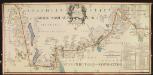
NRA GA 19
Thodal | Wetterstedt | Holm | Marelius | Krogh | Halldin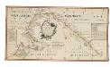
NRA GA 20
Thodal | Halldin | Krogh | Marelius | Holm | Wetterstedt
R7-7, R7-8 nordre del
1 : 40000 Andreas Theodor Walle
R7-7, R7-8 søndre del
1 : 50000 Andreas Theodor Walle
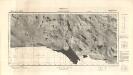
1633-3 Signaldalen
1 : 50000 Statens kartverk
1633-3 Signaldalen
1 : 50000 Statens kartverk
1633-3 Signaldalen
1 : 50000 Statens kartverk
1633-3 Signaldalen
1 : 50000 Norges Geografiske Oppmåling
1633-3 Signaldalen
1 : 50000 Statens kartverk
1733-3 Coahppejávri
1 : 50000 Statens kartverk
1733-3 Coahppejávri
1 : 50000 Statens kartverk
1733-3 Coap'pejav'ri
1 : 50000 Norges Geografiske Oppmåling