Maps of Luster

Trigonometrisk grunnlag, vedlegg 68-8
1 : 250000
Statistikk 43-10- Bosettingskart over Årdal. Blad 10
1 : 250000 Statistisk Sentralbyrå
Spesielle kart: Tyngdeanomalikart, Ã...rdal
1 : 250000 NGO
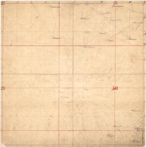
Årdal
1 : 250000 Army map service
Jostedalsbræen med tilgrænsende strøk

Kartblad 122: Situasion af de Bergenhuusske Regimenters Grændser udi Indre Sogn saaledes som samme vilde blive efter den af det Første Bergenhuusiske Regiment udkastede Plan

LE NÉVÉ DE JUSTEDAL ET SES ALENTOURS
M. Lyng's lith. Anst. Christiania
Museumskart 217-56: Specialkart over Sognefjorden
1 : 100000 G. Dellinger Den Geografiske Opmaaling
Norge 55-13: Accurat landcaart over Norges Rige anden Part
1 : 3000000 G. Bordin
30D 1; 30D 2; 30D 3; 30D 5; 30D 6; 30D 7; 30D 9; 30D 10; 30D 11; 30C 4; 30C 7; 30C 8; 30C 11; 30C 12; 30B 10; 36A 3; 36A 4; 36B 1; 36B 2
1 : 100000 Harald Nicolai Storm Wergeland
29D 1; 29D 5; 29D 6; 29D 9; 29D 10; 29D 11
1 : 100000 Karsten Lorange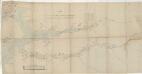
Kartblad 138: Vei-Cart over det Leirdalske Jæger Compagnie
Amund Wiegh
29B Sogndal
1 : 100000 E. Heiberg | H. T. Bjørnstad
29B Sogndal
1 : 100000 H. T. Bjørnstad | E. Heiberg
29B Sogndal
1 : 100000 H. T. Bjørnstad
Kartblad 56: Militairt Vej-Cart over det Lombske Compagnie District
Frederick Grüner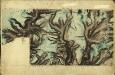
30C 5; 30C 6; 30C 7; 30C 9; 30C 10; 30C 11; 29D 12
1 : 100000 Henrik Lund
D31 aust Fillefjell
1 : 100000
D29 aust Skjåk
1 : 100000
D30 aust Sygnefjell
1 : 100000
D30 aust Sygnefjell
1 : 100000
D29 aust Skjåk
1 : 100000
30A 6; 30A 7; 30A 8
1 : 100000 Aksel Magnus
D31 aust Fillefjell
1 : 100000
D29 aust Skjåk
1 : 100000
D31 aust Fillefjell
1 : 100000
D31 vest Lærdal
1 : 100000
D31 vest Lærdal
1 : 100000
E29 vest Lom
1 : 100000