Maps of Svealand

Maps of Svealand

$title$

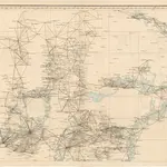
Trigonometrisk grunnlag, vedlegg 64b: Ort-Bestämmelsen i Södra Delen af Swerige

1 : 500000
$title$

Norgesavdelingen 38c sør: Græntse-Carte imellom Norge og Swerrige

1 : 800000 Jens Christian Spidberg
$title$

Uplandia. [Karte], in: Novus atlas absolutissimus, Bd. 1, S. 61.

1 Karte aus Atlas Janssonius Offizin
$title$

Vplandia

1 : 600000 Annotatie: Rechtsboven: XXIII; Origineel is Blad 142 in atlas factice; Annotatie geografische gegevens: Schaalstok op kaart: Milliaria Uplandica quorum 12 uni grad. altit. respondent [Oxford : apud Janssonio-Waesbergios et Mosem Pitt]
$title$

Dale Carliae et Westmanniae, Nova et Accurata descriptio. [Karte], in: Novus atlas absolutissimus, Bd. 1, S. 64.

1 Karte aus Atlas Janssonius Offizin
$title$

Ducatus Uplanida. [Karte], in: Theatrum orbis terrarum, sive, Atlas novus, Bd. 1, S. 61.

1 Karte aus Atlas Blaeu, Joan Blaeu, Willem Janszoon
$title$

$title$

Ducatus Uplandia. [Karte], in: Le théâtre du monde, ou, Nouvel atlas contenant les chartes et descriptions de tous les païs de la terre, Bd. 1, S. 61.

1 Karte aus Atlas Blaeu, Willem Janszoon und Blaeu, Joan Blaeu, Willem Janszoon
$title$

Ducatus Uplandia. [Karte], in: Novus Atlas, das ist, Weltbeschreibung, Bd. 1, S. 49.

1 Karte aus Atlas Blaeu, Joan Blaeu, Willem Janszoon
$title$

DVCATVS | VPLANDIA.

Joh. et Cornelius Blaeu exc.
$title$

Tractus Norvegiae Suecicus praefecturam Bahusiae finitimaeqve Daliae provinciae partem sistens

1 : 460000 Bohuslän (Švédsko) Homann, Johann Baptist a Ioh. Bap. Homanno S.C.M. geographo ejusqve filio
$title$

Norge 68: Charte von Anweisung des Landes und Vege nach dehm Grentzen sydenfields in Norwegen

1 : 400000
$title$

Blad LVI

1 : 250000 Scott Ruud | O. Engh
$title$

The channell of ABBO or UTTOY; A chart of STOCKHOLM Leith

from The sea-atlas : containing an hydrographical description of most of the sea-coasts of the known parts of the world.
$title$

Norge 28: Geographiske Carte over en Deel af Norge. Fra Fredrikshald til Mangen med tilgrænsende Dele av Sverige

1 : 300000
$title$

VI

1 : 400000 L. Arentz
$title$

VI

1 : 400000 L. Arentz
$title$

Trigonometrisk grunnlag, Squelet-Cart 65-4

$title$

Finnskog

1 : 250000
$title$

Spesielle kart 12: Kart over de projecterede Jernbanelinier fra Christiania gjennem Akershus og Smaalenenes Amter

1 : 400000
$title$

Finnskog

1 : 250000
$title$

Norge 50: Zweites Cantong erstreckett sich von Basmoe bis Kønigs-Winger

1 : 200000 von Arentskiold
$title$

Ostsee

1 : 200000 Alandské ostrovy (Finsko : souostroví) Reichs-Marine-Amt
$title$

Geologisk kart 88: Kvartærgeologisk kart, Oslo

1 : 250000 Gunnar Holmsen Norges geologiske undersøkelse
$title$

Geologisk kart over det Söndenfjeldske Norge

1 : 400000 Südost-Blatt Kjerulf, Theodor ; Dahll, Tellef Carl Schwenzens
$title$

Norge 4 Kart over en Del af Kristiania og Hamar Stifter, sørlig del

1 : 100000
$title$

Oslo

1 : 250000
$title$

Østfold

1 : 200000
$title$

Enningdalen

1 : 250000 Scott Ruud | C. Pedersen
$title$

Enningdalen

1 : 250000 Scott Ruud | C. Pedersen
© MapTiler © OpenStreetMap contributors
How does it work?
These instructions will show you how to find historical maps online.
Getting started
Type the place name in the search box to find the exact location. You can further adjust the search by zooming in and out.
Zoom
Zoom in and out with the buttons or use your mouse or touchpad natively.
Exact Area tool
Click here and draw a rectangle over the map to precisely define the search area.
Set filters
Narrow your search with advanced settings, such as Years (from/to), Fulltext, Publisher, etc.
Results
See the results of your search on the right side. You can scroll down to find more maps of this location.
?

Download OldMapsOnline Mobile