Maps of Norrbotten
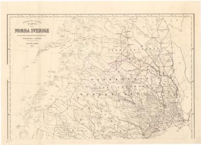
Trigonometrisk grunnlag, vedlegg 63b: Karta öfver Norra Sverige
1 : 500000 August Hahr Schlachter & Seedorff, Stockholm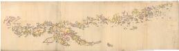
Museumskart 129: Nordlandene
1 : 200000 Hautz
Spesielle kart 89-2: Rikstelegrafens og private telefonselskapers linjeruter i det nordlige Norge
Ukjent
Spesielle kart 101-2: Postkart over det nordlige Norge
1 : 1000000 K. Gleditsch
Norgesavdelingen 227-4: Vægkart over Norge - nordlig blad
1 : 600000 P. Dybdahl | J. Sejersted A. Bruns Forlag
Norge 19 Cammermeyers Reisekart over det nordlige Norge
1 : 800000 Per Nissen
Spesielle kart 93-1: Riks-telegraf og telefonkart over det nordlige Norge 1914
1 : 600000
Spesielle kart 95-2: Riks-telegraf og telefonkart over det sydlige Norge 1916
1 : 600000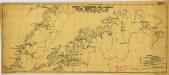
Norway-Aerodromes and possible sites North of Lat,65 (1940)
Norway-Aerodromes and possible sites North of Lat,65 [compiled from information supplied up to 16th May 1940], ADI (Maps) AM 33W. [S.l.] : Air Ministry, United Kingdom
Skogkart paa grundlag av det Hydrografiske kart, blad 5
1 : 500000 Kaptein K. Gleditsch
Spesielle kart nr 110: Hydrografisk kart over det nordlige Norge
1 : 500000 G. Sætren
Karta öfver Luleå Lappmark med en del af Norbottens Län
1 : 500000 författad af Franz von Schéele stentrijck af C. v. Schéele [S.l.] : C.M. af Robson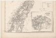
Norge 170: Kart over det nordlige Norge (sør)
1 : 700000 Peter Andreas Munch
Trigonometrisk grunnlag, vedlegg 68b: Kart over de trigonometriske Hovednet
1 : 500000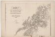
Norge 170: Kart over det nordlige Norge (nord)
1 : 700000 Peter Andreas Munch
Spesielle kart 154-3: Nattflykart, blad 3
1 : 500000
Statistikk 38-1 Bosettingskart over Troms og Norland. Blad 11
1 : 400000 Statistisk Sentralbyrå
Finmarkens amt nr 60: Charta öfver Twislige Riksskilnaden millan Sverige och Norje
1 : 20000 Laurent Lundgren, Per Tang
Finmarkens amt 54-4: HÃ¥ndtegnet kopi/skisse av Nesodden-Kristiania-Nordmarken
1 : 200000 Gerhard Munthe, Fredrik Rode
Spesielle kart 122-11: Postkart over Norge
1 : 400000 Toralf à ̃yen
Spesielle kart 122-10: Postkart over Norge
1 : 400000 Toralf à ̃yen
Statistikk 38-10: Bosettingskart over Nordland. Blad 10
1 : 400000 Statistisk Sentralbyrå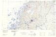
Statistikk 43-20-2: Bosettingskart over Mo i Rana. Blad 20
1 : 250000 Statistisk Sentralbyrå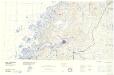
Statistikk 43-20- Bosettingskart over Mo i Rana. Blad 20
1 : 250000 Statistisk Sentralbyrå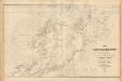
Museumskart 217-14: Kart over Den Norske Kyst fra Tranø til Gi Sund
1 : 50000 Due | Rynning | Hagerup | Vibe Opmaalings Directionen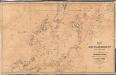
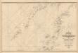
Trigonometrisk grunnlag, vedlegg 62: Kart over Den Norske Kyst fra Tranø til Gi Sund
1 : 200000 Rynning | Due | Hagerup | Vibe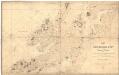
Museumskart 139: Kart over Den norske kyst fra Tranø til GiSund med Vesteraalen og den nordlige deel af Lofoten
1 : 200000 Vibe
Statistikk 43-21- Bosettingskart over Bodø. Blad 21
1 : 250000 Statistisk Sentralbyrå
Statistikk 43-23- Bosettingskart over Svolvær. Blad 23
1 : 250000 Statistisk Sentralbyrå