Maps of Scandinavia

Statistikk 26-1c: Heste. Antal Dyr pr 1000 Maal høstet Areal
1 : 2400000
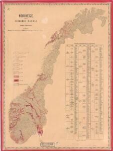
Statistikk 26-3b: Fremstilling af Kongeriget Norges Landbrug. Agerbruget
1 : 2400000
Statistikk kart 13-a: Norvège. Division ecclesiastique
1 : 2400000
Statistikk 26-2a: Grundeiendommenes Udstykning i Klasser
1 : 2400000
Statistikk 26-3a: Grundeiendommense Værdi efter Matrikulen
1 : 2400000
Statistikk kart 10: Mouvement de la population
1 : 2400000
Statistikk kart 21-2: Norvege. Pêches.
1 : 2400000
Statistikk 26-7b: Udsæd af Poteter
1 : 2400000
Spesielle kart 129-1: Oversigtskart over Gradavdelingskarter og Rektangelkarter, bilag 1
1 : 2800000
Statistikk kart 4-2: Kart udvisende Folkemængens fordeling i Norge
1 : 2400000
Statistikk kart 16: Norske kirker, med angivelse af lynnedslag
1 : 2400000
Statistikk kart 4- Kart udvisende Folkemængens fordeling i Norge
1 : 2400000
Statistikk 26-6c: Hornkvæg. Middeltal pr Gaard
1 : 2400000
Statistikk kart 20-3: Fremstilling af den norske Fædrift. Gjeden. Dyrenes antal pr. 1000 maal afhøstet areal
1 : 2400000
Statistikk kart 20-2: Fremstilling af den Norske Fædrift. Hornkvæget. Dyrenes antal pr 1000 maal afhøstet areal
1 : 2400000
Statistikk kart 11-4: Division judiciaire
1 : 2400000
Sweden and Norway.
1 : 6462720 Tallis, J. & F.
Statistikk kart 11-3: Division judiciaire
1 : 2400000
Statistikk kart 19-6: Fremstilling af Norges Agerbrug. Hovedsæden i hvert Herred
1 : 2400000
Statistikk kart 21- Norvege. Pêches.
1 : 2400000
Statistikk 26-2b: Herreder, hvis Kornavl er tilstrækkelig til eget Brug
1 : 2400000
Statistikk 26-10b: Eng i Procent af den dyrkede Jord, fogderivis
1 : 2400000
Statistikk kart 13-b: Norvège. Division ecclesiastique
1 : 2400000
Jordbunnskart
1 : 2000000 Juel Låg Norges Landbrukshøgskole | Norges geografiske oppmåling
Statistikk 26-1b: Hovedsæden i hvert Herred
1 : 2400000
Statistikk 26-7c: Faar. Antall Dyr pr 1000 Maal høstet Areal
1 : 2400000
Statistikk 26-2c: Hornkvæg. Antal Dyr pr 1000 Maal høstet Areal
1 : 2400000
Statistikk kart 20- Fremstilling af den Norske Fædrift. Hesten. Dyrenes antal pr. 1000 Maal afhøstet areal
1 : 2400000
Spesielle kart 66-7: Kart udvisende de med bidrag af Statskassen understøttende Dampskibsrouter
1 : 2400000