Maps of Aurskog-Høland

Spesielle kart 37: Oversigtskart over Urskog-Hølands-Banen
1 : 200000
Trigonometrisk grunnlag, dublett 23-2: Kart over trigonometriske punkter foretatt i ca 1805
1 : 500000 Hans Lemmich Juell | Hans Gløersen
Portefølje nr 24
1 : 100000
Portefølje nr 24
1 : 100000
Spesielle kart 85: Oversigtskart over jernbanelinierne til Enebak
1 : 100000
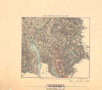
Geologisk kart 100: Fet
1 : 100000
15C Fet
1 : 100000
15C Fet
1 : 100000
15C Fet
1 : 100000
Trigonometrisk grunnlag, vedlegg 17: Fundament Mensul for Quadrat-Milen No 91
1 : 20000 Hans Nicolai Archtander | Niels Andreas Wibe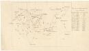
Trigonometrisk grunnlag, vedlegg 59
1 : 50000
Kartblad 40: Vey-Cart over det Høelandske Infanterie Compagnies District
Heyerdahl
Spesielle kart 108: à ̃versigtsprofil. Nordbanen-Lillestrà ̧m-Smaalensbanen
1 : 100000
15C Fet
1 : 100000 H. T. Bjørnstad | Johan Ferdinand Nordmann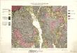
Geologiske kart 29: Den geologiske Undersøgelse, Fet
1 : 100000 T. Ch. Thomassen | H. T. Bjørnstad Norges geologiske undersøkelse
15C Fet
1 : 100000
Kartblad 37: Topographisk Chart over det Trøgstadske Compagnie District
Hans Nobel Coucheron
Kartblad 36: Militairisk Chart over det Enebakske Compagnie District
N. F. Lihme
Finmarkens amt 54-2: HÃ¥ndtegnet kopi av kart over Ã...rdalstangen
1 : 200000 Fredrik Rode, Gerhard Munthe
Kartblad 24: Wei-Kaart over det Schijedsmoiske Compagnie District
Lihme senior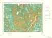
Geologisk kart 10 Nannestad
1 : 100000
Kartblad 42: Vej-Cort over det Ullensagerske Compagnies District (Under Norske Jægerkorps)
C. Hals
20A Nannestad
1 : 100000 Johan Ferdinand Nordmann | Ole Engh
Kart over iernbanelinie fra Christiania til à ̃ieren og Mjà ̧sen, tilligmed Vandlinien fra à ̃ieren til Mjà ̧sen
1 : 20000 Holcks Attelier
20A Nannestad
1 : 100000 Johan Ferdinand Normann | Carl Christian Olberg
20A Nannestad
1 : 100000 Carl Christian Olberg | Johan Ferdinand Normann
20A Nannestad
1 : 100000 Johan Ferdinand Normann | Carl Christian Olberg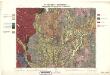
Geologiske kart 30: Den geologiske Undersøgelse, Nannestad
1 : 100000 T. Ch. Thomassen | Normann | Johan H. L. Vogt Norges geologiske undersøkelse
Spesielle kart 104-2: Kart over Fredrikshaldsvassdraget med Mangenvassdraget
1 : 50000 Finn Qvale