Maps of Rendalen

Spesielle kart 22-4: Koppang - Lilleelvdal
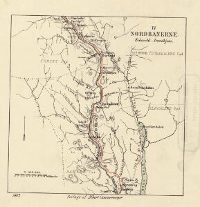
1 : 400000 Albert Cammermeyer Forlag
Kartblad 166b-2: Wej-Cart over det Aamodske Compagnie; 166b-2

Portefølje nr 56
1 : 100000 Munthe
Portefølje nr 56
1 : 100000 F. Akrell
Portefølje nr 56
1 : 100000 Munthe
38A Øvre Rendal
1 : 100000 Einar Sigurd Ween | B. Tolstad
Geologisk kart 90: Øvre Rendal
1 : 100000 Gunnar Holmsen | Chr. Oftedahl Norges geologiske undersøkelse
38A Øvre Rendalen
1 : 100000 B. Tolstad | Einar Sigurd Ween
38A Øvre Rendal
1 : 100000 Einar Sigurd Ween | B. Tolstad
38A Øvre Rendalen
1 : 100000 B. Tolstad | Einar Sigurd Ween
1818-1 Sollia
1 : 50000 Statens kartverk
1818-1 Sollia
1 : 50000 Statens kartverk
32C Ytre Rendalen
1 : 100000 Ole Tolstad | Ole Engh
32C Ytre Rendal
1 : 100000 Ole Tolstad | Ole Engh
32C Ytre Rendalen
1 : 100000 Ole Engh | Ole Tolstad
Geologisk kart 89: Ytre Rendal
1 : 100000 Per Holmsen | Chr. Oftedahl E. Moestue A.S.
1918-4 Hanestad
1 : 50000 Statens kartverk
1918-4 Hanestad
1 : 50000 Statens kartverk
1818-1 Sollia
1 : 50000 Norges Geografiske Oppmåling
32C 9
1 : 50000 Finn Qvale | Herman Løvenskiold
32C 6; 32C 10
1 : 50000 Finn Qvale
37B 4; 37B 8
1 : 50000 Ole Berg Getz | David Ebbesen
1818-1 Sollia
1 : 50000 Norges Geografiske Oppmåling
38A 1; 38A 5
1 : 50000 Haakon Schive
1918-1 Rendalen
1 : 50000
1918-1 Otnes
1 : 50000 Statens kartverk
1918-1 Rendal
1 : 50000 Norges Geografiske Oppmåling
1918-4 Hanestad
1 : 50000 Norges Geografiske Oppmåling
1918-1 Rendalen
1 : 50000 Statens kartverk