Maps of Scandinavia

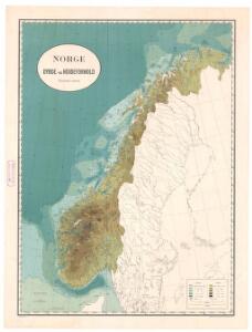
Spesielle kart nr 118: Norge. Dybde og hà ̧ydeforhold
1 : 2400000
Norge : Oversigtskart over Dybde- og Höjdeforholde
1 : 2400000 titelvariant: Oversigtskart over Dybde- og Höjdeforholde; Annotatie geografische gegevens: Met 3 profielen van de zeebodem en 1 west-oost-profiel over het zuidelijk deel van Noorwegen [S.l. : Norges geografiske Opmaaling]
Statistikk 9- Norvege. Mouvement de la population
1 : 2400000
Spesielle kart 66-6: Kart udvisende de med bidrag af Statskassen understøttende Dampskibsrouter
1 : 2400000
Statistikk kart 13-a: Norvège. Division ecclesiastique
1 : 2400000
Statistikk kart 20- Fremstilling af den Norske Fædrift. Hesten. Dyrenes antal pr. 1000 Maal afhøstet areal
1 : 2400000
Statistikk 26-8c: Gjeder. Middeltal pr. Gaard
1 : 2400000
Statistikk kart 19- Fremstilling af Norges Agerbrug. Udsæden af Korn i Tønder pr. 1000 maal ager
1 : 2400000
Statistikk kart 21- Norvege. Pêches.
1 : 2400000
Spesielle kart 72b: Kart over Valgmands- og Stortingsvalgene
1 : 2400000 K. Petersen Olaf Norli's forlag; Kristiania
Spesielle kart 66-5: Kart udvisende de med bidrag af Statskassen understøttende Dampskibsrouter
1 : 2400000
Statistikk kart 10: Mouvement de la population
1 : 2400000
Statistikk kart 20-3: Fremstilling af den norske Fædrift. Gjeden. Dyrenes antal pr. 1000 maal afhøstet areal
1 : 2400000
Spesielle kart 66-7: Kart udvisende de med bidrag af Statskassen understøttende Dampskibsrouter
1 : 2400000
Statistikk kart 20-2: Fremstilling af den Norske Fædrift. Hornkvæget. Dyrenes antal pr 1000 maal afhøstet areal
1 : 2400000
Statistikk kart 4- Kart udvisende Folkemængens fordeling i Norge
1 : 2400000
Statistikk kart 11-4: Division judiciaire
1 : 2400000
Statistikk 26-3b: Fremstilling af Kongeriget Norges Landbrug. Agerbruget
1 : 2400000
Statistikk 26-1c: Heste. Antal Dyr pr 1000 Maal høstet Areal
1 : 2400000
Statistikk kart 4-2: Kart udvisende Folkemængens fordeling i Norge
1 : 2400000
Statistikk 26-3a: Grundeiendommense Værdi efter Matrikulen
1 : 2400000
Statistikk 26-2a: Grundeiendommenes Udstykning i Klasser
1 : 2400000
Statistikk kart 12-a: Norvège. Division administrative
1 : 2400000
Statistikk kart 23: Les marchandises exportees
1 : 2400000
Statistikk kart 16: Norske kirker, med angivelse af lynnedslag
1 : 2400000
Spesielle kart 66-4: Kart udvisende de med bidrag af Statskassen understøttende Dampskibsrouter
1 : 2400000
Statistikk kart 22: Tonnage de navires 1873
1 : 2400000
Statistikk kart 11-3: Division judiciaire
1 : 2400000
Statistikk kart 21-2: Norvege. Pêches.
1 : 2400000