Maps of Gausdal

Spesielle kart 103-6: Flötningskart over Glommens vassdrag
1 : 1000 Einar Sigurd Ween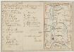
Kartblad 58: Carte over det Ringeboiske Compagnie District
Jens Bull | Kraft
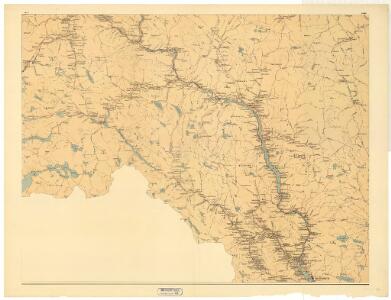
Portefølje nr 47
1 : 100000 Duncker | Munthe
Portefølje nr 47
1 : 100000 Duncker | Munthe
31A Espedalen
1 : 100000
F30 Fron
1 : 100000
31A 3; 31A 4; 31A 6; 31A 7; 31A 8; 31A 10; 31A 11; 25C 12; 25D 9
1 : 100000 Ramm
31B 3
1 : 100000 Ramm
30B 8; 30B 12; 30D 4; 30D 8; 31A 5; 31A 9; 31A 10; 31C 1; 31C 2; 31C 3; 31C 5; 31C 6
1 : 100000 Ramm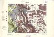
Geologiske kart 64: Den geologiske Undersøgelse, Gausdal
1 : 100000 K. O. Bjørlykke | Torgrim Lundtvedt Norges Geografiske Opmaaling
F30 Fron
1 : 100000
Kartblad 52: Militært Cart over det Gusdalske Compagnies District
Keilhau
Kartblad 59: Militair Vey-Cart over det Ringeboiske Compagnie District
P. Weybey
Portefølje nr 46
1 : 100000 N. S. Wergeland
Geologisk kart 123: Glasialgeologisk kart over sørøstlige Jotunheimen og tilgrensende områder
1 : 150000 A. B. Carlson | J. L. Sollid | H. Raastad Norsk geografisk tidsskrift
Portefølje nr 46
1 : 100000 F. Akrell
Kartblad 57: Militair Vei-Cart over det Qvambske Compagnie District
P. L. Stiboldt
31A Espedalen
1 : 100000
31A Espedalen
1 : 100000
31A Espedalen
1 : 100000
31B Gausdal
1 : 100000
31B Gausdal
1 : 100000 Torgrim Lundtvedt | Johan Nordhagen
31B Gausdal
1 : 100000 Torgrim Lundtvedt | C. Pedersen
31B Gausdal
1 : 100000 Torgrim Lundtvedt | Johan Nordhagen
31B Gausdal
1 : 100000 Johan Nordhagen | Torgrim Lundtvedt
F30 aust Fron
1 : 100000
Espedalen
1 : 100000 Norsko Norges geografiske Opmaaling
1817-4 Fåvang
1 : 50000 Statens kartverk
F31-11
1 : 50000 Per Tang