Maps of Smøla

45C Brattvær
1 : 100000
45C Bratvær
1 : 100000 H. Hagen | Oluf Lier
45C Bratvær
1 : 100000 H. Hagen | Oluf Lier
45C Brattvær
1 : 100000
45C Bratvær
1 : 100000 Oluf Lier | H. Hagen
1321-4 Silsingodden
1 : 50000 Statens kartverk
1321-4 Silsingodden
1 : 50000 Statens kartverk
1321-4 Silsingodden
1 : 50000 Norges Geografiske Oppmåling
1321-4 Silsingodden
1 : 50000 Statens kartverk
1321-4 Silsingodden
1 : 50000 Norges Geografiske Oppmåling
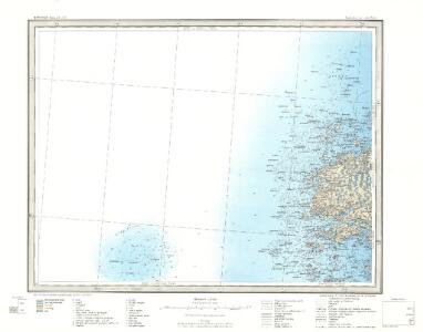
Museumskart 119: Trøndelagskysten, sør-vest
1 : 200000 Paus
45C 8; 45C 12; 45D 5; 45D 9
1 : 50000 Carl Ludovico Huitfeldt
45A 11; 45A 12; 45C 3; 45C 4
1 : 50000
1321-1 Smöla
1 : 50000 Statens kartverk
1321-1 Smöla
1 : 50000 Statens kartverk
1321-1 Smöla
1 : 50000 Norges Geografiske Oppmåling
1321-1 Smöla
1 : 50000 Norges Geografiske Oppmåling
Geologiske kart 121-J2: Kart med magnetisk totalfelt. Kristiansund
1 : 250000 Norges geologiske undersøkelse
Trigonometrisk grunnlag, Squelet-Cart 65-15

Statistikk 43-15-2: Bosettingskart over Kristiansund. Blad 15
1 : 250000 Statistisk Sentralbyrå
Museumskart 217-68: Kart over Havbankerne Langs den Norske Kyst fra Stadt til Smølen
1 : 200000 M. Lyng Den Geografiske Opmaaling
Norge 55-18: Accurat landcaart over Norges Rige anden Part
1 : 300000 G. Bordin
Norge 55-14: Accurat landcaart over Norges Rige anden Part
1 : 3000000 G. Bordin
Kartblad 112: Carte over det Wigsche-Nordmørsche Compagnie District
Johan Thomas Hornemann
Kartblad 119: Situations Kaart over det Gimnatsche Compagnie District
Johan Christian Richelieu
1322-2 Veidholmen
1 : 50000 Norges Geografiske Oppmåling
1322-2 Veiholmen
1 : 50000 Statens kartverk
1322-2 Veiholmen
1 : 50000 Norges Geografiske Oppmåling
1322-2 Veiholmen
1 : 50000 Statens kartverk