Maps of Tønsberg

9D 7
1 : 50000
Museumskart 35: Kaart over Udseilingen fra Tønsberg til Bulleren
1 : 20000
Museumskart 23: Fra Tønsbert og till Bullerne
1 : 10000
9D 3 nà ̧ 9D 7 sà ̧
1 : 50000 Henrik August Angell
9D 7 sv
1 : 25000 Jens Holst
9D 7 nv
1 : 25000 Finn Qvale
9D3 1
1 : 4000 Ring
Tønsberg
1 : 100000
1813-2 Tjøme
1 : 50000 Statens kartverk
1813-2 Tjøme
1 : 50000 Statens kartverk
1813-2 Tjöme
1 : 50000 Norges Geografiske Oppmåling
1813-2 Tjöme
1 : 50000 Norges Geografiske Oppmåling
1813-2 Tjöme
1 : 50000 Norges Geografiske Oppmåling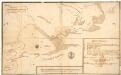
Museumskart 2 Situation Over Tønsbergs havn
1 : 200000
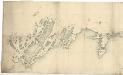
Museumskart 36: Kaart over Tønsberg Havn og ud til Giersøe
1 : 5000
Museumskart 24: Carte af Grinholm Sund
1 : 8500 Rasmus Iuel
9D 2 nà ̧ 9D 3 nv
1 : 25000 Henrik August Angell
9D 6 Ã ̧st
1 : 25000 Finn Abrahamson
9D 2 nà ̧
1 : 25000 Henrik August Angell
9D2 5
1 : 4000 Ring
Museumskart 37: Kaart over Grevskaberne Jarlsberg og Laurvigen
1 : 50000
Museumskart 217-45: Specialkart over Kristianiafjorden fra Bastø til Lille Færder
1 : 50000 C. F. Wille | G. Jacobsen Den Geografiske Opmaaling
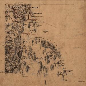
9D Tønsberg
1 : 100000 Carl Christian Olberg | Ole Tolstad
9D Tønsberg
1 : 100000 Ole Tolstad | Carl Christian Olberg
Geologisk kart 9: Den geologiske undersøgelse, Rektangel 9D Tønsberg
1 : 100000 M. T. Kingo | M. Bugge | A. Dellinger Norges geologiske undersøkelse
9D Tønsberg
1 : 100000 Ole Tolstad | C. Pedersen
9D Tønsberg
1 : 100000
9D Tønsberg
1 : 100000 Ole Tolstad | Carl Christian Olberg
9D Tønsberg
1 : 100000 Ole Tolstad | C. Pedersen