Maps of Sandefjord

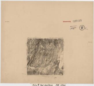
9D 6 nv
1 : 25000 Carl Ludvig Soelberg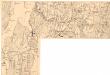
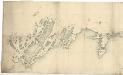
Holmestrand
1 : 12500 Johannesen
9D 6
1 : 20000
Kartblad 14: Millitairisk Vey-Cart over det Søndre Jarlsbergske Compagnie
Fougner | Hans Rad Ager
9D 6 sv
1 : 25000 David Ebbesen
Kartblad 15: Militair Cart over det Nordre Lauerwigske Compagnie District
Blix
9D 9
1 : 50000 Einar Christian Ingvald Nandrup Michelsen
Kartblad 28: Kart over det Waaleske Compagnie District

1813-4 Holmestrand
1 : 50000 Norges Geografiske Oppmåling
1813-4 Holmestrand
1 : 50000 Statens kartverk
Museumskart 37: Kaart over Grevskaberne Jarlsberg og Laurvigen
1 : 50000
Kartblad 33: Vei-Kart over det Lauerdahlske Compagnie Distict
Onserud
9D Tønsberg
1 : 100000 Carl Christian Olberg | Ole Tolstad
9D Tønsberg
1 : 100000 Ole Tolstad | Carl Christian Olberg
Geologisk kart 9: Den geologiske undersøgelse, Rektangel 9D Tønsberg
1 : 100000 M. T. Kingo | M. Bugge | A. Dellinger Norges geologiske undersøkelse
9D Tønsberg
1 : 100000 Ole Tolstad | C. Pedersen
9D Tønsberg
1 : 100000
9D Tønsberg
1 : 100000 Ole Tolstad | Carl Christian Olberg
9D Tønsberg
1 : 100000 Ole Tolstad | C. Pedersen
Kartblad 12: Geographisch_carte over de angrændsende Compagnier udi Jarlsbergs Græwskab af det 1ste Aggerhuusche og 2det Smaaleensche Infanterie-Regiment
Oppen
Trigonometrisk grunnlag, Squelet-Cart 34: En Deel af Laurvigs Grevskab trigonometrisk bestemte Punkter
H. Gløersen | J. J. Broch
Trigonometrisk grunnlag, Squelet-Cart 30: En Deel af Laurvigs Grevskab
H. Gløersen
Trigonometrisk grunnlag, dublett 27-2: Kart over trigonometriske punkter foretatt i rundt 1795
1 : 200000
Trigonometrisk grunnlag, Squelet-Cart 27: Grunnlagspunkter i Østfold og Akershus
Museumskart 16: Kysten utenfor Vestfold og Telemark, nordlige del
1 : 35000 Jens SÃ ̧rensen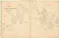
Museumskart 15: Udkast af Indløbet til Christiania
1 : 200000 Carl Frederik Grove | Gustaf Klint
Portefølje nr 16
1 : 100000 F. Akrell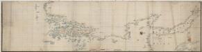
Norge 69: Kristianiafjordens vestre Kyst fra Tønsberg til Drammen
1 : 50000
Spesielle kart 45: Oversigtskart over Tønsberg - Eidsfos Jernbane
1 : 100000