Maps of Færder

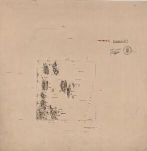
9D 3 sv
1 : 25000 Nils Hartvig Ruud
9D3 17
1 : 4000 Høyer
9D3 16
1 : 4000 Rye
9D3 21
1 : 4000 Ring
9D3 11
1 : 4000 Høyer
9D 3
1 : 50000 Holmboe
9B 10 nà ̧ 9B 11 nv
1 : 25000 Einar Halle
1813-2 Tjöme
1 : 50000 Norges Geografiske Oppmåling
1813-2 Tjøme
1 : 50000 Statens kartverk
1813-2 Tjöme
1 : 50000 Norges Geografiske Oppmåling
1813-2 Tjöme
1 : 50000 Norges Geografiske Oppmåling
1813-2 Tjøme
1 : 50000 Statens kartverk
9D 2 nà ̧ 9D 3 nv
1 : 25000 Henrik August Angell
9D 2 sà ̧
1 : 25000 Carl Peter Bruun
9D2 15
1 : 4000 O. Rye
9D2 25
1 : 4000 Ring
9D2 20
1 : 4000 Leigh
9B11 1
1 : 10000 L. S. Ring
1813-2 Tjøme
1 : 50000 Statens kartverk
Museumskart 37: Kaart over Grevskaberne Jarlsberg og Laurvigen
1 : 50000
Museumskart 217-45: Specialkart over Kristianiafjorden fra Bastø til Lille Færder
1 : 50000 C. F. Wille | G. Jacobsen Den Geografiske Opmaaling
9D Tønsberg
1 : 100000 Ole Tolstad | Carl Christian Olberg
Geologisk kart 9: Den geologiske undersøgelse, Rektangel 9D Tønsberg
1 : 100000 M. T. Kingo | M. Bugge | A. Dellinger Norges geologiske undersøkelse
9D Tønsberg
1 : 100000 Ole Tolstad | C. Pedersen
9D Tønsberg
1 : 100000
9D Tønsberg
1 : 100000 Ole Tolstad | Carl Christian Olberg
9D Tønsberg
1 : 100000 Ole Tolstad | C. Pedersen
9D Tønsberg
1 : 100000 Carl Christian Olberg | Ole Tolstad
Trigonometrisk grunnlag, Squelet-Cart 34: En Deel af Laurvigs Grevskab trigonometrisk bestemte Punkter
H. Gløersen | J. J. Broch