Maps of South Varanki

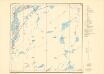
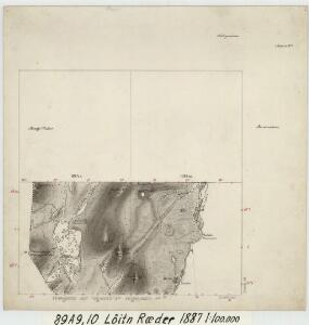
89A 9; 89A 10
1 : 100000 Johan Christopher Ræder
89A 5; 89A 6
1 : 100000 Johan Christopher Ræder
2333-2 Krokfjellet
1 : 50000 Statens kartverk
2333-2 Gjøkåsen
1 : 50000 Statens kartverk
2333-2 Krokfjellet
1 : 50000 Statens kartverk
89C 1; 89C 5
1 : 100000 Johan Christopher Ræder
2333-2 Krokfjell
1 : 50000 Norges Geografiske Oppmåling
2333-2 Krokfjell
1 : 50000 Norges Geografiske Oppmåling
Z7 Krokfjeld Mutkavarre
1 : 100000 Johan Nordhagen | Torgrim Lundtvedt
2333-2 Krokfjellet
1 : 50000 Statens kartverk
Z7 Krokfjeld Mutkavarre
1 : 100000 Torgrim Lundtvedt | Johan Nordhagen
Æ7 Vaggetem
1 : 100000 Johan Nordhagen | Johan Gulbrandsen Natrud
Spesielle kart 172-17: Kart over riksgrensen mellom Norge og Finland
1 : 40000 Kristian Nissen | Gleditsch | Arvo Manner | K. Vaala
Æ7
1 : 100000 Gunvald Hagene
Spesielle kart 172-16: Kart over riksgrensen mellom Norge og Finland
1 : 40000 Kristian Nissen | Gleditsch | Arvo Manner | K. Vaala
Z7 Krokfjeld Mutkavarre
1 : 100000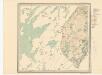
Z7 Krokfjeld Mutkavarre
1 : 100000 Torgrim Lundtvedt | Ole Engh
Z7 Krokfjeld Mutkavarre
1 : 100000 Torgrim Lundtvedt | Ole Engh
Z7 Krokfjeld Mutkavarre
1 : 100000 Torgrim Lundtvedt | Ole Engh
Z7 Krokfjeld Mutkavarre
1 : 100000 Torgrim Lundtvedt | Johan Nordhagen
Æ7 Vaggetem
1 : 100000
89C 2; 89C 6; 89C 7
1 : 100000 Aksel Hvide Bang
2333-1 Vaggatem
1 : 50000 Norges Geografiske Oppmåling
2333-1 Vaggatem
1 : 50000 Norges Geografiske Oppmåling
2333-1 Vaggatem
1 : 50000 Statens kartverk
2333-1 Store Spurvvatnet
1 : 50000 Statens kartverk
2333-1 Vaggatem
1 : 50000 Statens kartverk
2333-1 Vaggatem
1 : 50000 Norges Geografiske Oppmåling
Æ7 Vaggetem
1 : 100000 Johan Nordhagen | Johan Gulbrandsen Natrud