Maps of Grong

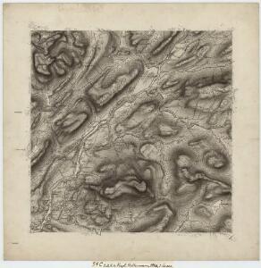
54C 1; 54C 2; 54C 5; 54C 6
1 : 50000 Eiler Christian Holtermann
1824-2 Namskogan
1 : 50000 Norges Geografiske Oppmåling
1824-2 Skorovatn
1 : 50000 Norges Geografiske Oppmåling
1824-2 Skorovatn
1 : 50000 Statens kartverk
1824-2 Skorovatn
1 : 50000 Norges Geografiske Oppmåling
1824-3 Harran
1 : 50000 Statens kartverk
1824-3 Harran
1 : 50000 Statens kartverk
54C 1 (øst/2); 54C 2 (vest/2)
1 : 40000
54C Trones
1 : 100000
Geologisk kart 110: Trones
1 : 100000 Steinar Foslie Norges geologiske undersøkelse
54C Trones
1 : 100000 C. Pedersen | Johan Gulbrandsen Natrud
54C Trones
1 : 100000
54C Trones
1 : 100000 Johan Gulbrandsen Natrud | Johan Nordhagen
Geologisk kart 97: Trones
1 : 100000 Steinar Foslie Norges geologiske undersøkelse
1824-3 Harran
1 : 50000 Statens kartverk
1824-2 Skorovatn
1 : 50000 Statens kartverk
1824-3 Harran
1 : 50000 Norges Geografiske Oppmåling
1824-2 Skorovatn
1 : 50000 Statens kartverk
1824-3 Harran
1 : 50000 Norges Geografiske Oppmåling
1824-3 Harran
1 : 50000 Norges Geografiske Oppmåling
54C 10; 54C 11
1 : 50000 Emil Adolf Eriksen
54C 9
1 : 50000 Emil Adolf Eriksen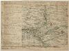
Kartblad 90-2: Cituations Carte over det Overhaldske Præstegield og Major F. H. Sommerschields Compagnie; versjon 2
Henrich Christopher Sommerschield
Liene
1 : 250000
Kartblad 90- Cituations Carte over det Overhaldske Præstegield og Major F. H. Sommerschields Compagnie; versjon 1
Henrich Christopher Sommerschield
Norge 55-12: Accurat landcaart over Norges Rige anden Part
1 : 3000000 G. Bordin
Kartblad 89: Overhaldske Compagnie
P. Q. Borg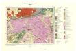
Geologisk kart 93: Sanddøla
1 : 100000 Steinar Foslie Norges geologiske undersøkelse
54C 3; 54C 4; 54C 7; 54C 8
1 : 50000 Carl Aksel Sigurd Sissener