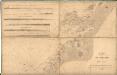
Maps of Vikna
53C 9; 53C 10
1 : 50000 Thorvald Johan Randin Johannessen
56A 1; 56A 2
1 : 50000 Thorvald Johan Randin Johannessen
1624-1 Vikna
1 : 50000 Statens kartverk
1624-1 Vikna
1 : 50000 Norges Geografiske Oppmåling
1624-1 Vikna
1 : 50000 Statens kartverk
1624-1 Vikna
1 : 50000 Norges Geografiske Oppmåling
53C Fosnes
1 : 100000
53C Fosnes
1 : 100000 Torgrim Lundtvedt | Johan Gulbrandsen Natrud
53C Fosnes
1 : 100000 Johan Gulbrandsen Natrud | Torgrim Lundtvedt
53C Fosnes
1 : 100000 Carl Christian Olberg | Torgrim Lundtvedt
53C Fosnes
1 : 100000 Torgrim Lundtvedt | Carl Christian Olberg
53C Fosnes
1 : 100000 Torgrim Lundtvedt | Johan Gulbrandsen Natrud
53C Fosnes
1 : 100000 Carl Christian Olberg | Torgrim Lundtvedt
1624-1 Vikna
1 : 50000 Statens kartverk
55B 4
1 : 50000 Thorvald Johan Randin Johannessen
52D 8; 52D 12
1 : 50000 Thorvald Johan Randin Johannessen
1624-4 Nordøyan
1 : 50000 Statens kartverk
1624-4 Nordöyan
1 : 50000 Statens kartverk
1624-4 Uren
1 : 50000 Norges Geografiske Oppmåling
1624-4 Nordøyan
1 : 50000 Statens kartverk
1624-4 Nordöyan
1 : 50000 Norges Geografiske Oppmåling
53C 11; 53C 12
1 : 50000 Hans Gjestvang
53C 3; 53C 7
1 : 50000 Abraham Ludvig Amundsen
53C 1; 53C 2; 53C 5; 53C 6
1 : 50000 Abraham Ludvig Amundsen
Namsos
1 : 250000
Namsos
1 : 250000
Museumskart 12 Trøndelagskysten, nord-øst
1 : 200000 Paus
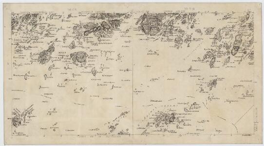
Museumskart 217-10: Kart over Den Norske Kyst fra Haltenøe til Lekøe
1 : 50000 H. Paludan | Vibe | Hagerup Opmaalings Directionen
Norge 55-1 Accurat landcaart over Norges Rige anden Part
1 : 3000000 G. Bordin