Maps of Melhus

46B 1; 46B 2; 46B 3; 46B 4; 46B 5; 46B 6; 46B 7; 46B 8
1 : 50000 Fredrik Christian Sejersted
Geologiske kart 15: Den geologiske Undersøgelse, Melhus
1 : 100000 Theodor Kjerulf | J. Vogt | H. T. Bjørnstad | M. Bugge | C. Schultz Norges geologiske undersøkelse
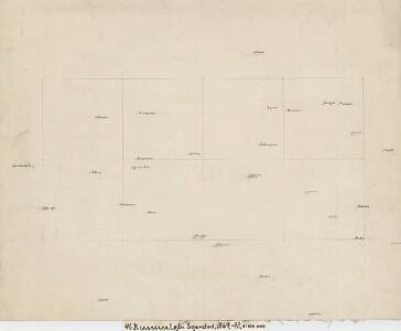
46B Melhus
1 : 100000 C. Pedersen | Arnt Magnus Andreassen Øgaard
46B Melhus
1 : 100000
46B Melhus
1 : 100000
46B Melhus
1 : 100000 C. Pedersen | Arnt Magnus Andreassen Øgaard
46B Melhus
1 : 100000
46B Melhus
1 : 100000 C. Pedersen | Arnt Magnus Andreassen Øgaard
46B Melhus
1 : 100000 C. Pedersen | Arnt Magnus Andreassen Øgaard
46B Melhus
1 : 100000 C. Pedersen | Arnt Magnus Andreassen Øgaard
46B Melhus
1 : 100000 Arnt Magnus Andreassen Øgaard | C. Pedersen
Kartblad 105: Carte over det Størenske Compagnie District
Peter Laurentius Sidelmann Sigholdt
1521-2 Hølonda
1 : 50000 Statens kartverk
1521-2 Orkland
1 : 50000 Norges Geografiske Oppmåling
1621-3 Stören
1 : 50000 Norges Geografiske Oppmåling
1521-2 Hølonda
1 : 50000 Statens kartverk
46B 1; 46B 2; 46B 5; 46B 6
1 : 50000 Fredrik Christian Sejersted
Kartblad 103: Carte over det Budwigske Compagnie District
Ræder
46B 3; 46B 4; 46B 7; 46B 8
1 : 50000 Fredrik Christian Sejersted
1521-2 Hölonda
1 : 50000 Norges Geografiske Oppmåling
1621-3 Støren
1 : 50000 Statens kartverk
1521-2 Hølonda
1 : 50000 Statens kartverk
1621-3 Støren
1 : 50000 Statens kartverk
1621-3 Stören
1 : 50000 Norges Geografiske Oppmåling
1621-3 Støren
1 : 50000 Statens kartverk
Melhus med omegn
1 : 25000 Reinhold Ziegler
Kartblad 94: Wey-Carte over det Melhusiske Compagnie District

Fra Hovin til Fornes
1 : 20000 J. H. Reichborn
G25-8-nø/6
1 : 25000 Alf Hattestad