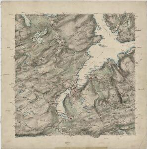
Maps of Hemne

46A 9; 46A 10; 46C 1; 46C 2
1 : 50000 Holtermann
1421-1 Hemne
1 : 50000 Statens kartverk
1421-1 Kyrksæterøra
1 : 50000 Statens kartverk
1421-1 Heim
1 : 50000 Norges Geografiske Oppmåling
1421-1 Hemne
1 : 50000 Statens kartverk
1421-1 Hemne
1 : 50000 Norges Geografiske Oppmåling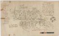
Kartblad 112: Carte over det Wigsche-Nordmørsche Compagnie District
Johan Thomas Hornemann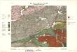
Geologisk kart 34: Den Geologiske Undersøgelse, Rektangel 46A Rindalen
1 : 100000 M. Bugge Norges geologiske undersøkelse
Kartblad 10 Situations Cart over det Børsensche Compagnies Destrichte
Casper Fridrich von Brodtkorb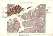
Geologiske kart 23: Den geologiske Undersøgelse, Terningen
1 : 100000 J. Johnsen | K. M. Hauan | M. Bugge | Theodor Kjerulf Norges geologiske undersøkelse
46A Rindal
1 : 100000
46A Rindal
1 : 100000
46A Rindal
1 : 100000
46C Terningen
1 : 100000 F. Eriksen | Georg Dellinger | Johan Nordhagen
46A Rindalen
1 : 100000 Ole Engh | Johan Gulbrandsen Natrud
46A Rindalen
1 : 100000 Nicolai Franck | Johan Gulbrandsen Natrud
46C Terningen
1 : 100000 Georg Dellinger | F. Eriksen | Johan Nordhagen
46C Terningen
1 : 100000 Georg Dellinger
46A Rindal
1 : 100000 Ole Engh | Johan Gulbrandsen Natrud
46C Terningen
1 : 100000 Ole Engh | Georg Dellinger | F. Eriksen
46A Rindalen
1 : 100000 Ole Engh | Johan Gulbrandsen Natrud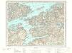
46C Terningen
1 : 100000
46C Terningen
1 : 100000
46C Terningen
1 : 100000 Georg Dellinger | F. Eriksen | Johan Nordhagen
1421-2 Vinjeøra
1 : 50000 Statens kartverk
1421-2 Vinjeøra
1 : 50000 Norges Geografiske Oppmåling
1421-2 Vinjeöra
1 : 50000 Norges Geografiske Oppmåling
1421-2 Vinjeøra
1 : 50000 Statens kartverk
46A 1; 46A 2; 46A 5; 46A 6
1 : 50000 Aksel Magnus