Maps of Midtre Gauldal

42D-11-nv
1 : 10000 Køppen
42D-11-nv
1 : 10000 Køppen
42D-11-nv
1 : 10000 Køppen
Fra Løklia til Gunhildsøya
1 : 20000 J. H. Reichborn
Fra Støren hovedkirke til Krokstad
1 : 20000 J. H. Reichborn
Kartblad nr 2b: Kaart over Postveien fra Trondheim til Røraas
1 : 20000 J. H. Reichborn
Kartblad nr 14 og 3: Kaart over Postveien fra Korsødegaarden til Trondhjem igjennom Gulbrandsdalen over Dovrefjeld
1 : 20000 J. H. Reichborn
Fra Kjellen til Folstad
1 : 20000 J. H. Reichborn
42D 7; 42D 8; 42D 11; 42D 12
1 : 50000
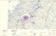
1621-3 Stören
1 : 50000 Norges Geografiske Oppmåling
42D Rennebu
1 : 100000
46B 1; 46B 2; 46B 3; 46B 4; 46B 5; 46B 6; 46B 7; 46B 8
1 : 50000 Fredrik Christian Sejersted
Kartblad 105: Carte over det Størenske Compagnie District
Peter Laurentius Sidelmann Sigholdt
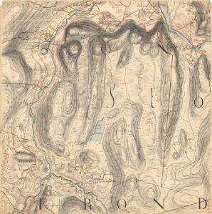
Geologiske kart 15: Den geologiske Undersøgelse, Melhus
1 : 100000 Theodor Kjerulf | J. Vogt | H. T. Bjørnstad | M. Bugge | C. Schultz Norges geologiske undersøkelse
Kartblad 104: Carte over det Størensche Compagnie District
A. Collin
Spesielle kart 22-2: Tyvold - Rognæs
1 : 400000 Albert Cammermeyer Forlag
Kartblad 166b-1a: Wej-Cart over det Aamodske Compagnie; 166b-1a

42D Rennebu
1 : 100000
Trigonometrisk grunnlag, Squelet-Cart 65-13

Trigonometrisk grunnlag, Squelet-Cart 56: kart over de i Sommeren 1859 bestemte Punkter
A. Heiberg
Røros
1 : 250000
Trondheim
1 : 250000
Statistikk _43-14-2: Bosettingskart over Røros. Blad 14.
1 : 250000
Spesielle kart: Tyngdeanomalikart, RÃ ̧ros
1 : 250000 NGO
Norge 55-10: Accurat landcaart over Norges Rige anden Part
1 : 300000 G. Bordin
Geologiske kart 121-D: Kart med magnetisk totalfelt. Trondheim
1 : 250000 Norges geologiske undersøkelse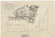
Spesielle kart 11: Oversigtskart og Profil over den projecterede Jernbanelinie fra Trondhjem til Jemtland over Meraker
1 : 400000 C. Collett
Geologisk kart 109: Røros
1 : 250000 Gunnar Holmsen Norges geologiske undersøkelse
Kartblad 107: Situations Cart over det 2det Trondhiemske Regiments District
J. C. R.