Maps of Rennebu

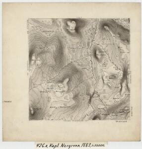
42C 8
1 : 50000 Ole Hagbart Bertrand Norgrenn
42C 8; 42C 12; 42D 5; 42D 9
1 : 50000 Ole Hagbart Bertrand Norgrenn
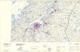
42C Trollhetta
1 : 100000
42C Troldhetta
1 : 100000 Ole Engh | Oluf Lier
42C Trollhetta
1 : 100000
42C Troldhetta
1 : 100000 H. Hagen | Oluf Lier
42C Troldhetta
1 : 100000 H. Hagen | Oluf Lier
42C Troldhetta
1 : 100000 Oluf Lier | C. Pedersen
Kartblad 106: Carte over det Renneboiske Compagnie District

1520-4 Trollhetta
1 : 50000 Norges Geografiske Oppmåling
1520-4 Trollhøtta
1 : 50000 Statens kartverk
1520-4 Trollhetta
1 : 50000 Statens kartverk
1520-4 Trollhetta
1 : 50000 Norges Geografiske Oppmåling
1520-4 Trollhetta
1 : 50000 Statens kartverk
42C 3; 42C 4
1 : 50000 Thorlak Aas
1520-1 Rennebu
1 : 50000 Statens kartverk
42C 12
1 : 50000 Ole Hagbart Bertrand Norgrenn
42C Trollhetta
1 : 100000
42C Troldhetta
1 : 100000 Oluf Lier | C. Pedersen
Kartblad 104: Carte over det Størensche Compagnie District
A. Collin
Kartblad 166b-1a: Wej-Cart over det Aamodske Compagnie; 166b-1a

Trigonometrisk grunnlag, Squelet-Cart 65-13

Trigonometrisk grunnlag, Squelet-Cart 56: kart over de i Sommeren 1859 bestemte Punkter
A. Heiberg
Norge 55-14: Accurat landcaart over Norges Rige anden Part
1 : 3000000 G. Bordin
Statistikk _43-14-2: Bosettingskart over Røros. Blad 14.
1 : 250000
Spesielle kart: Tyngdeanomalikart, RÃ ̧ros
1 : 250000 NGO
Norge 55-10: Accurat landcaart over Norges Rige anden Part
1 : 300000 G. Bordin
Geologiske kart 121-D: Kart med magnetisk totalfelt. Trondheim
1 : 250000 Norges geologiske undersøkelse
Kartblad 107: Situations Cart over det 2det Trondhiemske Regiments District
J. C. R.