Maps of Hå

3D 10
1 : 50000 Hans Knagenhjelm Gill
3D 10
1 : 50000 Gulbrandson
1212-3 Nærbö
1 : 50000 Norges Geografiske Oppmåling
1212-3 Nærbö
1 : 50000 Norges Geografiske Oppmåling
1212-3 Naerbø
1 : 50000
1212-3 Nærbø
1 : 50000 Statens kartverk
1212-3 Nærbø
1 : 50000 Statens kartverk
1212-3 Nærbø
1 : 50000 Statens kartverk
Geologiske kart 43b: Kart over Jæderen med Angivelse av Høideforholdene og Jordbundens Art
1 : 50000 A. Grimnes | H. Reusch Norges geologiske undersøkelse
3D 11
1 : 50000 Gulbrandson
3D Egersund
1 : 100000
3D Egersund
1 : 100000 Finn Abrahamson | Tolstad
3D Egersund
1 : 100000 Tolstad | C. Pedersen
3D Egersund
1 : 100000 Tolstad | C. Pedersen
3D Egersund
1 : 100000 Tolstad | Finn Abrahamson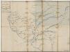
Kartblad 152: Veikort over det 2det Stavangerske Compagnie District

Portefølje nr 4
1 : 100000 F. Staib
6B Jæren
1 : 100000 Johan Nordhagen | Johan Gulbrandsen Natrud
6B 1 6B 2 6B 5 6B 6
1 : 50000 Daniel TÃ ̧nnesen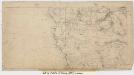
6B 1 6B 2
1 : 50000 Jonas Ravn Daae
3D 3 3D 6 3D 7 3D 11 3D 8
1 : 50000 T. A. Henriksen
3D 3 3D 6 3D 7
1 : 50000 Gulbrandson
6B 3
1 : 50000 Hans Knagenhjelm Gill
6B 3
1 : 50000 David Vogt
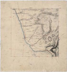
Museumskart 67: Kart over den Norske kyst fra Ekersund til Stavanger og Hvidingsø fyr
1 : 100000 H. Wille | Schie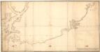
Museumskart 72: Kyststrekningen fra Sireåen til Tungenes
1 : 20000 Rasmus Iuel
Museumskart 217-29: Kart over Den Norske Kyst fra Ekersund til Stavanger og Hvidingsø-fyr
1 : 50000 H. Wille | Schie Opmaalings Directionen
Spesielle kart 24: Jæderbanen
1 : 400000 Albert Cammermeyer Forlag
Spesielle kart 13: Kart over den projekterede Jernbanelinie mellem Stavanger og Ekersund
1 : 200000