Maps of Rendalen

38B 9
1 : 50000 Bjarne Gjølme
38B 5
1 : 50000 Ole Sandberg Midelfart
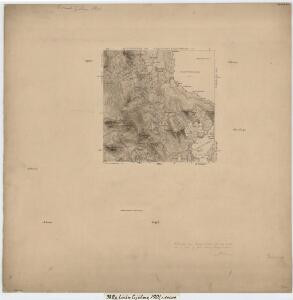
Mil nr 305
1 : 10000 Friderich Georg Beichmann | Johan Friderich Næser
38B 5
1 : 50000 Ramm
38B 10 sv
1 : 10000 Friderich Georg Beichmann | Johan Friderich Næser
Mil nr 305
1 : 10000 Friderich Georg Beichmann | Johan Friderich Næser
38B 9 nø
1 : 10000 Friderich Georg Beichmann | Johan Friderich Næser
38B 6 vest
1 : 10000 Friderich Georg Beichmann | Johan Friderich Næser
38B 10 vest
1 : 10000 Friderich Georg Beichmann | Johan Friderich Næser
38B 6 nv
1 : 10000 Friderich Georg Beichmann | Johan Friderich Næser
Mil nr 306
1 : 10000 Johan Friderich Næser
38B 9 vest
1 : 10000 Friderich Georg Beichmann | Johan Friderich Næser
38B 9 øst
1 : 10000 Johan Friderich Næser | Friderich Georg Beichmann
38A 12
1 : 50000 Karl Marius Leewy
38B 6 sv
1 : 10000 Friderich Georg Beichmann | Johan Friderich Næser
Mil nr 296
1 : 10000 Friderich Georg Beichmann
38B 9 sø
1 : 10000 Friderich Georg Beichmann | Johan Friderich Næser
38B 10 nv
1 : 10000 Friderich Georg Beichmann | Johan Friderich Næser
38B 9 nv
1 : 10000 Johan Friderich Næser | Friderich Georg Beichmann
38B 9 sv
1 : 10000 Friderich Georg Beichmann | Johan Friderich Næser
38D 2 sv
1 : 10000 Friderich Georg Beichmann
38D 2 sv
1 : 10000 Friderich Georg Beichmann
38D 2 sv
1 : 10000 Friderich Georg Beichmann
38A 4 nø
1 : 10000 Friderich Georg Beichmann
38B 10 sø
1 : 10000 Friderich Georg Beichmann | Johan Friderich Næser
38B 6 sø
1 : 10000 Friderich Georg Beichmann | Johan Friderich Næser
1719-3 Holöydal
1 : 50000 Statens kartverk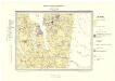
Geologisk kart 78: Søndre Femund
1 : 100000 Gunnar Holmsen Norges geologiske undersøkelse
1719-3 Holøydal
1 : 50000 Statens kartverk