Maps of Engerdal

38B 10 vest
1 : 10000 Friderich Georg Beichmann | Johan Friderich Næser
Mil nr 306
1 : 10000 Johan Friderich Næser
38B 10 nv
1 : 10000 Friderich Georg Beichmann | Johan Friderich Næser
38B 10 sv
1 : 10000 Friderich Georg Beichmann | Johan Friderich Næser
1719-2 Elgå
1 : 50000 Statens kartverk
1719-2 Elgå
1 : 50000 Statens kartverk
1719-2 Elgå
1 : 50000 Statens kartverk
1719-2 Elgå
1 : 50000 Norges Geografiske Oppmåling
1719-2 Femund
1 : 50000 Norges Geografiske Oppmåling
38B 10; 38B 11
1 : 50000 Carl Ludvig Soelberg
38B 9
1 : 50000 Bjarne Gjølme
38B 6; 38B 7
1 : 50000 Olav Herman Paulsen
38B 5
1 : 50000 Ole Sandberg Midelfart
38B 9 nø
1 : 10000 Friderich Georg Beichmann | Johan Friderich Næser
38B 6 nø
1 : 10000 Friderich Georg Beichmann | Johan Friderich Næser
Mil nr 305
1 : 10000 Friderich Georg Beichmann | Johan Friderich Næser
38D 2 sø
1 : 10000 Friderich Georg Beichmann
38D 2 sø
1 : 10000 Friderich Georg Beichmann
38B 10 nø
1 : 10000 Friderich Georg Beichmann | Johan Friderich Næser
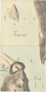
38B 10 sø
1 : 10000 Friderich Georg Beichmann | Johan Friderich Næser
Portefølje nr 57
1 : 100000 Schilling
Geologisk kart 78: Søndre Femund
1 : 100000 Gunnar Holmsen Norges geologiske undersøkelse
Spesielle kart 103-4: Flötningskart over Glommens vassdrag
1 : 1000 Einar Sigurd Ween
Kartblad 166b-4: Wej-Cart over det Aamodske Compagnie; 166b-4

Røros
1 : 250000
Geologisk kart 92: Kvartærgeologisk kart, Røros
1 : 250000 Gunnar Holmsen Norges geologiske undersøkelse
Trigonometrisk grunnlag, Squelet-Cart 65-10

Norge 55- Accurat landcaart over Norges Rige anden Part
1 : 300000 G. Bordin
Røros
1 : 250000