Maps of Stor-Elvdal

38A 2 nv
1 : 10000 Friderich Georg Beichmann | Johan Friderich Næser
Mil nr 282
1 : 10000 Friderich Georg Beichmann | Johan Friderich Næser
38A 2 vest
1 : 10000 Johan Friderich Næser | Friderich Georg Beichmann
Fra Løkken til Tobro
1 : 20000 J. H. Reichborn
38A 6 sv
1 : 10000 Johan Friderich Næser | Friderich Georg Beichmann
1918-4 Hanestad
1 : 50000
1918-4 Hanestad
1 : 50000 Statens kartverk
1918-4 Hanestad
1 : 50000 Norges Geografiske Oppmåling
38A 1; 38A 5
1 : 50000 Haakon Schive
32C 9
1 : 50000 Finn Qvale | Herman Løvenskiold
38A 1; 38A 2
1 : 50000 Haakon Schive
38A 6 vest
1 : 10000 Friderich Georg Beichmann | Johan Friderich Næser
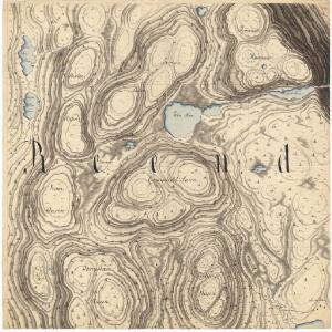
Mil nr 292
1 : 10000 Friderich Georg Beichmann | Johan Friderich Næser
38A 2 nø
1 : 10000 Friderich Georg Beichmann | Johan Friderich Næser
38A 6
1 : 50000 Bjarne Gjølme
38A 2 sv
1 : 10000 Friderich Georg Beichmann | Johan Friderich Næser
Mil nr 281
1 : 10000 Eilert Woldemar Preben Ramm | Mons (Mogens) Brynie
38A 1 øst
1 : 10000 Ramm | Mogens Brynie
38A 1 øst
1 : 10000 Ramm | Mogens Brynie
Mil nr 282
1 : 10000 Friderich Georg Beichmann | Johan Friderich Næser
1918-4 Hanestad
1 : 50000 Statens kartverk
1918-4 Hanestad
1 : 50000 Statens kartverk
38A Øvre Rendalen
1 : 100000 B. Tolstad | Einar Sigurd Ween
38A Øvre Rendal
1 : 100000 Einar Sigurd Ween | B. Tolstad
38A Øvre Rendalen
1 : 100000 B. Tolstad | Einar Sigurd Ween
Geologisk kart 90: Øvre Rendal
1 : 100000 Gunnar Holmsen | Chr. Oftedahl Norges geologiske undersøkelse
38A Øvre Rendal
1 : 100000 Einar Sigurd Ween | B. Tolstad
Portefølje nr 56
1 : 100000 Munthe
Portefølje nr 56
1 : 100000 F. Akrell