Maps of Folldal

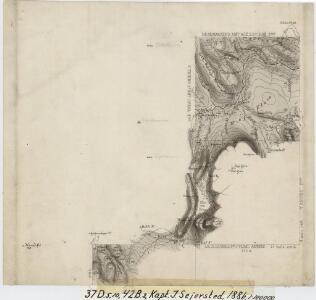
37D 5; 37D 10; 42B 2
1 : 100000 Johannes Sejersted
Geologisk kart 116: Kvartærgeologisk kart over 1519 i Einunna
1 : 50000 L. Sørbel | J. L. Sollid Geografisk institutt, Universitetet i Oslo
1519-1 Einunna
1 : 50000 Statens kartverk
1519-1 Einunna
1 : 50000 Norges Geografiske Oppmåling
1519-1 Einunna
1 : 50000 Norges Geografiske Oppmåling
1519-1 Unndalsvatnet
1 : 50000 Statens kartverk
37C 12; 37D 9; 42A 4; 42B 1
1 : 50000 Per Schielderup Nissen
37D 9; 37D 10
1 : 50000 Einar Halle
37D Foldal
1 : 100000
37C 11; 37C 12
1 : 50000 Niels Sire
Geologisk kart 76: Foldal
1 : 100000 W. Marlow Norges geologiske undersøkelse
37D Folldal
1 : 100000
37D Folldal
1 : 100000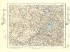
37D Folldal
1 : 100000
1520-2 Innset
1 : 50000 Norges Geografiske Oppmåling
1520-2 Innset
1 : 50000 Statens kartverk
42B Kvikne
1 : 100000 F. Jacobsen | Ole Engh
42B Kvikne
1 : 100000
42B Kvikne
1 : 100000 F. Jacobsen | C. Pedersen
42B Kvikne
1 : 100000 F. Jacobsen | C. Pedersen
37C 7; 37C 8
1 : 100000 Johannes Sejersted
Fra Porten til Grautbekken
1 : 20000 J. H. Reichborn
Kartblad nr 11 og 6: Kaart over Postveien fra Korsødegaarden til Trondhjem igjennom Gulbrandsdalen over Dovrefjeld
1 : 20000 J. H. Reichborn
fra Vollen til Risan
1 : 20000 J. H. Reichborn
Fra Holet til Stølan
1 : 20000 J. H. Reichborn
Spesielle kart 113-2: Oversigtskart over de forskjellige Grænsealternativer mellem Trondhjems Stift og Hamar og Bergens Stifter
1 : 100000 J. Sejersted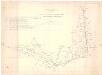
Spesielle kart 111-2: Oversigtskart til Kaptejn J. Sejersted's Indberetning angaaende Grænsen mellem Trondhjem's og Hamar's Stifter
1 : 100000 J. Sejersted
Kartblad 166b-1a: Wej-Cart over det Aamodske Compagnie; 166b-1a

Trigonometrisk grunnlag, Squelet-Cart 65-13