Maps of Oppdal

37C 11; 37C 12
1 : 50000 Niels Sire
1519-4 Snøhetta
1 : 50000 Statens kartverk
37C 12; 37D 9; 42A 4; 42B 1
1 : 50000 Per Schielderup Nissen
1519-4 Snöhetta
1 : 50000 Norges Geografiske Oppmåling
1519-4 Snöhetta
1 : 50000 Norges Geografiske Oppmåling
1519-4 Snøhetta
1 : 50000 Statens kartverk
37C 7; 37C 8
1 : 100000 Johannes Sejersted
Fra Porten til Grautbekken
1 : 20000 J. H. Reichborn
Fra Holet til Stølan
1 : 20000 J. H. Reichborn
Kartblad nr 11 og 6: Kaart over Postveien fra Korsødegaarden til Trondhjem igjennom Gulbrandsdalen over Dovrefjeld
1 : 20000 J. H. Reichborn
Fra Hjerkinn til Porten
1 : 20000 J. H. Reichborn
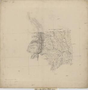
Kartblad 110: Carte over det Opdalske Compagnie District
M. F. Dons
37C 10; 37C 11; 42A 2; 42A 3
1 : 50000 Frithjof Jacobsen
37C 2; 37C 3; 37C 4; 37C 6; 37C 7; 37C 8; 37C 10; 37D 1; 37D 5
1 : 100000 C. Lund
37D 5; 37D 10; 42B 2
1 : 100000 Johannes Sejersted
37C 3; 37C 4; 37C 7; 37C 8
1 : 50000 Niels Sire
Geologisk kart 116: Kvartærgeologisk kart over 1519 i Einunna
1 : 50000 L. Sørbel | J. L. Sollid Geografisk institutt, Universitetet i Oslo
1519-1 Einunna
1 : 50000 Statens kartverk
1519-1 Unndalsvatnet
1 : 50000 Statens kartverk
1519-1 Einunna
1 : 50000 Norges Geografiske Oppmåling
1519-1 Einunna
1 : 50000 Norges Geografiske Oppmåling
37C 6; 37C 10; 37C 11
1 : 50000
37D 9; 37D 10
1 : 50000 Einar Halle
37C 7
1 : 25000 Adler Gleditsch
42A 7
1 : 50000
fra Vollen til Risan
1 : 20000 J. H. Reichborn
Spesielle kart 111-2: Oversigtskart til Kaptejn J. Sejersted's Indberetning angaaende Grænsen mellem Trondhjem's og Hamar's Stifter
1 : 100000 J. Sejersted
Spesielle kart 113-2: Oversigtskart over de forskjellige Grænsealternativer mellem Trondhjems Stift og Hamar og Bergens Stifter
1 : 100000 J. Sejersted
[Romsdals Amt]
1 : 200000 Norsko Norges geografiske Opmaling